June 2018 – Northern Washington – Following the NWOR…
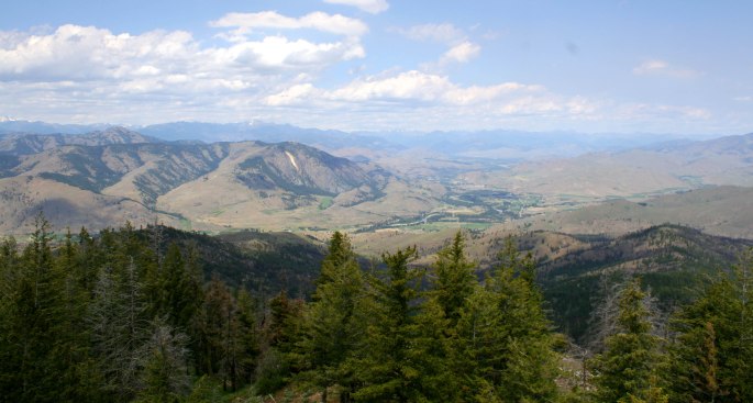
As the 2018 NW Overland Rally came to an end (see trip report HERE), we had a week to get lost in the bush and found the horizon wooing us in no particular direction. We were in Plain, WA which is nestled smack dab in the middle of the northern Washington cascades. Peering in various directions all we saw was mountains – some covered in trees, and others towering above into the alpine.
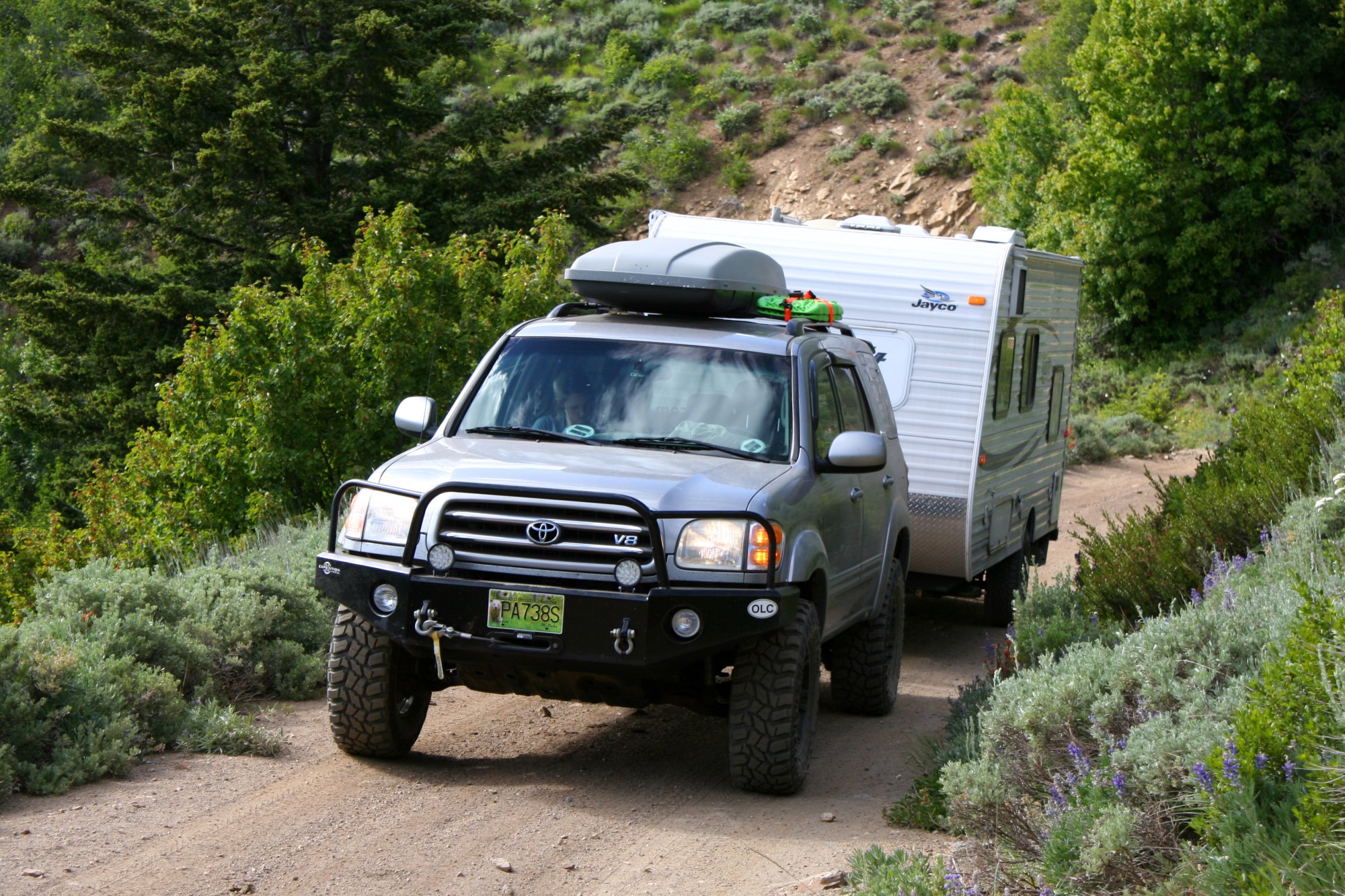
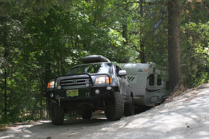
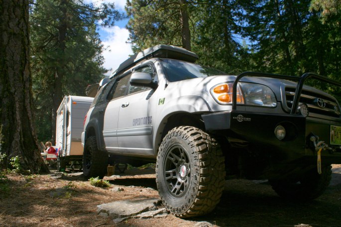
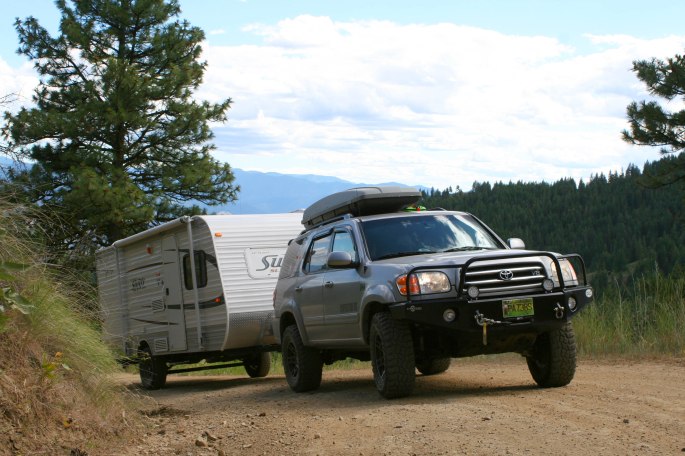
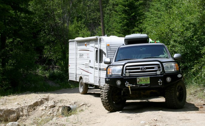
We were towing our new to us “softroader” trailer, a 2013 Jayco 184BH which we improved with new larger wheels, taller and more aggressive tires and a hefty skid plate. While it has been slightly modified for rougher roads, it is by no means an off-road trailer capable of the harsh roads we’ve been known to drag the Kakadu Bushranger on.
Idling down the grassy exit path from the rally, we turned left and headed south. Any direction would have sufficed, with roads and trails leading off to parts unknown, but we turned south because… well that’s just what happened.
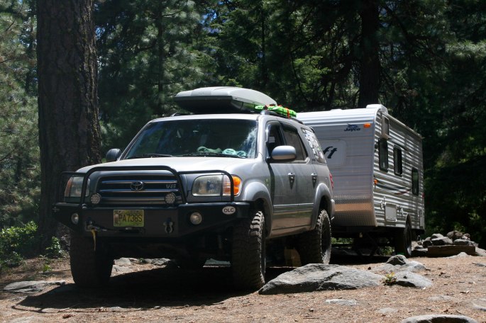
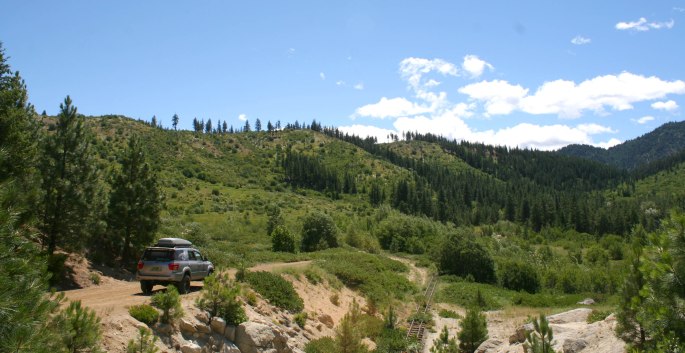
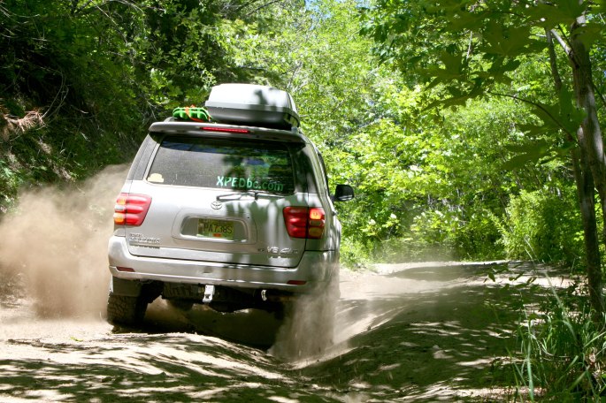
We found ourselves south of Leavenworth and found camp underneath the rugged looking Icicle Ridge. The side trail leading off the forest road and to our spot was a tight squeeze between boulders and trees. The dips, bumps and alternating deep ruts didn’t help either. I pictured Jayco reps anxiously tugging at their neckties, and tow operators greedily rubbing their palms together as we zigged, then zagged the trailer between tree trunks and large pieces of granite.
It was a typical hot summer day in the Leavenworth area at 30+ degrees Celsius. Mother nature, however, was providing her own climate control combining ample shade from giant evergreens and a steady breeze blowing down the valley.
The Cooper STT Pro’s were finally getting to flex their muscles on pointy roots and jagged rocks, not even breaking a sweat despite the fully loaded Sequoia and almost 400 lb tongue weight of the trailer. Plus, they looked pretty good on there too.
Being a summer weekend, we were pleased to mostly have the camping area to ourselves. As the afternoon went on though we slowly realized that it was us who were guests in what was apparently a dirt-bag climber’s mecca. I used the term “dirt-bag” not in a demeaning manner, but in a way describing the hardcore lifestyle transient climber, living out of their vehicles on the outskirts of places such as Squamish, Yosemite, Jackson Hole, Canmore, and yes… even Leavenworth! Dirtbag climber in the summer, ski-bum pow seeker in the winter etc.
***Scroll down a few paragraphs if you don’t wish to read my rare ramblings on deep life thoughts***
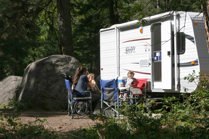
One by one the Subarus and old Toyota pickups clambered in, parking wherever there was room. Tarps were laid down, climbing gear carefully spread out, adventure dogs roaming freely – at times coming by to beg for any scraps. By dinner time, there must have been twelve or fifteen climbers gathered together.
I watched, somewhat mesmerized, as they sat in circles on the tarps, sorting out gear, chatting amongst themselves and laughing at the excited stories of the day’s climb. I didn’t capture a photo of the moment out of casual respect, but I enjoyed the glimpse into a lifestyle I’m only vaguely familiar with, yet somehow attracted to…
I’m not a part of that world, nor do I have any close friends who I would genuinely label a dirtbag. But a small part of me understands the appeal of the lifestyle. The day-to-day freedom, apparent lack of concern for future life plans or a career. Your only responsibilities being to secure a solid belay or place that bit of protection for your climbing partner. Many of them are quite possibly at a professional level of climbing, but turned off by the thought of sponsors and stardom from magazines and Red Bull type films, or being told where to climb and to cut your hair…
Just as the thought of a mountain-bum lifestyle starts to sound too good to be true, I turn around and see my wife and kiddos, happily chilling at camp, and realize that I wouldn’t have life any other way than how it is now, with my family.
Back to the trip report…
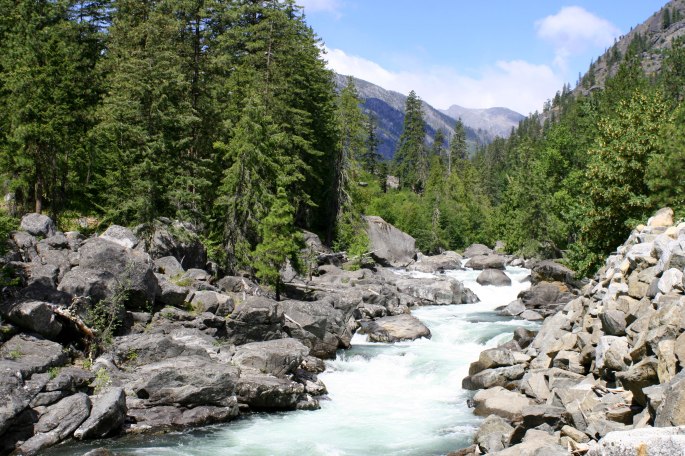
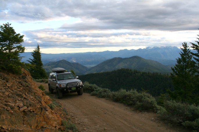
The next day we left our home-on-wheels at camp, and drove off in the Sequoia in search of some rougher trails in the area. Icicle Creek itself was roaring down the valley, the frigid water newly in liquid form from the melting glaciers and snow fields up near the mountain tops.
We missed the shady canopy of the trees, but the strong breeze and scenic views made up for the heat of the day.
Reaching the top of an unnamed pass, we came across an anomaly in the wilderness that absolutely required a closer look!
A narrow-gauge railway line presented itself out of nowhere, then disappeared just as quickly. This was a mystery to us, and maybe one of our readers can fill us in, but our best guess was that it was made for a movie set at one time? It didn’t look like any other mine that we’ve seen in our travels…
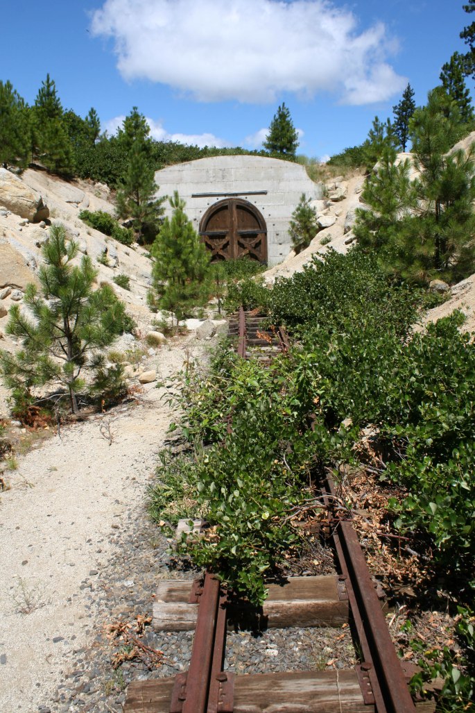
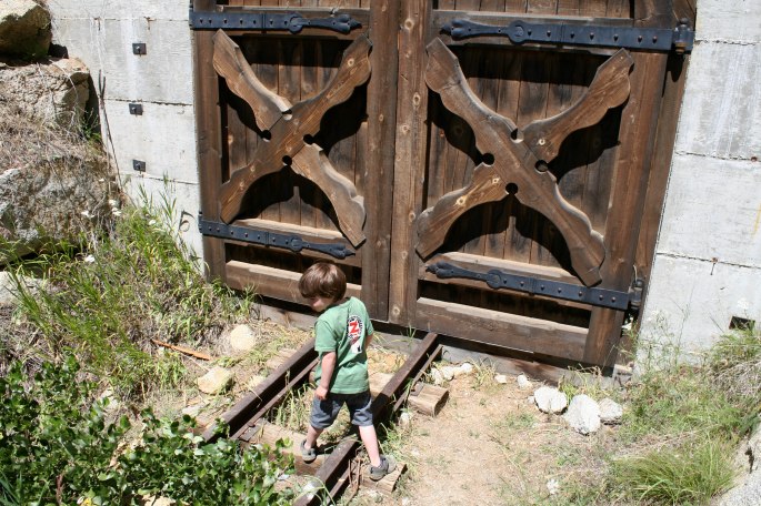
We enjoyed the bizarre surprise find in the woods, remembering that it’s finds like these that make us love to explore. The complete lack of signs in the area added to the mystery… Carrying on we explored new roads and sights afforded to us by our gained elevation.
We have our front swaybar disconnected for added flex and travel, a weakness of the Sequoia cushy V.I.P. coil suspension. The rear is still in place for towing, although perhaps it’s time to experiment with a quick-disconnect.
The afternoon was a feast of new sights and hot weather, so we capped off the day with some iced coffee, a fantastic air conditioned Mexican restaurant, and a loop through the antique mall – all in downtown Cashmere. We’ve returned to this restaurant and antique mall (the one right in town, not across the highway) several times over the past few years and cannot recommend them enough! Cashmere also has a great outdoor pool which is a nice way to refresh oneself after a dusty day of exploring.
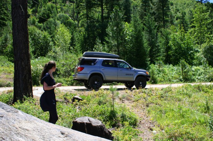
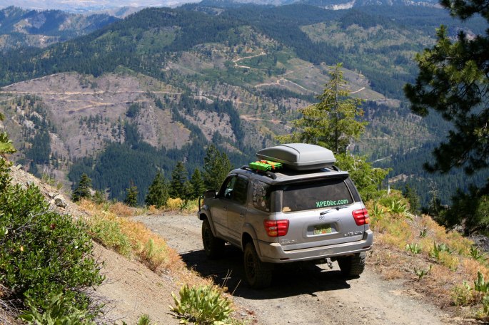
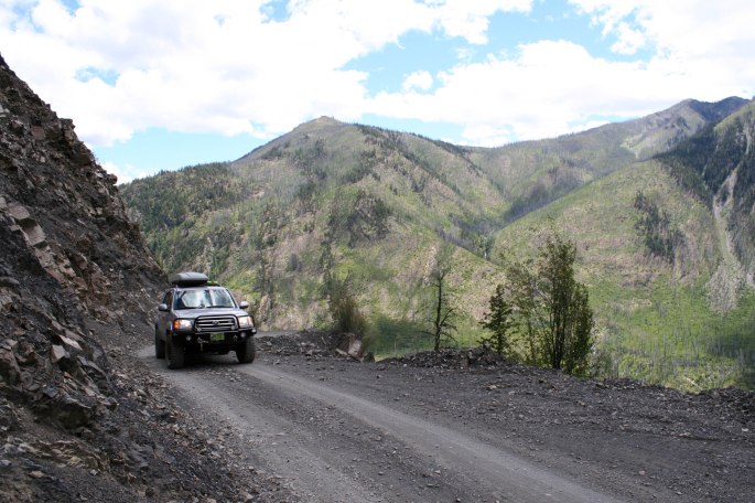
On day three we hooked up the trailer and broke camp. Instead of south, this time we went east along the highway, then north into the hills yet again. Our maps showed the forest road as a thick black line, indicating it was a mainline road – although sometimes I forget we’re towing the softroader, which is both a tad wider and taller than the truck.
The road was steep, loose and quickly became overgrown, creating an interesting scenario. Imagine trying to back down a road where the thick bushes are scraping both sides of your trailer, blocking any view of the path the road follows. After some time, teamwork and a bit of a sketchy turn-around (lesson learned), we were back on track with the correct route to intersect the Washington Backroad Discovery Route (WABDR for short).
Before long, we took another side road we had no business being on, but this time it paid off. It snaked its way up the shoulder of Chumstick Mtn and opened up into a broad shoulder where we setup for the night.

The mosquitoes and flies were horrendous in the lee side of the wind, a pocket created by the trailer blocking the adiabatic flow of air up the mountain side. Times like these we appreciate being able to cook and eat inside the trailer, as opposed to out of the back of the truck. Ditching the trailer after dinner, we drove up the trails toward the summit of Chumstick Mountain.
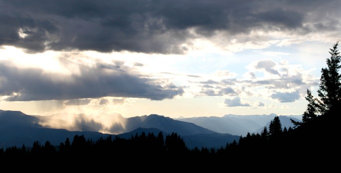
At 5810 feet in elevation, we had hoped the summit would afford a nice sunset view, and we were not disappointed.
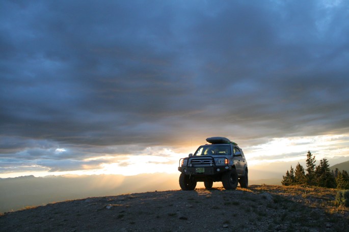
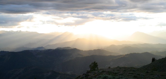
We meandered around on top, alternating between trying to capture on camera the sights our eyes so effortlessly take in, and putting the camera down to soak up the moment. On our way down the mountain we stopped to snap one more sunset picture, a desperate attempt to accurately portray the dance of the clouds in this ballroom of light. Having no formal photographic training (it shows, I know…) I clicked the button that makes that shutter sound, which somehow takes a picture, seizing a memory to enjoy many times over. The pictures in no way do the sky justice, as some things are meant to be experienced in person, nevertheless, here is the result of pressing that little round button.
Another comfortable night’s sleep (thanks to the cooler temps at elevation), a quick morning hike, and uneventful drive rambling along a smoother-than-a-Canadian-highway forest road, we descended into the reality of a 37 degree summer day at valley-bottom. We setup for the day in the shade of a lakefront tree, stepping in and out of the warm water and eating snacks at our leisure. Once the sun dipped the hills, we packed up and once again followed an unknown dirt track into the national forest. It was well after dark and we were gaining elevation in an attempt to reach cooler temperatures for the night, when we came across an old sign advising of a turn off to Leecher Mtn. A quick look at the map book showed a fire lookout tower at the summit. Naturally we took the turn off, paying little heed to the multiple signs warning of a rough road and 4×4 high clearance required (what trailer??).
We navigated several washouts, overhanging tree branches and more large rocks – an hour later we made it to the top, convinced that we shouldn’t have brought the trailer up. Another 15 minutes later we managed to turn the truck and trailer around, and find somewhere level to camp just below the summit. It was close to midnight by the time we crawled in to our home on wheels.
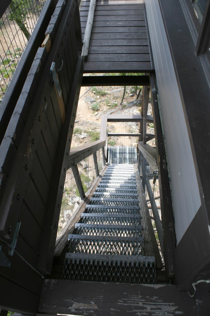
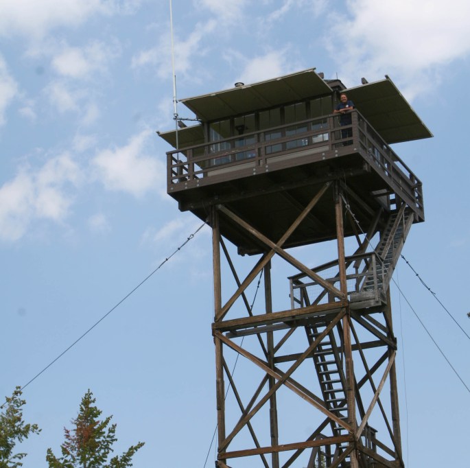
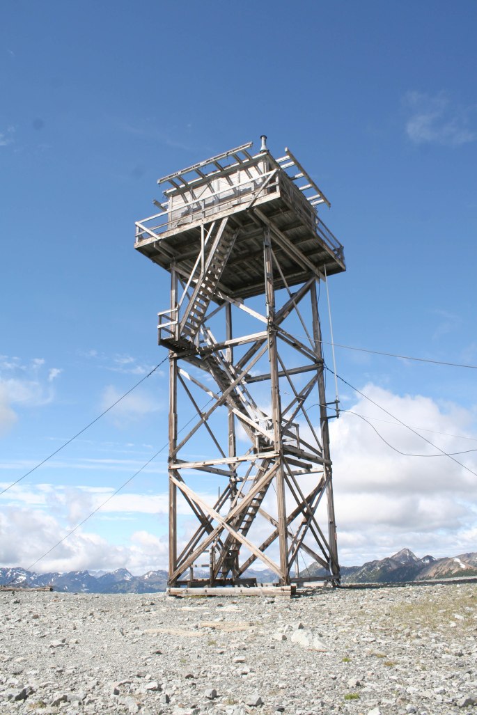
First thing in the morning we walked up the road to see if there was still a lookout tower on top, and there was – a giant one in all of its historic glory.
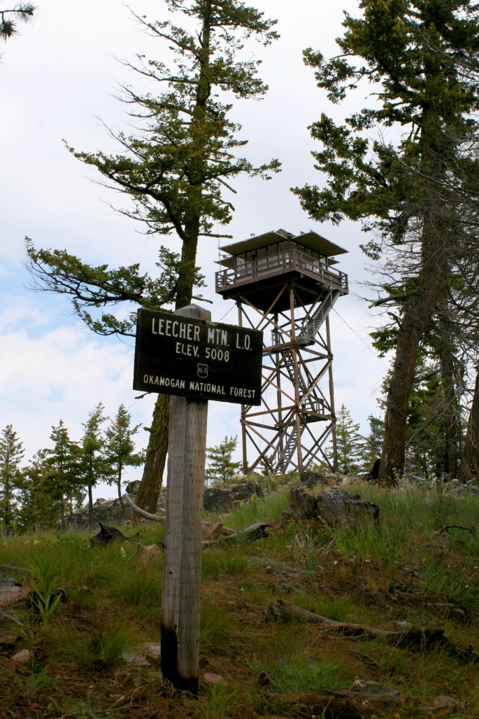
Turns out, the tower was occupied by a US Forest Service employee – unlike all the decommissioned towers in B.C., this was one still being used to spot wildfires. Almost immediately a man appeared on the balcony and welcomed us up for a visit!
“Lightning Bill” has worked for the USFS for years, and spends all his summers in active lookout towers spotting fires.
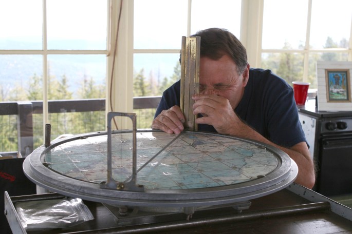
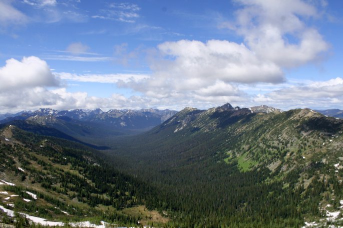
We received the royal treatment as he gave us a full tour, and even had some gifts for the kids, including a Smokey The Bear hat. Lightning Bill runs an Instagram and Facebook page under the name Lightning Bill Art. The view was spectacular in all directions of course.
It was a most enjoyable time, and we planned to return for another visit.
As we were leaving, Bill chuckled as he admitted he laughed at the sight of a trailer up at the summit – something he hasn’t seen in all his years up there, thinking we were lost.
We made our way down, winding our way around the obstacles and washouts, finding it slightly less of a challenge during daylight as opposed to the night before. I made a mental note to leave the trailer at the bottom for when we return.
Back onto the highway, we bee-lined it for Winthrop, WA and enjoyed a huge feast at the Mexican Cantina in town. A few days were spent in and around town exploring back roads and swimming in the various rivers and creeks.
One evening while returning to camp, a familiar orange Jeep caught our eye at the roadside. A friendly-looking fellow appeared to be using the wifi outside the town library. We pulled in and said hello to Chris Shontz, of Venture4wd.com.
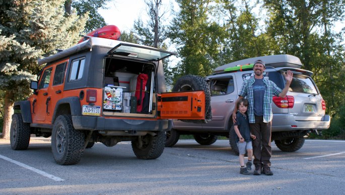
Chris lives full time in his Jeep, travelling around North America and chronicling his adventures in the form of a weekly Youtube video. While not exploring, Chris can be found loitering around town libraries, Starbucks locations and often a pizza joint or two! We’ve been following his journey for almost two years now, so it was great to run into him while out exploring.
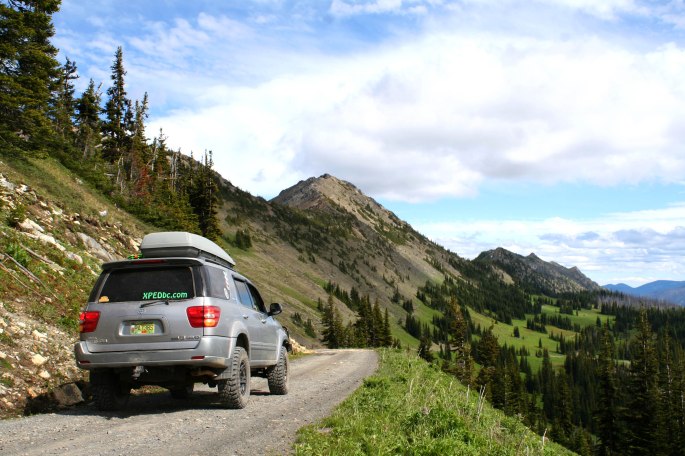
On our last day in the area, we made our way up to Slate Peak, high above the hills near Mazama. This is apparently the highest drive-able road in the state at 7440 feet.
The final few hundred feet is an easy walk, despite being short of breath due to the elevation and pushing a loaded stroller!
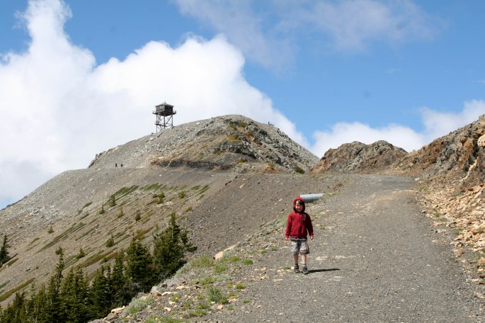
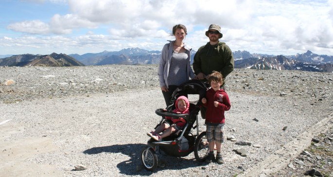
The fire lookout tower at the top is condemned, but still standing and offers a glimpse into the history of the site. The wind up top was ferocious and the tower could be heard creaking at times. Despite the wind, we spent a considerable time up top, enjoying lunch and playtime with the kids.
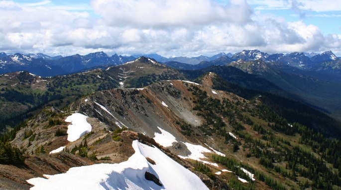
Although it can be quite busy during the summer, this was a must-see and we would wholly recommend it, even with the crowds. The drive and scenery reminded us of the high Colorado passes and meadows we experienced a few years prior. One thing we would do different, is spend the night at one of the rustic and insanely beautiful camping areas near the summit, then head up to the peak early in the morning to avoid the crowds.
The Slate Peak area was a highlight and a great way to end our time softroading around the Cascades. We loved our time in the area so much that we are planning to return for the Expedition BC group trip in October. Thanks for following along!
-JC
