Part three of a solo trek to the Shulaps area of British Columbia… Previously published on Overland Canada in 2014.
Turning down yet another unsigned trail I spotted something on the ground that peaked my interest.

Another promising looking destination:

The roads here were pleasant to travel. Fairly smooth, only a few cross ditches and not too many sharp rocks. Some areas were steep enough to require 4L gearing but most of it was relatively 2wd.

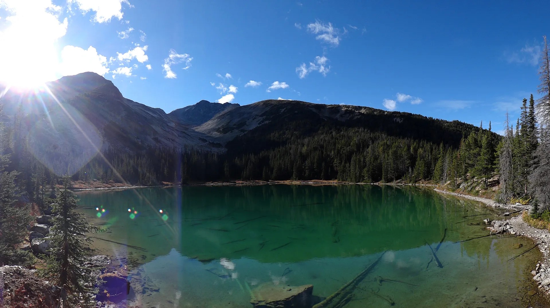
Eventually at approx. 2000 m (6500 ft or so) I came to this beautiful alpine lake:

The road continued beyond the lake and turned into a rough mining track. Steep, loose, boulders and sharp rocks.

Soon I began to wonder how far I’d be able to go. Turning around would be difficult and the road was becoming pretty hardcore for general exploration. At this point I had aired down much more compared to driving on smooth gravel surfaces.


I don’t have a whole lot of undercarriage clearance over stock (2.5″ lift + 33″ tires, weighted down by cargo and front bumper/winch). It was coming time to decide if I would continue or not. Problem was, the road looked like it climbed higher and higher and I’ve been seeking to find the highest elevation drive-able roads in BC (Blowdown, Molebdynite, Canoe Mtn, etc). If I could just get to the next section I’d at least be able to turn around or have a better look at the next stretch. As I was exploring alone and early in the adventure, I was wise to take it easy on the ol’ girl.


Up I went and it just got worse. I was in 4 low, aired down, had the centre locking diff engaged and all traction control systems turned off. The boulders were getting big and I was having to stop, back up and pick new lines to make it further. Eventually the road turned into a V-shape and it was difficult keeping 3 wheels on the ground. Well, it was time to call it quits with this spur. With a few hours work moving some boulders, shoveling some dirt, etc., it could have been passable, but I figured it was time to bust out the hiking boots. It was 4pm and I had 3 or so hours of daylight left. The peak at the head of the valley was calling my name! The peak was about 2550 m or so (8400 ft) and I’d have to hoof it pretty good on foot to make it up there before dark….

Up I went, enjoying a light breeze.

I passed underneath the shoulder of another lesser peak on my left. I noticed it had a small ice field partially buried by rocks as well. This was possibly another good option to summit from around the backside.

Once I gained the ridge between the two peaks, I’d have to traverse to hiker’s right to access the shoulder that would lead up to the top of the peak at the head of the valley. As I got closer the ridge started to look pretty gnarly.

Looking back down to where I came from:

I eventually reached the high ridge at the head of the valley. The ridge I’d have to traverse to make the summit of the black rock peak looked better from this vantage point:

It was getting dark and the temperatures were dropping. There was some flat ground on the ridge which would make a decent camp. This region is full of grizzly and black bears, however up here on the ridge would be an unlikely encounter. I made the call and decided to spend the night here. I would soon find out it was not the greatest camp spot.
Continued in Part 4: Ghost bears & Cross Ditches…
