The Ashnola-Placer traverse is a little-known route located in the Similkameen Region of the province. The “traverse” is really just a rough roadbed made up of loose and sharp red shale rock, linking the Ashnola and Placer road systems. Most of the route is on 2WD mainline forest roads, with the red shale road in the middle being the only real crux. I have fond memories from years past of winching my solid-axle-swapped Toyota 4Runner up the tight switchbacks, and pushing through the overgrown bush encroaching on the trail. Usually this route is only traveled by hunters on quads and has been known to be a challenge for lightly built or stock 4X4’s. There is not much information or trip reports available out there, so we figured this would be a good route to run and document on XPED BC. We decided to attempt it east-west, from the town of Keremeos to East Gate (east side of Manning Park).
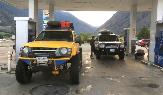
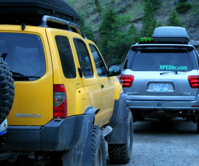
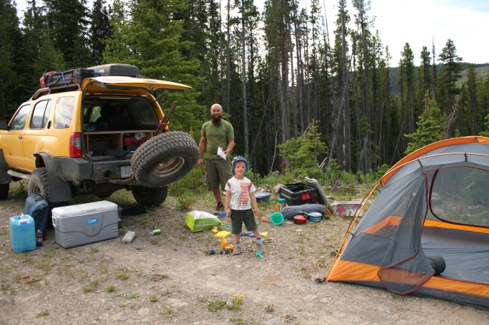
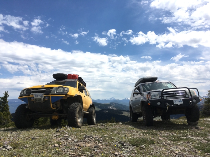
On the Sunday afternoon after the BC Overland Rally, I dropped off the Kakadu and wife/kids at home and temporarily replaced them with a trail buddy, Andrew. Ever since our freezing Harrison snow camp/winch fest (see earlier in the blog), I promised Andrew some proper camping with a fire! We met up with Keane and his kiddo who XPED BC met at the BC Overland Rally. Keane’s rig is a very capable Nissan Xterra and we were happy to have him along for the adventure. We convoyed out east from Hope, B.C. and filled up the tanks in sleepy Keremeos prior to hitting the trail.
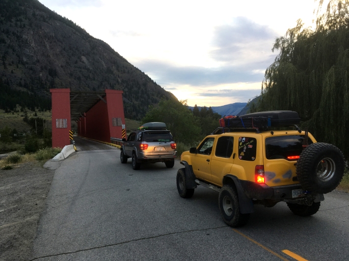
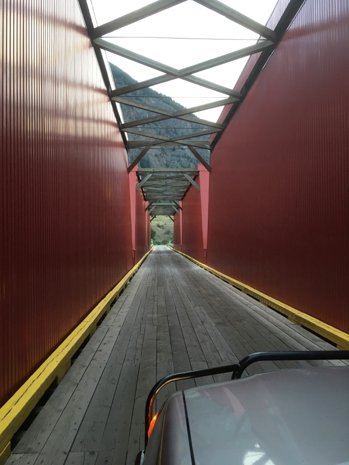
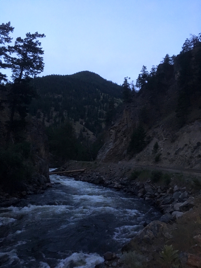
We backtracked a few clicks west to the “big red bridge” (circa 1907), one of the few remaining covered bridges in North America. The bridge crosses the Similkameen and gives vehicle access to the Ashnola valley where we would soon hit gravel.
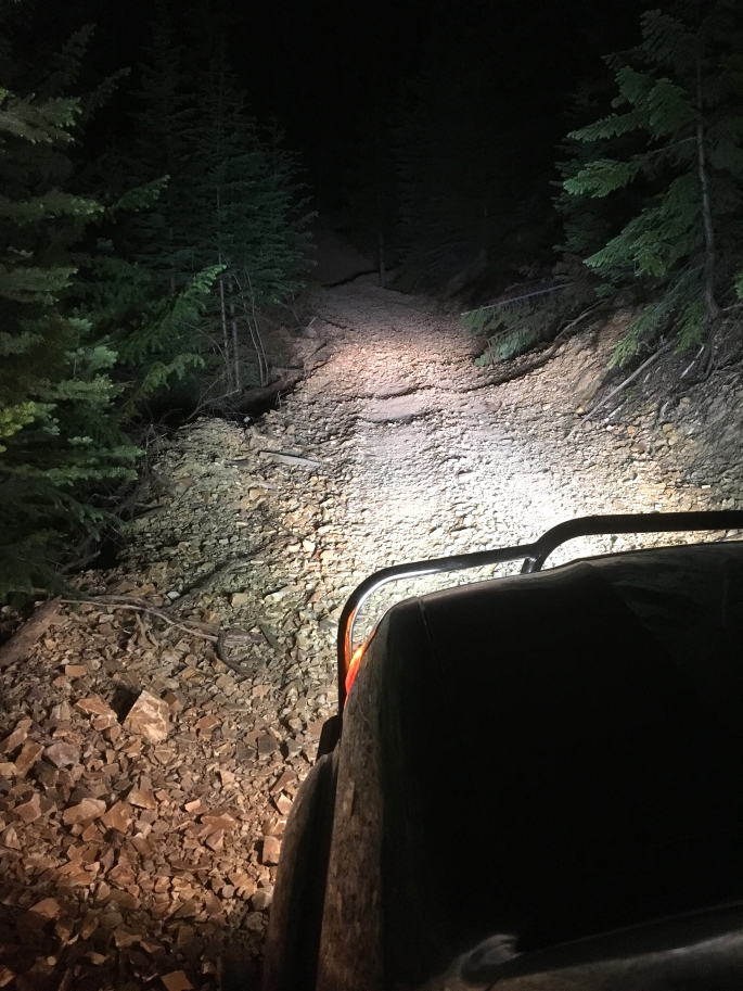
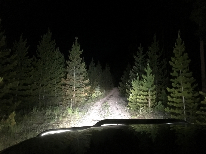
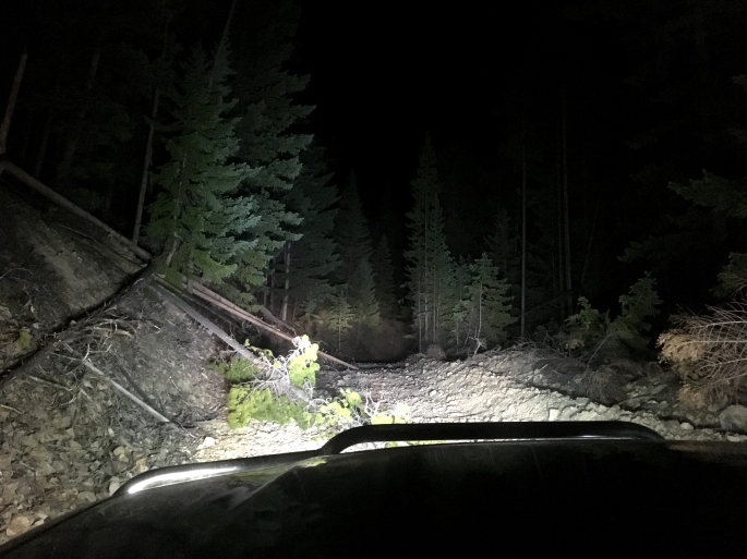
We wound our way into the Ashnola canyon and stopped to air down once we hit gravel. It was starting to get dark and we realized we’d be heading up the shale road in the dark… oh well – sounded fun!
I forgot how truly beautiful the canyon was, and decided I’d have to return in full daylight to see it all over again.
The Ashnola main FSR is maintained until the base camp for the private lodge up in Cathedral Provincial Park on the west bank of the river. After the base camp, the road is clearly less traveled.
After consulting the BC Backroad Mapbook (Thompson Okanagan version), along with the GPS, we found the turnoff where we would begin the climb to the shale road. As far as we could see, there was no sign labeling the road. It has also been deactivated for well over a decade and there is a small obstacle / dirt berm right as you leave the main FSR. Despite the dirt berm, the road is not closed. The berm appears to exist to indicate the road is not an easy drive and not meant to be traveled by most regular vehicles on the mainline FSR.
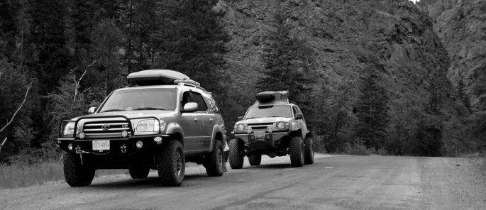
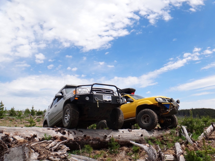
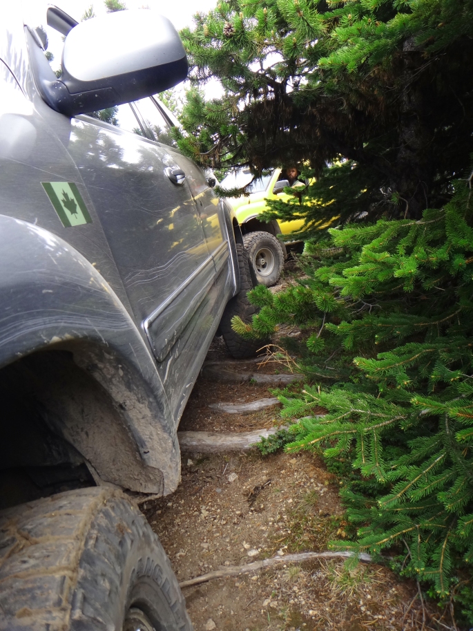
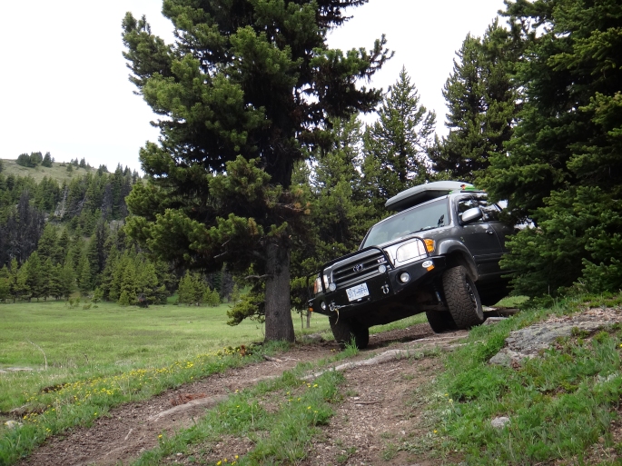
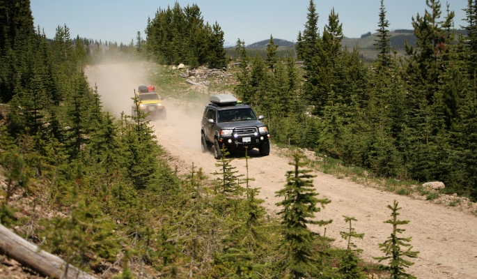
After climbing up the trail, my fond memories of the challenge of the tight shale switchbacks quickly faded. It was soon apparent, and somewhat bittersweet, that some improvements had been made to the hardest areas. Most of the loose shale had been packed down by machinery and leveled out, creating a trail surface wide enough for full size trucks. Gone was the “jeep trail” and tight 180 degree switchbacks requiring Austin Powers-style multi-point turns.
The trail was still enjoyable, requiring 4low and at times carefully picking the right line to maintain traction. The shale was still there, red and sharp as ever, and there are some loose sections where it feels you are trying to drive over marbles up a smooth incline – but there was never any feeling of “oh crap we’re not going to make it!” from years past. Sure, the switchbacks are still there, some still tighter than others, but I think a confident driver operating any high-clearance 4×4 with good tires would enjoy the trail in its current condition.


It was a disappointing to not have to overcome a real challenge, but also nice to know that we’d very likely be able to complete our route without turning around. We did not run into any spring snow drifts blocking the road, but we did come across another expected obstacle:
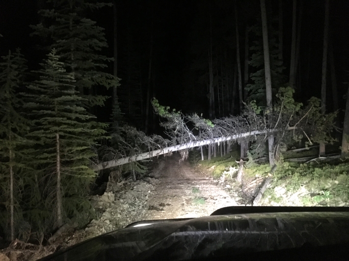
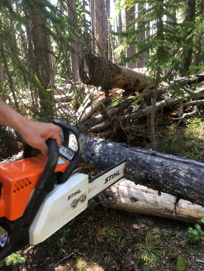
Out came the mini chainsaw which made quick work of this freshly fallen pine. After making a few wrong turns and some backtracking, we came to a desirable camp spot with some morning shade. We set up the tents and relaxed around the camp fire until the early morning hours.
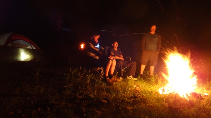
Even at an altitude of 1800m / 6000 ft, it was a balmy 18 degrees overnight and plenty warm enough to sleep on top of the sleeping bag. The morning brought breakfast, coffee and blue skies including a nice view of the area.
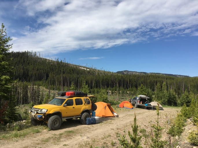
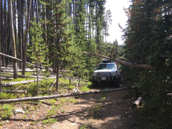
The day started with some easy exploring of the different roads, and then we tackled the quad trail which circumnavigates Placer Mountain proper. This is where Andrew earned his keep as he eagerly diced up the fallen pine trees with the chainsaw so we could pass through. Keane also showed off his northern bush skills, blasting through some logs with his axe with ease.
We came across an area tourist attraction created by some logger with a sense of humour.

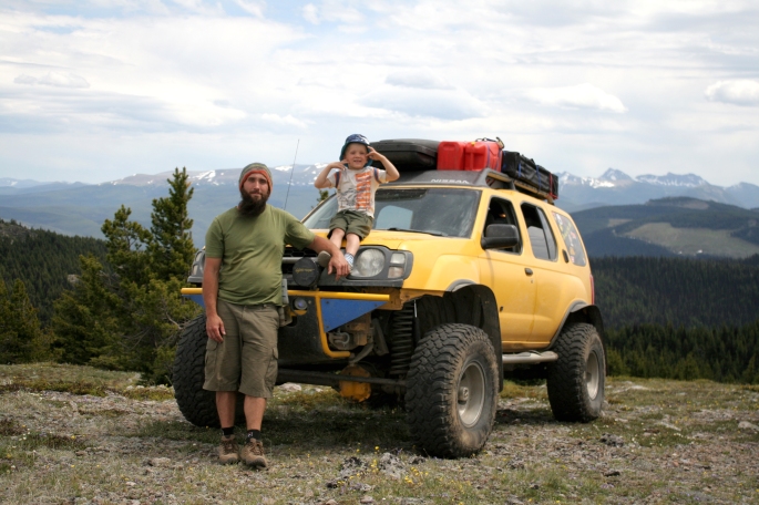
We also took the time to goof around and do some posing for my admittedly excessive picture taking.
We took a side trail, basically a quad-sized two track, which runs to the summit of Placer Mountain at 2210m (7250 ft). This trail runs though open sub-alpine meadow which is extremely sensitive and can take years to recover after damage. We were careful to stay on the existing trail as any trail users should. There has been some motorized abuse in this area and it could face closure if the yahoo’s keep it up. I didn’t notice any fresh or recent abuse and the meadows were in good shape.
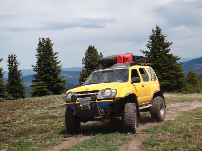
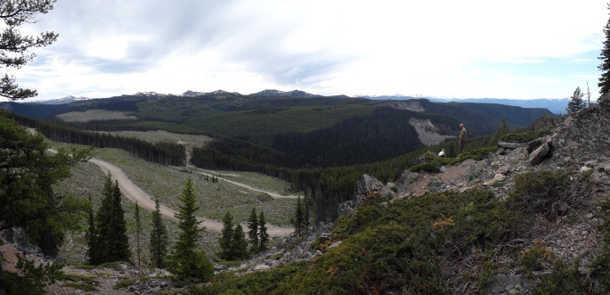
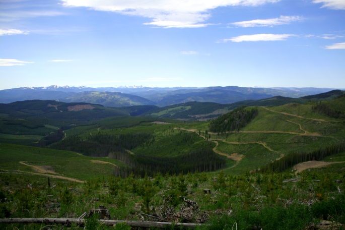
The summit affords epic views in all directions. It’s wide open up top with room to camp if you don’t mind the wind and little shade. There’s also a hidden geocache, giant rock cairn and some communication towers. We hung around for an hour and ate lunch.
Eventually we made our way back to the quad trail around the mountain, stopping to cut more trees and also to see the view at one of the camp spots on the trail.
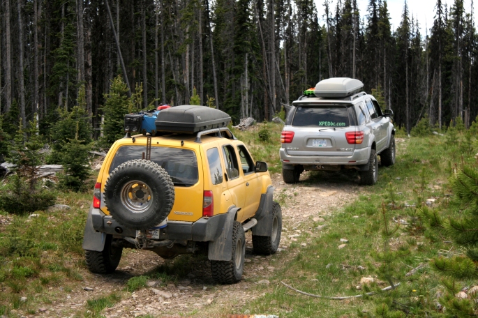
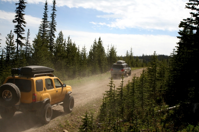
We made our way back to the main Placer Mountain FSR system and enjoyed the smooth dirt cruising.
There are numerous roads in this area and it can be easy to get lost. Aerial maps could be confused for green spaghetti noodles…. make sure you have some good form of mapping/route finding to save any troubles. It is scenic though. We saw one bear and several deer throughout the trip.
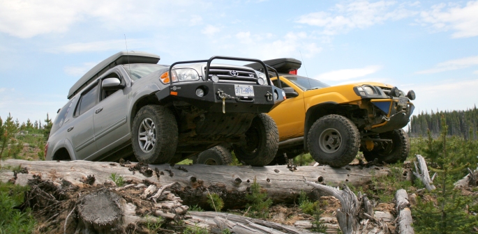
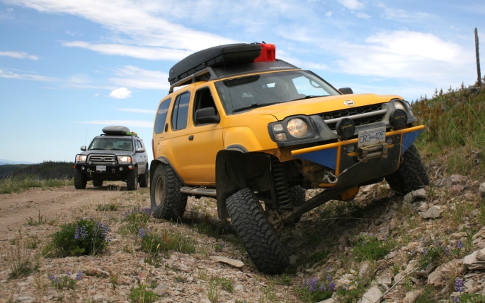
As we made our way down toward the Crowsnest Hwy, we stopped for one last photo, showing the capability of the Xterra’s suspension setup. There will be a blog post posted soon featuring a profile of Keane and his truck.
Less than a kilometer before returning to pavement, we stopped at a river to cool off and air the tires up. A slight breeze kept some of the mosquitoes away, but they were out in force at this time of year. We were pretty dusty, but wading in the river felt like a backroads spa treatment. Here we parted ways and said goodbye to Keane and his son who were making their way back north to the Cariboo. Andrew and I cruised westbound to the Lower Mainland and back into the real world until the next outing….
As far as the Ashnola-Placer traverse is concerned, it is still worth doing, despite the improvements to the hard section. I say this as there were still some fun parts to drive, and the scenery and amount of roads to explore is right up there. We left out Placer Lake, another area gem, until we return next time along with some other area goals in mind. Feel free to comment or message us for any questions or trail beta!
