In late October, 2017 I took off on a solo journey to circumnavigate the Clear Mountain Range in southwestern BC. The Clear Range is bordered by the Fraser River on the west, the Thompson River on the south and east, and capped off with Hat Creek and Marble Canyon on the north. The range is technically apart of the interior plateau, however it has qualities of the Coast, Cascades and Interior mountain ranges, with desert benches, dry alpine forests and rambling gentle alpine ridges. The highest peak is Blustry Mountain, overlooking the Fraser River at 2330m (7650 ft), although you wouldn’t know it as it is difficult to observe from areas accessed by even a 4×4 from many angles.
I spent 5 days circumnavigating the range, roughly counter-clockwise beginning and ending in the sleepy town of Lytton. Throughout the journey, I seldom passed any vehicles other than on the short stretches of highway used to jump between the back roads. Several times I was turned around by deep snow, and at times felt as if I was the only human around. The adventure was elevated, since I was fully aware of two separate on-going searches for missing persons in the area, as I had been following in the news. I went prepared, in order to ensure I would not add to the tally. I don’t believe either one has been found to date…
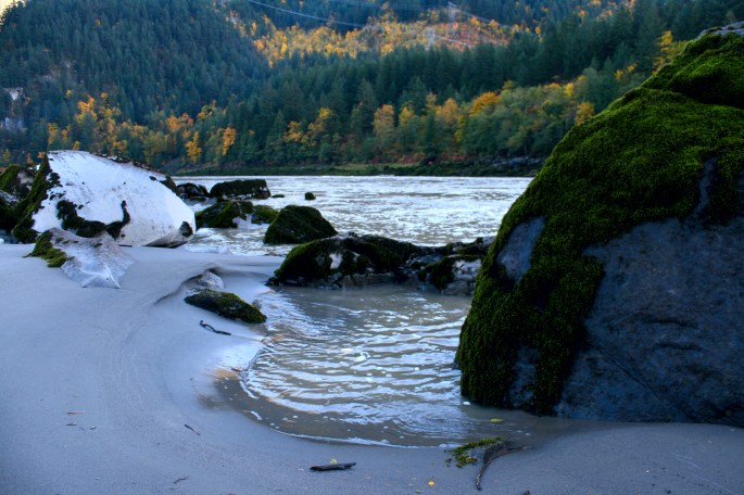
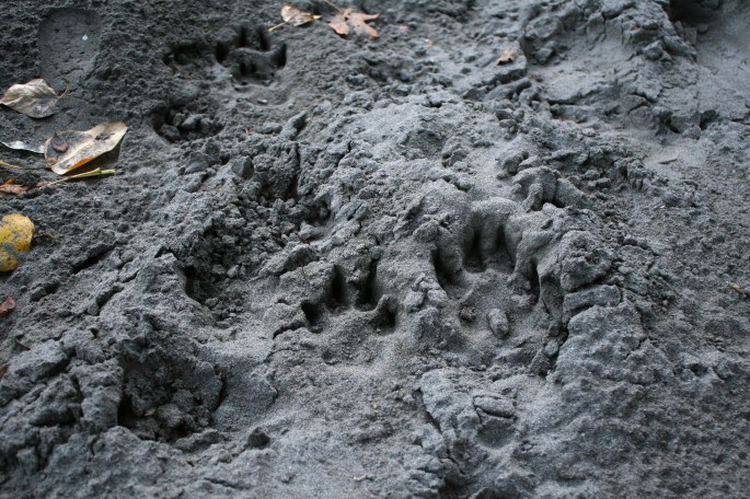
It all began in the Fraser Canyon of course, there is always somewhere new and interesting to stop and check out along the way. One of my first stops was this beach on the Fraser River near the community of Yale. There were many telltale signs of past visits in the area, these ones specifically I suspect were made by a playful doggy.
What would a trip through the canyon be without mentioning trains. Trains going up and trains coming down, they are everywhere and I am okay with that as they are pretty entwined with the history of the entire Province.


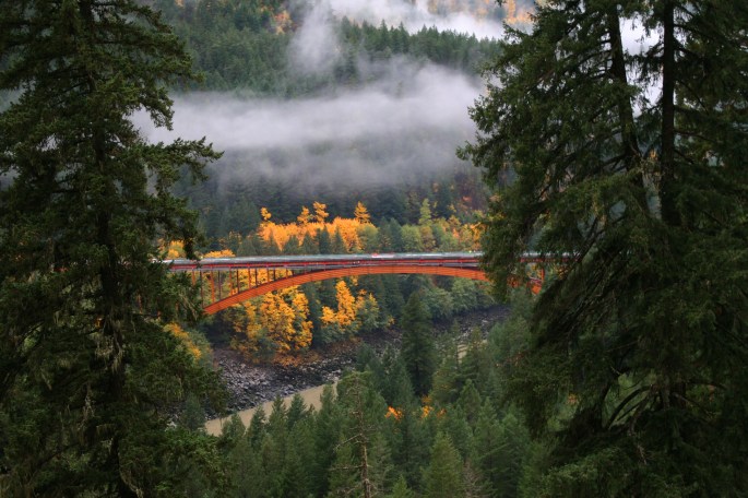
Another popular stop is the Alexandria Bridge, located in the tiny provincial park of the same name. I had the place to myself, just prior to darkness falling, being close to Halloween and all…


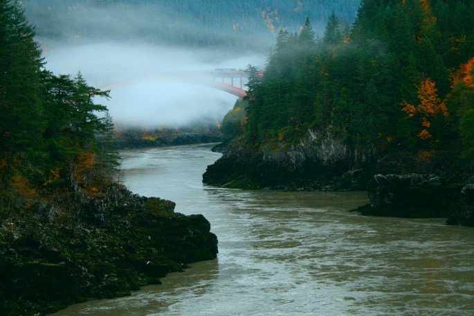
Views of the canyon and river were spooktacular at that time of evening, especially with the lower water level.


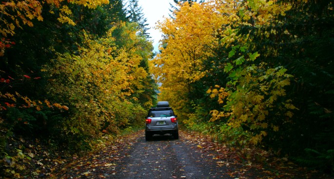
Since I had almost a full week to ramble around on this outing, I made sure to take my time and let the day’s itinerary play themselves out. Thanks to the beautiful distractions along the way, it took almost two full days to arrive in Lytton and the true start to my insertion into the Clear Range. The first evening found me high up on a powerline road, somewhere off the Anderson FSR south of Boston Bar. It rained all night but I was dry and very comfortable sleeping on the platform inside the Sequoia. It dried up a bit in the morning so I was happy to make picture stops whenever something caught my eye – such as this oddly smooth but steep old road in the canyon.
Coming back down the ridge, I caught a glimpse of the new Alexandria Bridge on the main highway.
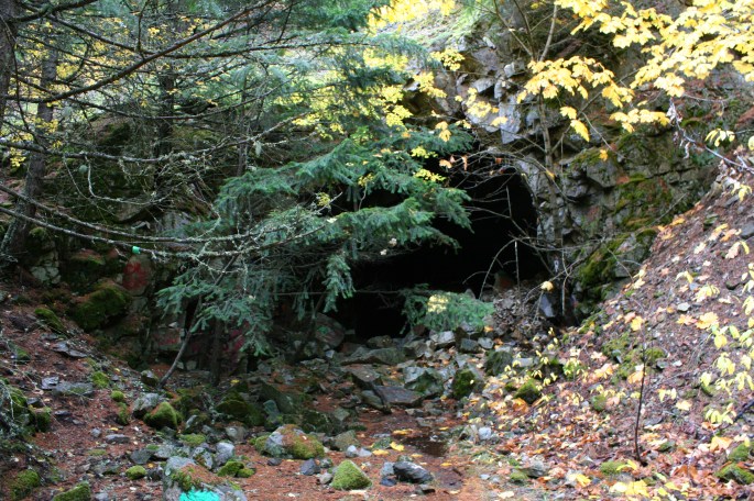
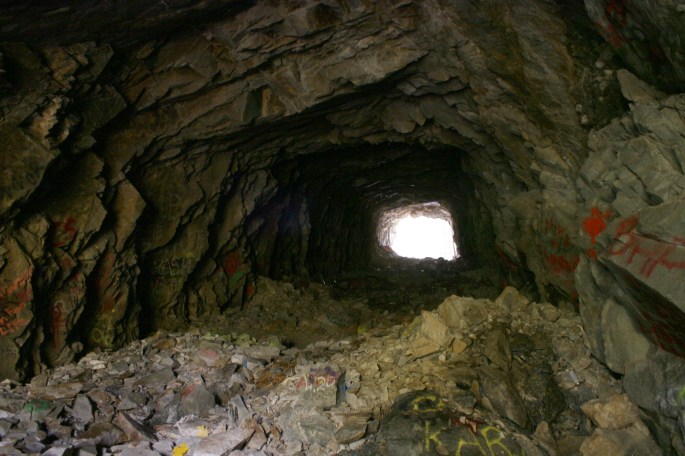
Meandering further north brought me to the old Hell’s Gate Tunnel, the original which is hidden in the trees. Despite driving by over at least 50 times over the years, I’ve yet to stop and scope it out, until now.
Soon I found myself in Lytton and the official start to the main reason for the trek out to these parts. I quickly found myself airing down and heading up the Botanie Creek Rd and into the bush. Before venturing out of town, of course I stopped and snapped a few more train photos.


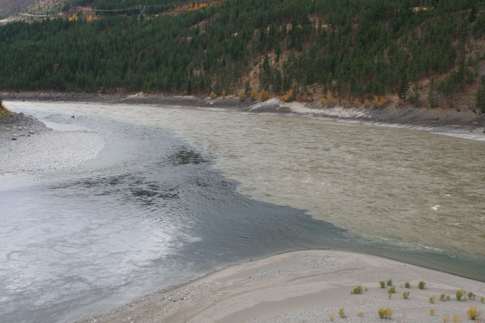
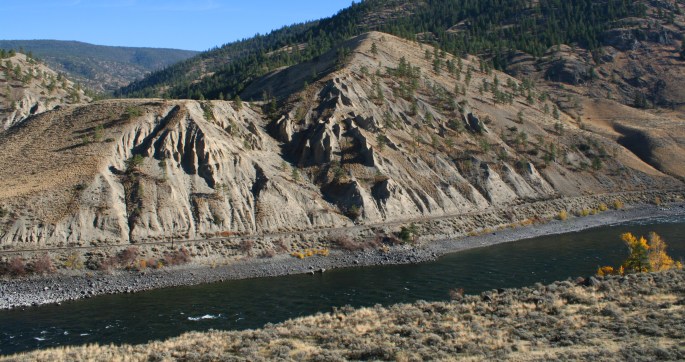
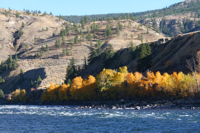
Looking back you could see the clear water of the Thompson meeting the silty brown waters of the Fraser. A place this reminds me of is where the green outflow waters of Seton Lake meet with the Fraser River, upstream of here and near Lillooet, BC.
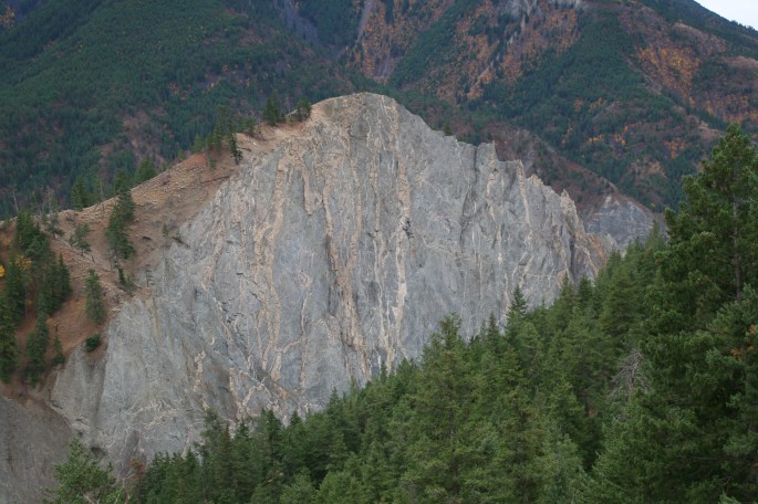
From town, I headed north, finally leaving the pavement behind for a few days. Here is where I actually entered the Clear Range proper on this outing. Climbing up into the bush I took in the views, such as this unique geological abnormality.
The next set of photos are from the climb up to Devil’s Leap and an abandoned fire lookout tower – a favorite place of mine. I’ve never seen anyone else up here, ever. I also had to chainsaw about 30 downed trees in a large burn to access this area. This will be a destination on a future Expedition BC group trip for sure.


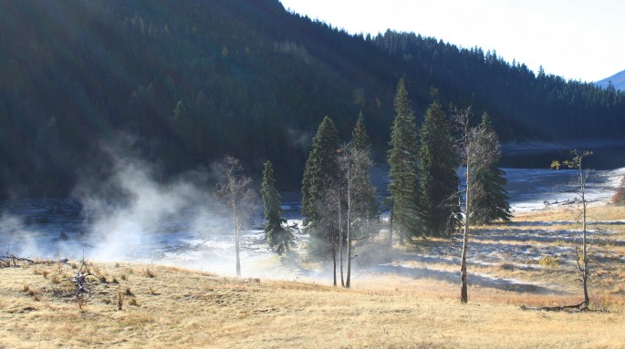
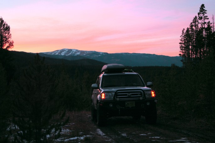
After spending the night up high, I was treated to a mesmerizing view while morning coffee was consumed. The last time I was here, a black bear was chilling out at this viewpoint / camp spot, and so this time I camped here hoping I’d see more wildlife, but it was just me and the valley views. With the morning fog at valley bottom, you wouldn’t know that the largest river in the Province is hidden from sight.


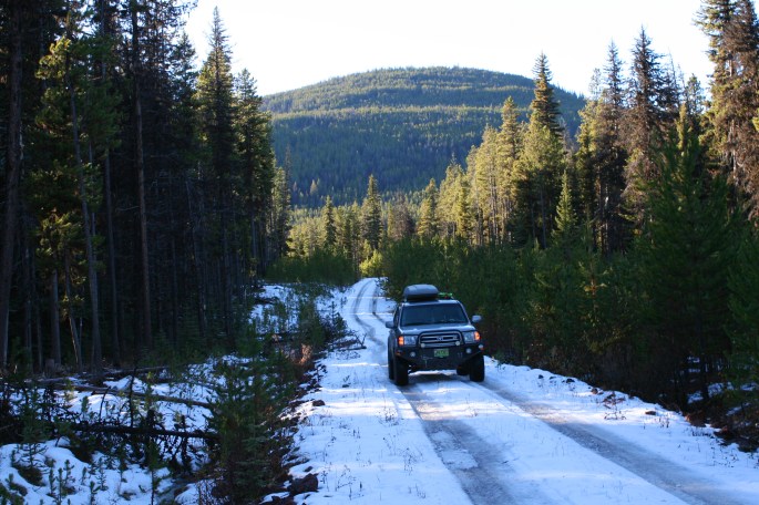
For the next few days, I continued to zig-zag back and forth across the Clear Range on a plethora of mainline forest roads as well as deactivated trails. Some I was able to loop together, others were out and back, and there was some places I found myself stuck in early season snow and mud. Had I been earlier in the season, I would have been able to connect a few more routes together where they travel above 1500 metres.

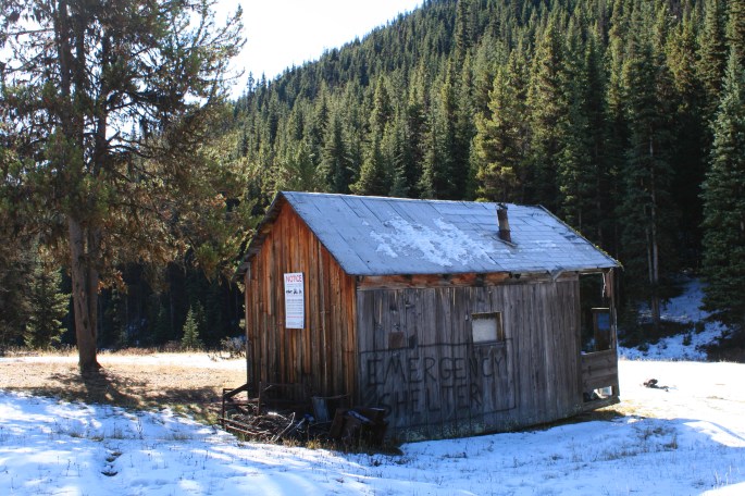
I came across an old emergency cabin, likely used more by the sledding crowd in winter. It was in rough shape, but would be a welcome sight for anyone looking to warm up on a cold winter’s night.
It seemed there was something new to see around each corner.
I spent about two hours exploring a dead-end road, taking me deep into the remote centre of the Clear Range. This was one of the few areas I was able to set my eyes on Blustry Mountain (in the background). The roads to access the bottom of it were blocked by snow on this side.
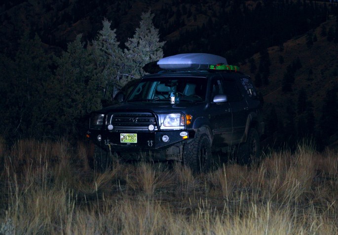
As darkness fell, I found myself heading toward the village of Spences Bridge, with a plan to grab breakfast in town in the morning. I camped on a quiet and breezy plateau, up above town and with more tremendous views. Access was via a quite steep two track leading off the main gravel road. Not that I had seen any other trucks for the past 24 hours or so, at least the steep access road would ensure I’d have the place to myself that night.
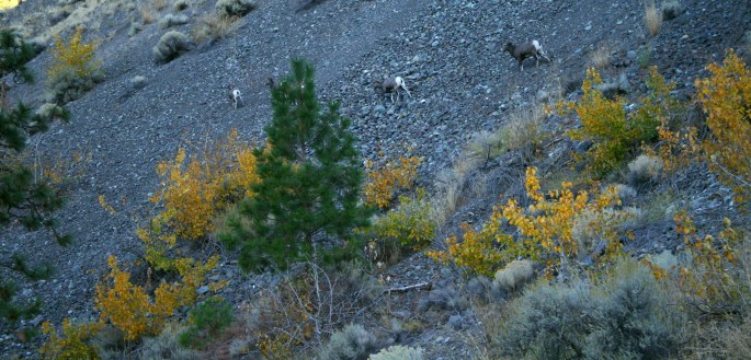
I finally was able to see some wildlife while winding my way down into town the next morning: Bighorn Sheep.
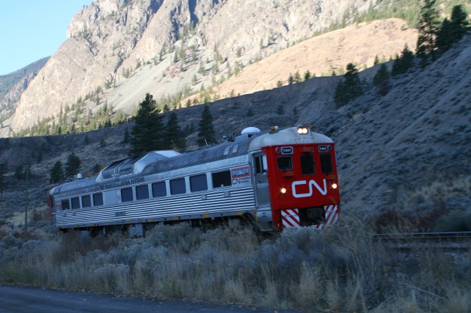
Almost as natural as the bighorn sheep in the area, another train, and a rare one at that!
After a few hours spent at the Packing House, delighting in an absolute treat of a meal in the truly rustic and historic setting, as well as sitting back with my feet up and conversing with locals, I found myself winding my way north along the Thompson.
Most people haven’t heard of Epsom Provincial Park, let alone visited or explored it. There is no infrastructure in place, other than a dusty two-track accessing the middle of the small river-side park. What a gem it was though.


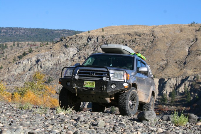
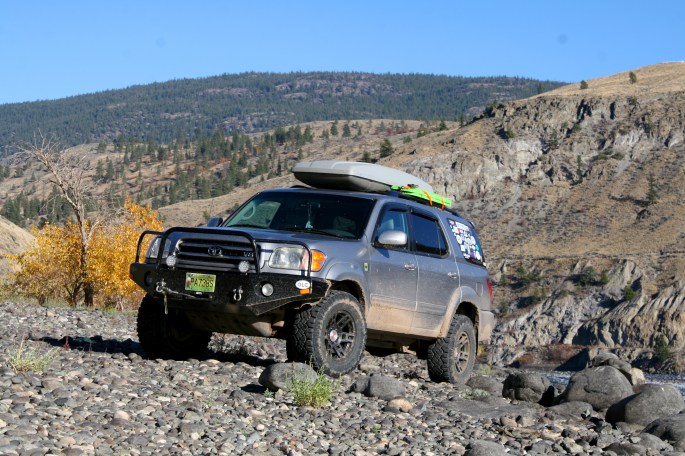
There was some other river side stops to soak up the sun, drive new roads and snap some promo shots of the Endurance.
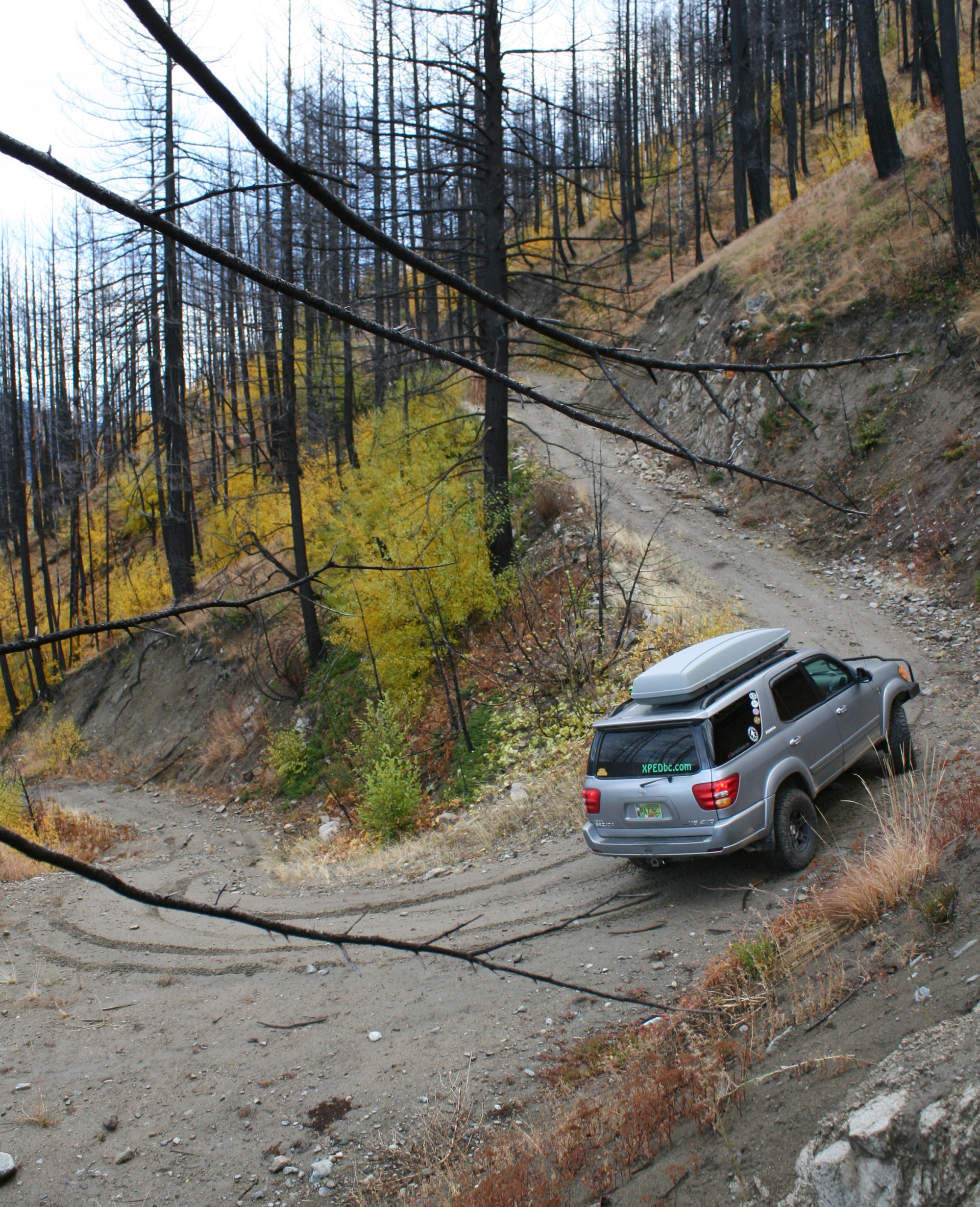
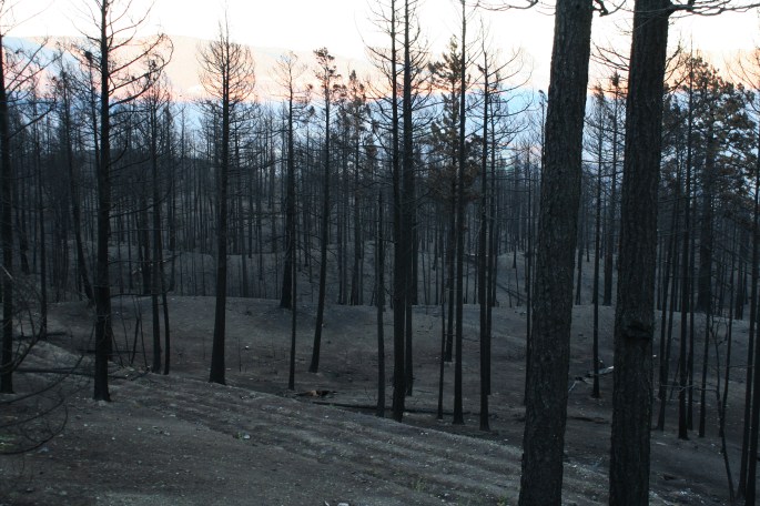
The next few days I made my way through the northern part of the mountain range, including through the enormous Elephant Hill Wildfire burn area… the scale is hard to describe. This fire destroyed dozens of homes and cabins, and caused several towns to completely evacuate, only months before my visit. In some areas the fire burned too hot for any visible plants or trees to survive. The ground was reduced to just scorched dirt.
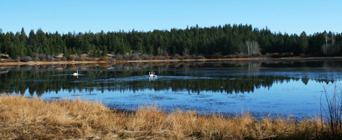
Lower Hat Creek area with some type of large white swan waterfowl. They were very wary of any human presence.
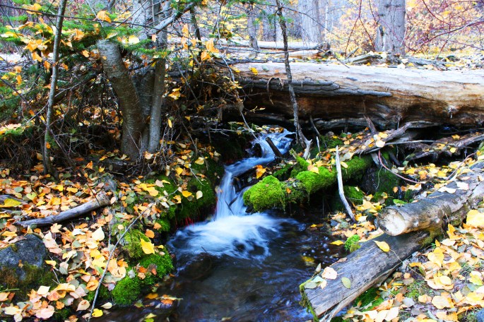
Encircling Blustry Mountain, this time trying to attack it from the west, I ascended a road with dozens of switchbacks, and a path only wide enough for one truck. I must have crossed this pretty creek over 10 times on the way up.
I fell short of the alpine, but did locate the trail head to the top of Blustry. A local Christian and outdoor-oriented highschool group was camped in the clearing at the end of the road. Some of the youths had already hiked up to the summit and were on their way down. I wish my school had done adventures like this! What a great experience for the kids!
I back tracked and found my own place to camp. The campfire lasted for about 3 hours and kept me warm during dinner, dessert, and some time I spent writing up a small article for another publication.
My time was coming to an end, and in the morning I found myself back in the town of Lytton. This was day 6 and I was due back home, but it had been a satisfying and successful “investigation” into the whole area. Of course there were roads that were left for a subsequent visit, which has yet to happen. Hopefully I can share parts of this area with some of you readers on the next open-invite overland trip. Ideally the trip would include a hike to the summit of Blustry!
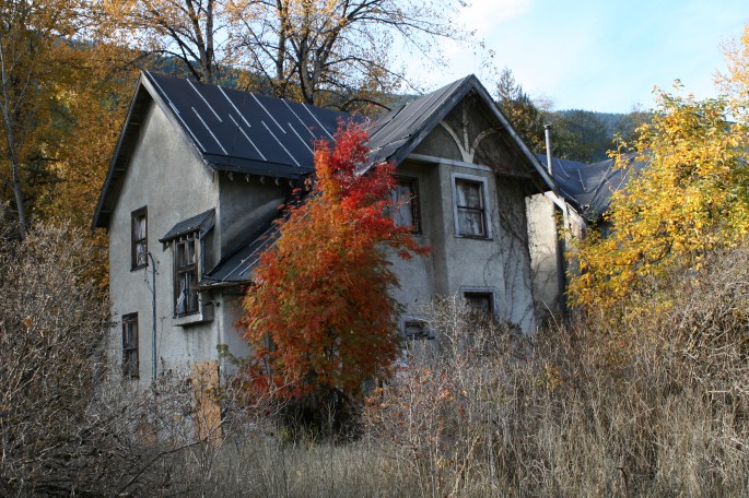
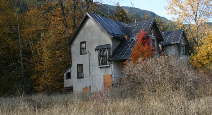
I’ll finish off this one with some intriguing abandoned houses I found while exploring the community of North Bend on the way home.
-JC.