
This is the second part of the write up covering the 2018 Expedition BC open-invite group trip. The event saw a group of nine people in six trucks, spend several days exploring in the remote back country of British Columbia. Part One can be found HERE and Part Two continues below.
We (Kyle and myself in my Sequoia, and Andrew in his 4Runner) rolled into the parking lot at the edge of town to our predetermined meeting spot. One by one the rigs rolled in to join the group. Upon arrival we were greeted with friendly faces, some familiar and some brand new. It was impressive to see Ryan and Jenny (5th gen 4Runner) arrive on time since Ryan had just finished an all-nighter at work (thanks to Jenny for doing all the driving). Danny convoyed along behind Ryan and Jenny in his capably modified Jeep, eager to hit the trails. Cam, an experienced woodsman, made the trek in his nicely equipped Durango and got a head start on the fun by spending a few nights solo-camping on the way up.
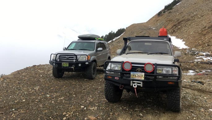
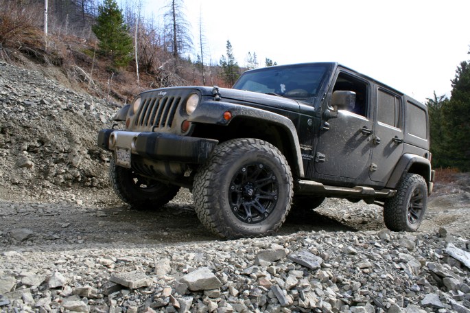
New to the group were Curt and Terry as well as Curt’s faithful pup Emma, a black lab. Curt was driving his recently acquired and modified 80-series Land Cruiser. It is a thing of beauty and I was glad another bigger truck with a winch was coming along in case my Sequoia became beached somewhere.
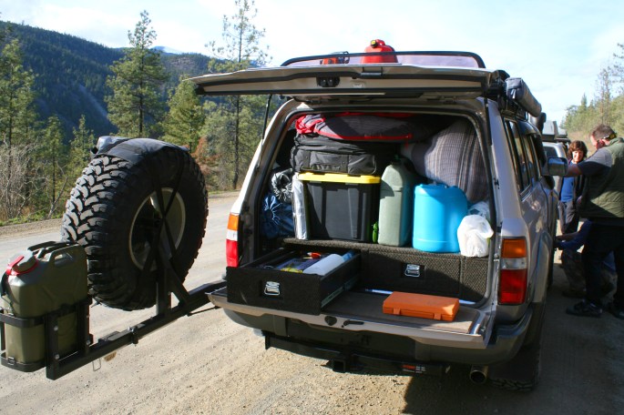
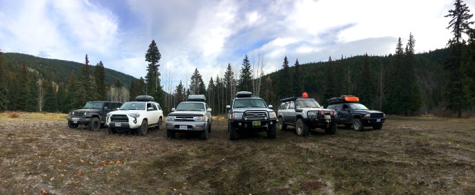
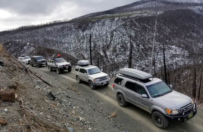
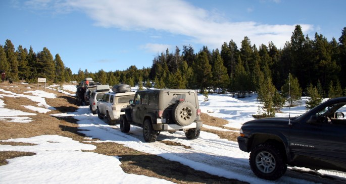
The group spent a few minutes acquainting themselves and discussing each vehicle’s driver experience, off-road capabilities and recovery gear. I was relieved to hear that everyone had brought along the basics as requested. Out of the entire group, only Cam and myself (JC) had some knowledge of the area and driven a portion of the route we planned to follow. The group had grown to a total of six vehicles and nine people – on the verge of being too large for the logistics of locating suitable camp spots and smooth communication, but at least every vehicle was equipped with a radio to discuss issues on the fly.
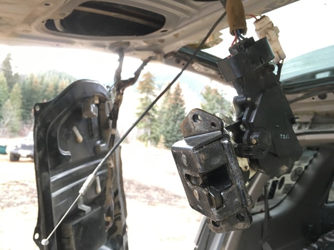
As luck would have it, Andrew’s 4Runner developed a braking issue in the parking lot: one of the rear brakes was sticking. Around the same time, my rear hatch decided to call it quits for the twentieth time, staying closed and locked no matter what I tried. I decided it was a problem for later, and Andrew’s brakes were sorted with only a minor delay. Finally, all together we set off to the north, away from all towns and paved roads.
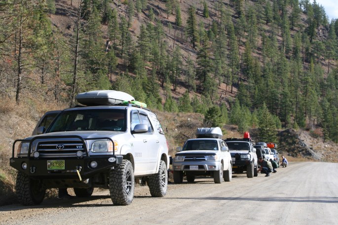
Reaching gravel, the line of trucks pulled over to the shoulder to air down as we wouldn’t see asphalt for several days. You could sense the excited vibe of the group as the main part of the trip was beginning, and it didn’t take long for the cameras to make an appearance. It didn’t hurt that the weather was absolutely perfect.
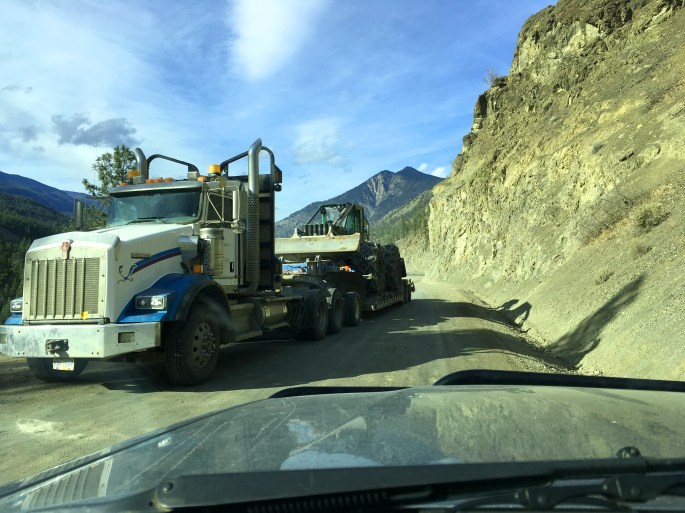
Several times we moved over as loaded logging trucks were heading down the valley – I’m always happy to give them space and let them work. After all, they are the reason many of the bush roads we travel on exist in the first place.
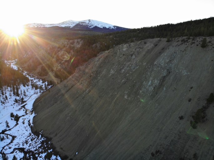
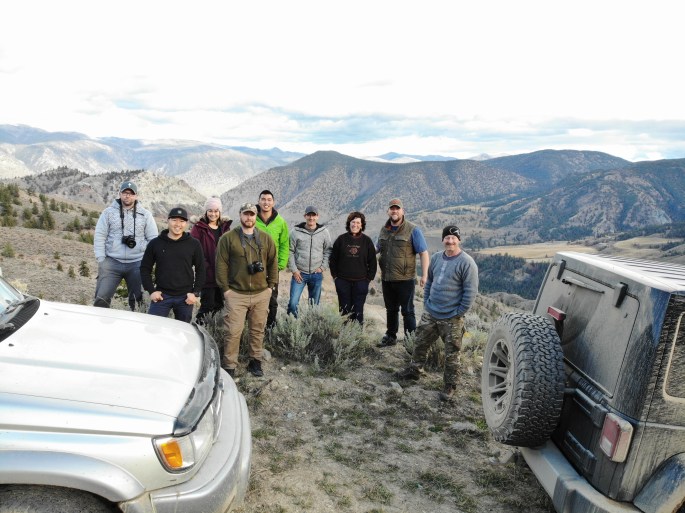
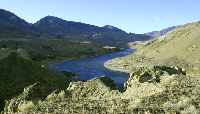
Soon we reached the first pit stop, and a scenic one at that. Moha is the name of the area, but also of the large horseshoe like canyon near the confluence of the Bridge and Yalakom Rivers. A small pull out affords a great vantage point to see the canyon in its entirety. Out came Curt’s drone and it took the first group photo, except Kyle was MIA so we’ll just say he was finding a tree somewhere.


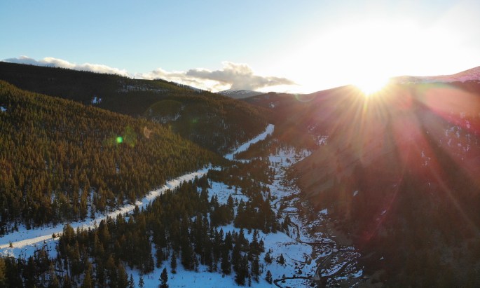
Moving along, the goal for the day was to keep the driving light and set up camp early. Following the Yalakom River up the valley, we were soon into real wilderness = grizzly country. Years ago while camped up in this area, a local rancher told us a chilling story of a large grizzly killing and dragging away one of his cattle. To me, this is just affirmation that the Yalakom area is still a wild place, and I’m perfectly content to share it with the big bears.
Prior to reaching our destination for the day, we passed through a First Nation informal checkpoint… okay technically it was a road block as they have a log across the road to stop traffic. This was not a surprise as I had passed through the area a few months prior. A local elder, supported by other volunteers, has set up a permanent camp alongside the road with the intent to preserve the integrity of their people’s historic territory. From my experiences, they are usually polite and want to know your intentions in their proclaimed area. If you are hunting, they request you provide proper documentation. I would suspect if you are working for a mineral or resource company, they would take issue with that and try to deny access. Although technically a civil issue, I could see a confrontation turning criminal rather quickly. In our case, there was no drama as we voluntarily divulged we were heading up camping and to explore the back roads. If we were successful in our route, we wouldn’t be returning through this area anyways. The log was moved aside and our convoy continued without issue. I’ve included this portion of the story into the trip report purely as information to other explorers who may head this way in the future. I would suggest a quick search on the topic before heading through in the event the local political landscape has changed.
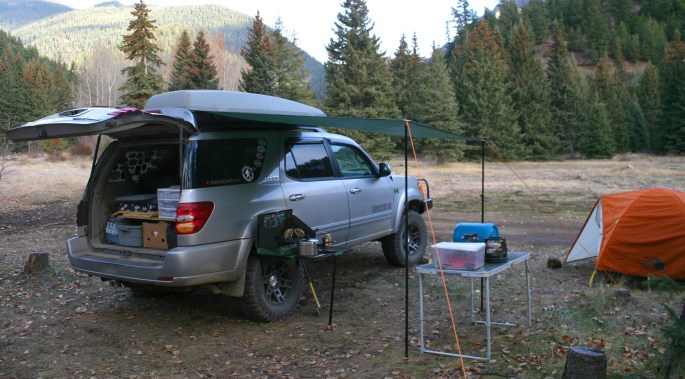
At last, with hours of daylight to spare, we nestled into camp along the Yalakom River. Our home for the night was a vast meadow with a preexisting fire ring, picnic table, and even an old outhouse. Perfect. Each vehicle quickly had their respective dinners being cooked up with food being shared around to others – something that would become a staple of the trip! Even Emma the dog was mooching food from several camp kitchens.
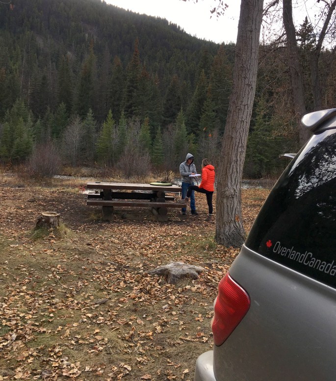
I had to take a sneaky photo of Andrew showing off his bush poop-chair to Jenny, I’m sure it was a fascinating conversation.
In camp I pulled apart the hatch on the Sequoia and re-worked the cable and lock mechanism, eventually getting it to work again, likely only for a few months as this is a common problem on the 1st generation Sequoias.
The group settled in around the roaring fire, only to be distracted by Cam crossing the river in his swim shorts, only to grab a giant piece of firewood and return to camp.
We all had a laugh as we knew the river was frigid. I’m pretty sure I overheard some mutterings on the likeness between a sasquatch and the crazy guy in the river, although they may have been my mutterings…


Day 4:
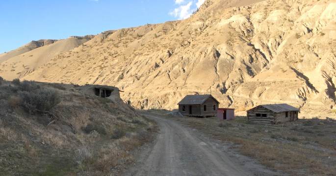
The next morning we all woke up at varying times and cooked a leisurely breakfast. A small rain shower made us pack up quickly and come together to discuss the route and plan for the day. We hit the road by 1030 which I thought was a decent start for a large group. We continued up the valley, exploring the odd side road and any spur which looked intriguing. The further we went upriver, the more mountain views became exposed. We cautiously approached an old mine which had been shut down, seemingly recently, and wondered if it had something to do with checkpoint charlie we experienced the day before. Without seeing signs stating “no trespassing” or anything similar, we stopped to stretch our legs and respectfully check out the area.
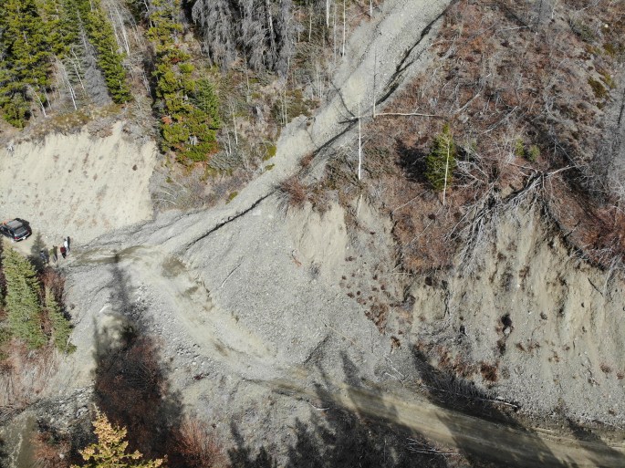
Returning to the Yalakom Rd proper, we hit the rumoured slide at the 74K mark. Apparently it had been impassable in the past, but by this point there was a rough “jeep trail” up and over the debris.
Everyone made it through without a hitch, but I would imagine things would change again by next spring.


Coming around a corner we passed a rugged hunting camp. There was smoke coming from the wood stove but no hunters around (presumably out looking for dinner!). Passing the hunting camp we also took a chance at some more spur roads, but eventually returned to our intended route up the valley.


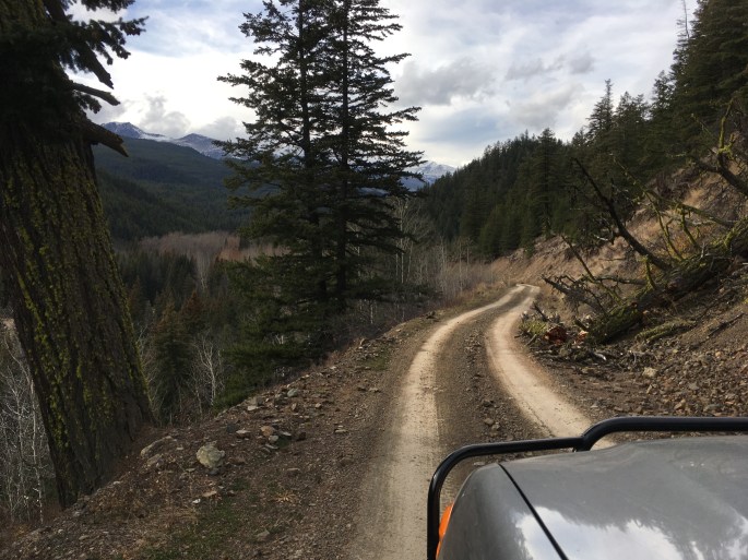
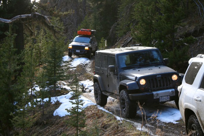
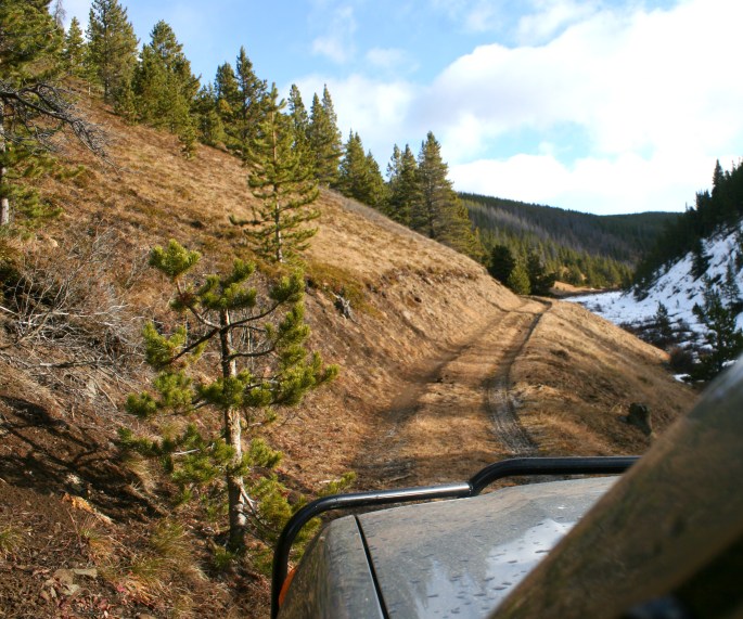
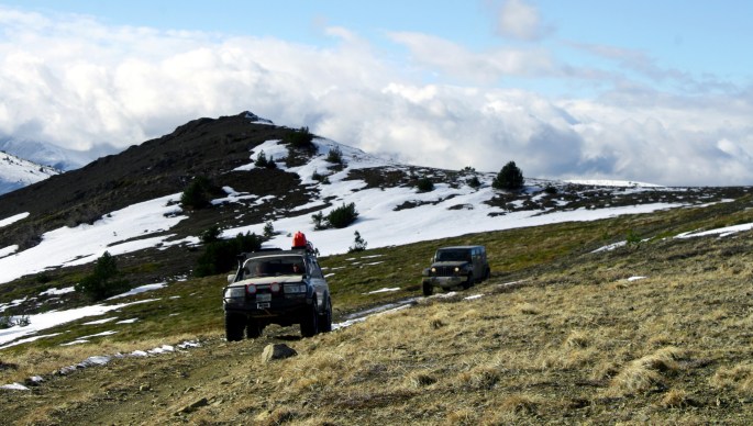
Reaching a split in the road with Poison Mountain in view, we took a chance on a tight track to the south west. The track was a glorified quad trail, with varying depths of snow on northern facing slopes, and bare in sections where rays of sun reached the forest floor.

The trail crossed Poisonmount Creek numerous times, and each corner brought something new to see. It was an enjoyable route, even more so with the uncertainty of making it through, or having to turn around. It was nice to drive some more technical terrain, thanks to the snow and odd steep sections, either up or down. In summer or dry conditions, any 4×4 content with some pin striping would have an easy time completing that portion of the route.
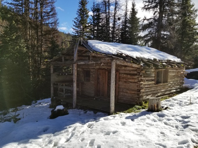
We had almost completely circumnavigated the base of Poison Mountain when an old trapper’s cabin came into view. It was immediately clear that it had seen better days as the floor was rotting and covered in giant rodent excrement (marmot possibly?). With the Hantavirus in mind, we only had a quick peak inside to satisfy curiosity. The foul smell alone ensured it would be a short visit.
Eventually we came to the meadows and trail junctions on the northern side of Poison – so many trails to explore but not enough time! The group took another break and discussed options on the maps. One of the routes to the west went down to the Mud Lakes area, however with the current snow conditions, it would have been a gong show to attempt.
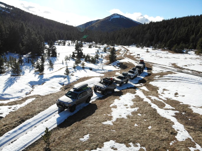
The access road to the summit of Poison was under approx. one metre of snow drifts. After I scouted it out, and my forward progress ended, I u-turned and the group proceeded to the start of China Head.
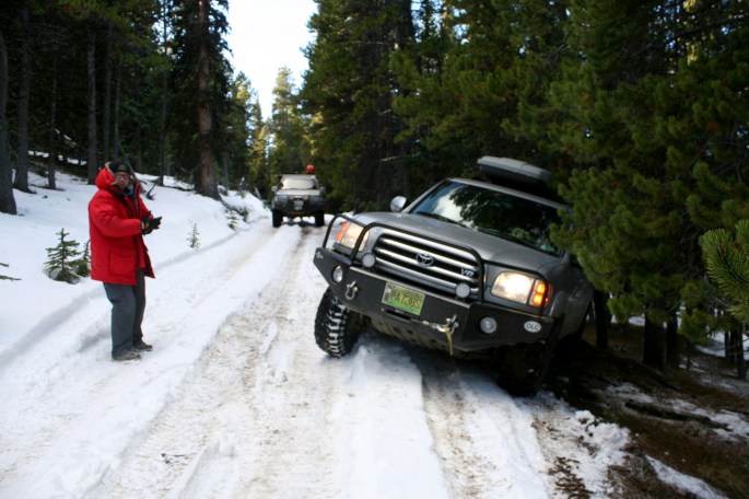
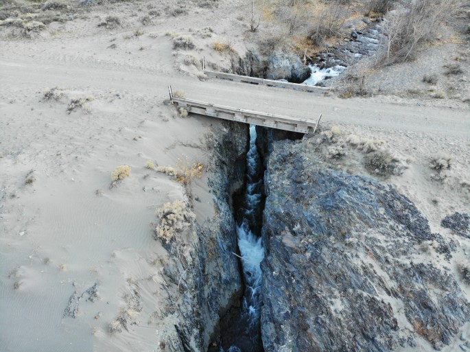
It was an icy decent in the shade of the pines down to Davey Jones Creek. Darkness was approaching and the plan was to find a spot along the creek for the night. Of the several spots I had in mind, all were covered in snow, which is not ideal for mucking around camp. We found the bypass around the washed out portion at the start of China Head trail. The snow made an otherwise easy detour a bit more challenging (fun) and we all made it through easily enough.
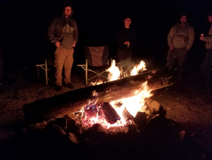
About a click past the bypass we reached a dry and grassy spot large enough for our giant camp. Immediately Cam disappeared into the bush on the hill above camp, and soon the shriek of his chainsaw could be heard. Moments later, logs and chunks of firewood were tumbling down the hill, landing right near the fire ring, much to our amusement. Cam is set on his priorities when reaching camp, and getting another roaring fire going is a great first priority. Camp kitchens were assembled and steaks, soups, salads and some exotic sausages were shared, along with camp coffee. Emma made her rounds, begging for food from each camp as usual.


After sunset, the temperatures plummeted, reaching minus 17 Celsius around midnight! Naturally, the fire was the popular place to hang out. Someone bragged about an electric blanket in their tent. Kyle (this was one of his first camping trips) laughed at his generic sleeping bag purchased from Canadian Tire, and received many offers of extra blankets from various people. I can’t remember if he accepted any offers, but I was glad to see him alive and poking his head out of the tent come morning.
Day 5:
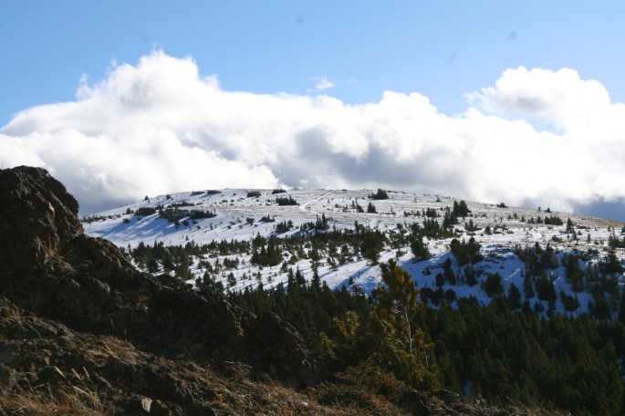
In the early morning hours, a minor weather system rolled in, affording us cloud cover and rising temperatures. The quick weather fluctuations in the Yalakom/Poison areas never cease to amaze me – there have been several times I’ve been camped in the area and seen some wild weather changes. At nearly 6000 feet I suppose the elevation has something to do with it.
The plan was to attempt the China Head traverse, east to west. Once complete, we’d have another 100 kms of gravel to drive before reaching any paved roads. At this point, I was unsure if the traverse was even possible, never mind the road conditions due to snow and ice – but that’s part of the adventure and turning around would be okay too, we were having a blast.
The route, which isn’t wide enough for two vehicles to pass most of the time, begins on a shelf road meandering along the heather meadows adjacent to Davey Jones Creek. Of course it was off-camber, leaning to the downhill side, and covered in packed snow/ice. As many of you readers know, Expedition BC has been testing a set of 285/70/17 Cooper STT Pro tires, through a partnership with OutHereAdventure.com and Cooper Tires.
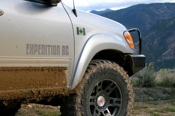
Up until this trip, I’d been waiting to experience what the tires had to offer in snow and ice conditions, so despite the sketchy-at-best road conditions, I was eager to put them through the ringer. (The tire review has been completed and can be read HERE.)
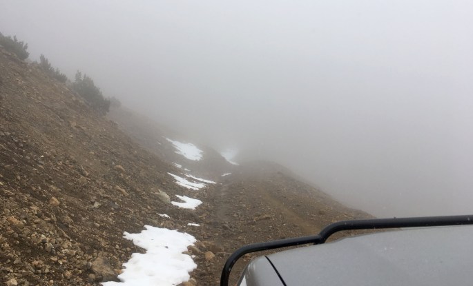
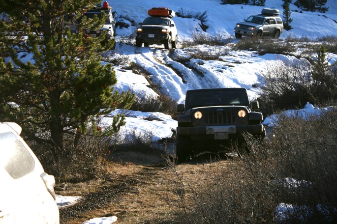
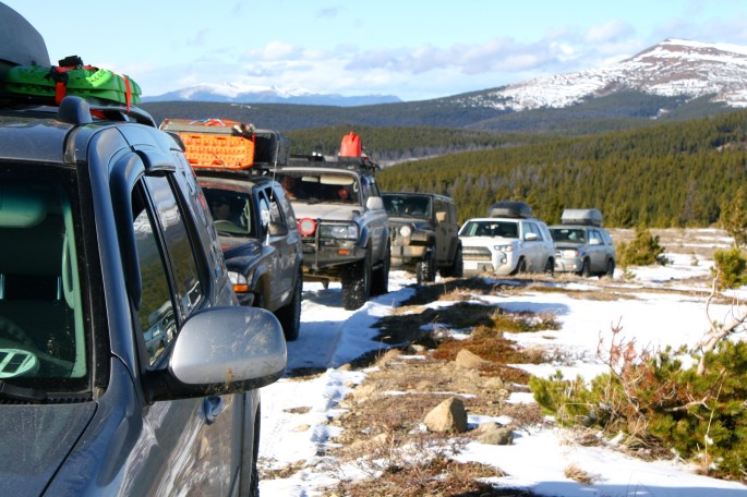
Each rig navigated the shelf road carefully, then turned back into the trees for the ascent up to China Head proper. Climbing above treeline, the trail crosses sensitive alpine meadows, hence the motorized closure in the area (with the exception of the China Head route we were adhering to). The sense of uncertainty we’d complete the route grew as glimpses of the trail above came into view.
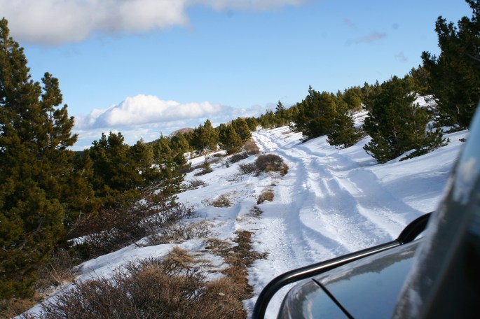
The whole ridge was covered in waves of drifted snow with a solid wind-crust layer on top. Normally, staying on track would be challenging, however we were following faint tire ruts from some brave souls a few weeks before us. Seeing other tracks on the route helped to brush some of our uncertainty away! One benefit of the high winds and exposed ridge is that snow depths aren’t typically as deep as we experienced in the forest where the snow accumulates.
Only Andrew, in his bone stock 4Runner (right down to the factory street tires) had any real issues summiting the ridge. With the rear locker engaged and a bit of momentum, he was able to scoot up with a big grin on his face and some hootin’ and hollerin’ over the radios.
The wind was so strong that it blew my ball cap off my head and out the window. I sat there flabbergasted as I watched it tumble and swirl down a snow field and disappear out of view – I really liked that hat! I stopped the truck and waded knee deep down the snow field to the bowl at the bottom where I promptly recovered my hat and tucked it in a pocket. Out of the truck, one had to lean into the wind gusts to stay on their feet.
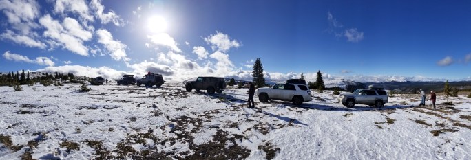
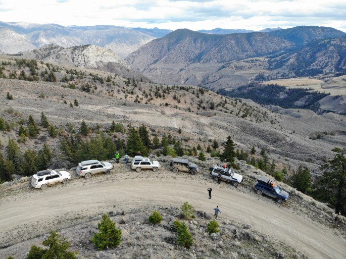
Returning to my truck, I saw that the group had also stopped and the cameras were out. It really was beautiful as we were on one of the highest points around, with views of the Shulaps Range, Red Mountain, large glaciated peaks far off to the west, as well as Poison Mountain in prominent view. Once up top, the route varied between hard snow and bare dirt, which was a nice reprieve.
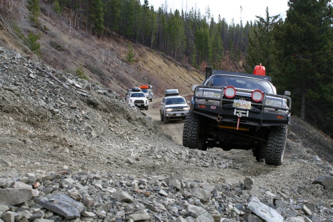
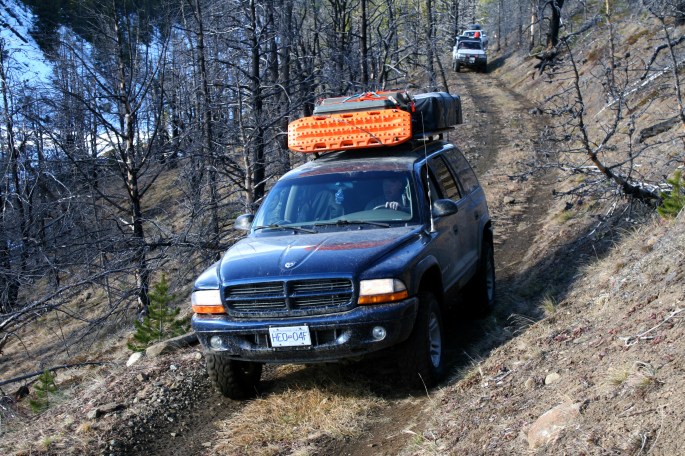
With fingers and faces freezing, we retreated back to our respective trucks and continued off the ridge and back into the trees. The convoy came to a halt at the top of a steep hill packed with snow on the trail. I had visions of the trucks playing a mix of slip-and-slide and pinball, bouncing from tree to tree down the trail. The drivers all came together at the top and shared ideas on how best to proceed. Suggestions were being tossed around, ranging from winching each vehicle down slowly, to just winging it and seeing what happened! Cam came up with a brilliant idea, as he had packed a set of v-bar chains and offered to go first, with the intent of chewing up the surface to increase traction for the rest of us.
The group ensured each driver was comfortable moving forward with that plan, which was important to stop and take the time to confirm, as everyone had varied four-wheeling experience. To allow Cam to move to the front of the line, I plunked the Sequoia into a ditch as there was no room otherwise (remember what I said previously about the Sequoia getting beached somewhere?). A quick tug from the Durango got me going again, albeit with many onlookers snickering quietly.
Cam chained up and crept down the hill, giving the “all-clear” via radio once he was out of the way at the bottom. Like a heard of turtles, each vehicle made their way down, leaving a big gap between. Ryan and Jenny enjoyed using their crawl-control gizmo, while others kept tires out of each-others tracks for more grip.
Success! Beyond this point, there was no more expected obstacles and the group relaxed, knowing we’d likely complete the route and be able to continue. The route curled its way through thick forest with the odd clearing and view down the valley. We dropped below the snow line and passed by a large hunting camp with several truck/quad combos and various tarp shelters. With the amount of stacked firewood, I guessed they were planning for a long stay. With a significant elevation loss and a fun, but not difficult track, we popped out on the larger forest road near French Bar Creek. This road eventually became the West Pavillion FSR which is wider and allows for much faster travel in most sections.
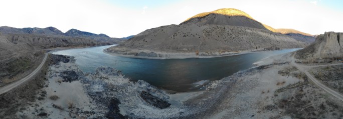
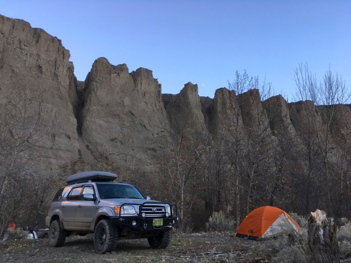
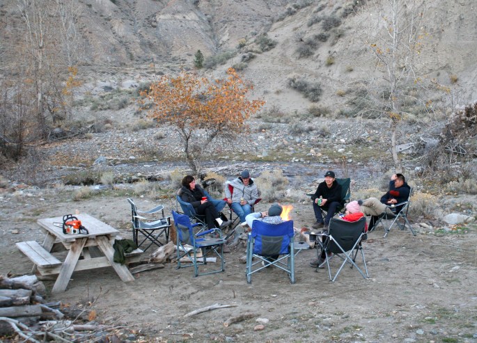
That evening’s camp was at a secluded creek side spot, very close to the shore of the Fraser River. Honouring the request of the person that shared the spot with us, I won’t disclose too many location details.
It was an epic spot for the last night of the trip, and down at the measly elevation of the Fraser, the daytime temperature was plus 17 degrees Celsius, balmy compared to the previous night’s minus 17!
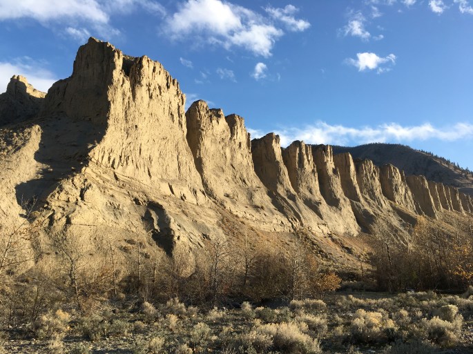
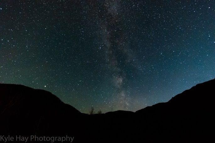
More gourmet meals were shared around the fire. Kyle wandered off in the dark with his fancy photography equipment to catch shots of the Milky Way, while the rest of us enjoyed the company around camp. A wall of hoodoos dominated the view in camp, and it was a fantastic evening to cap off the trip.
Day 6:
The morning of Day 6 confronted some with the realities of the real world back in town and the group split for the drive home. Many of us were strangers at the start of the trip, but we all left as friends and vowed to adventure together again. Plans for Roam Wild 2019 were discussed, with all of this year’s participants hoping to partake again next year. These open-invite group trips are one of the highlights of the year, and we’re hoping to take on more epic multi-day group trips in 2019!
JC.
