During August 2018, during the height of forest fire season in British Columbia, we put out an open-invite online for others to join us on a back roads trip from the Fraser Valley to the Cariboo. The idea was to follow unpaved roads as much as possible, even if it meant detours and taking the long-way around. A trip that normally would take a half-day on the main highway, our dirt-route took us four days to complete.
Jeff and his family responded to the open invite and it turned out that they had a Kakadu Bushranger trailer as well. The start of the trip was the first time any of us had met in person, but since we all shared a passion for camping and exploring, we got along just fine!
We met in the small tourist village of Harrison Hotsprings and started out on the East Harrison FSR.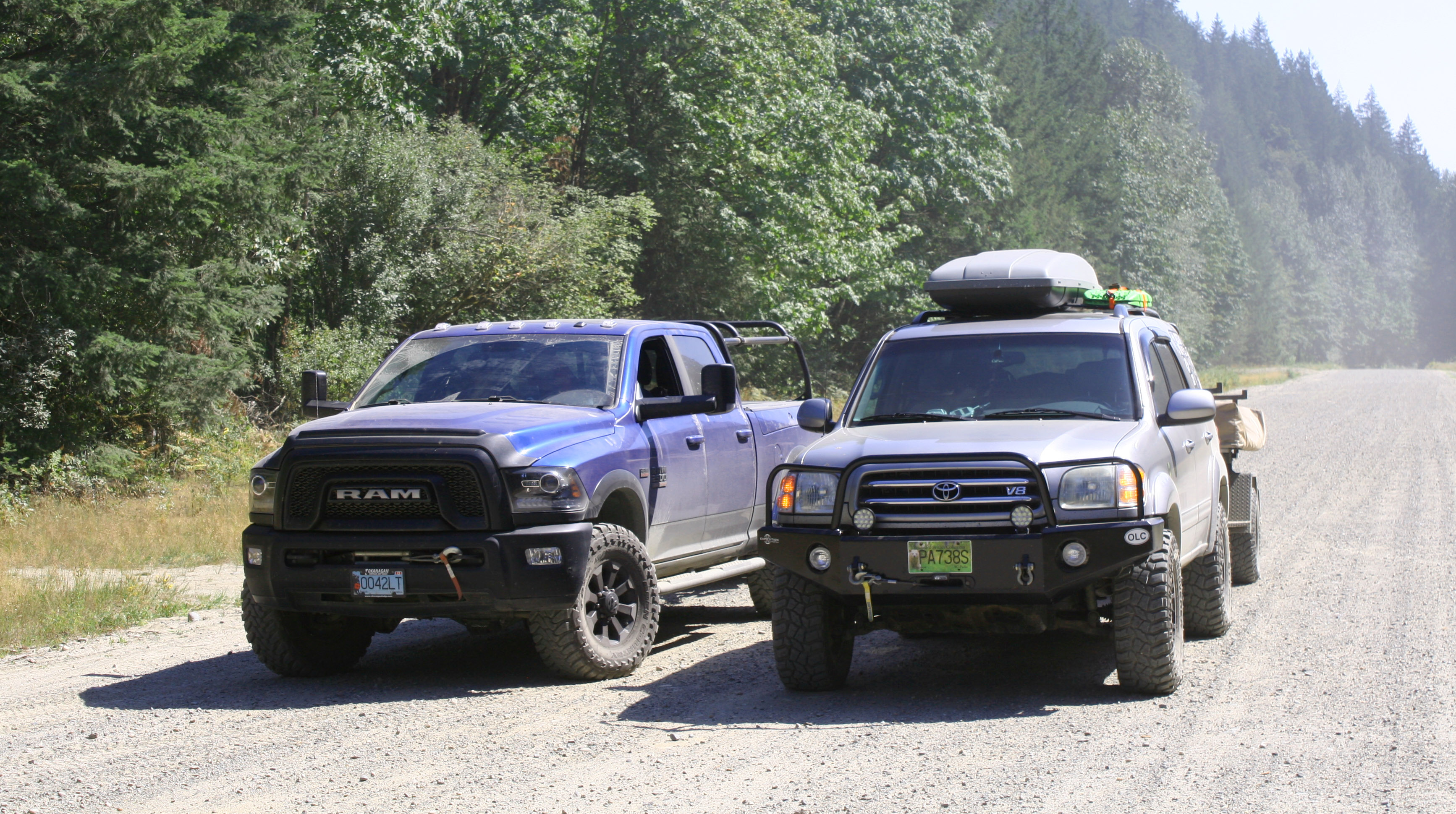
It was a hot summer day and quite dusty on the gravel roads. The entire route was brand new for Jeff’s family so luckily we got to lead the way and they usually rode in our dust cloud (sorry guys!).
Turning inland from the lake, we stopped for a break to check out the hydro-electric dam. If only we had time to swim…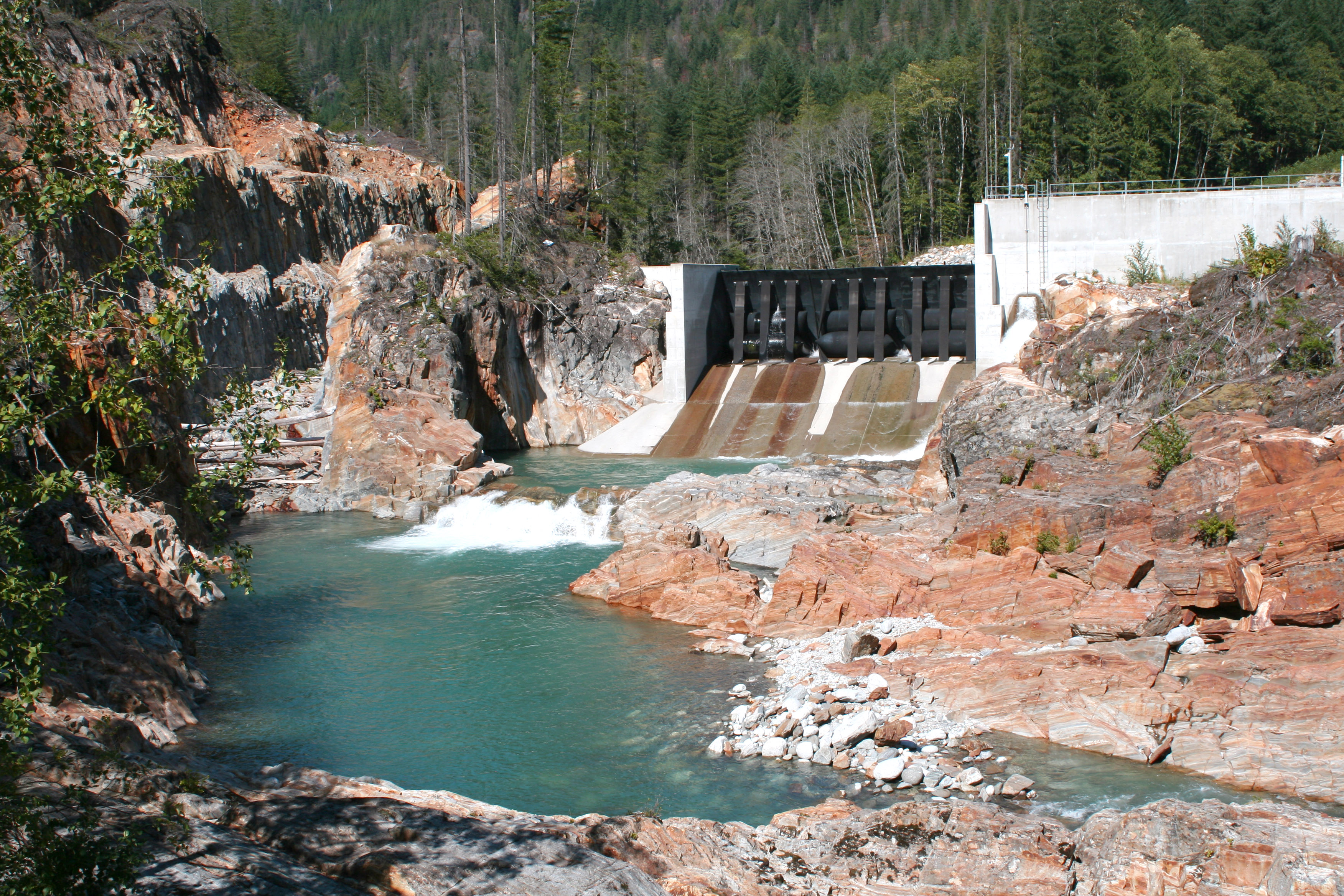
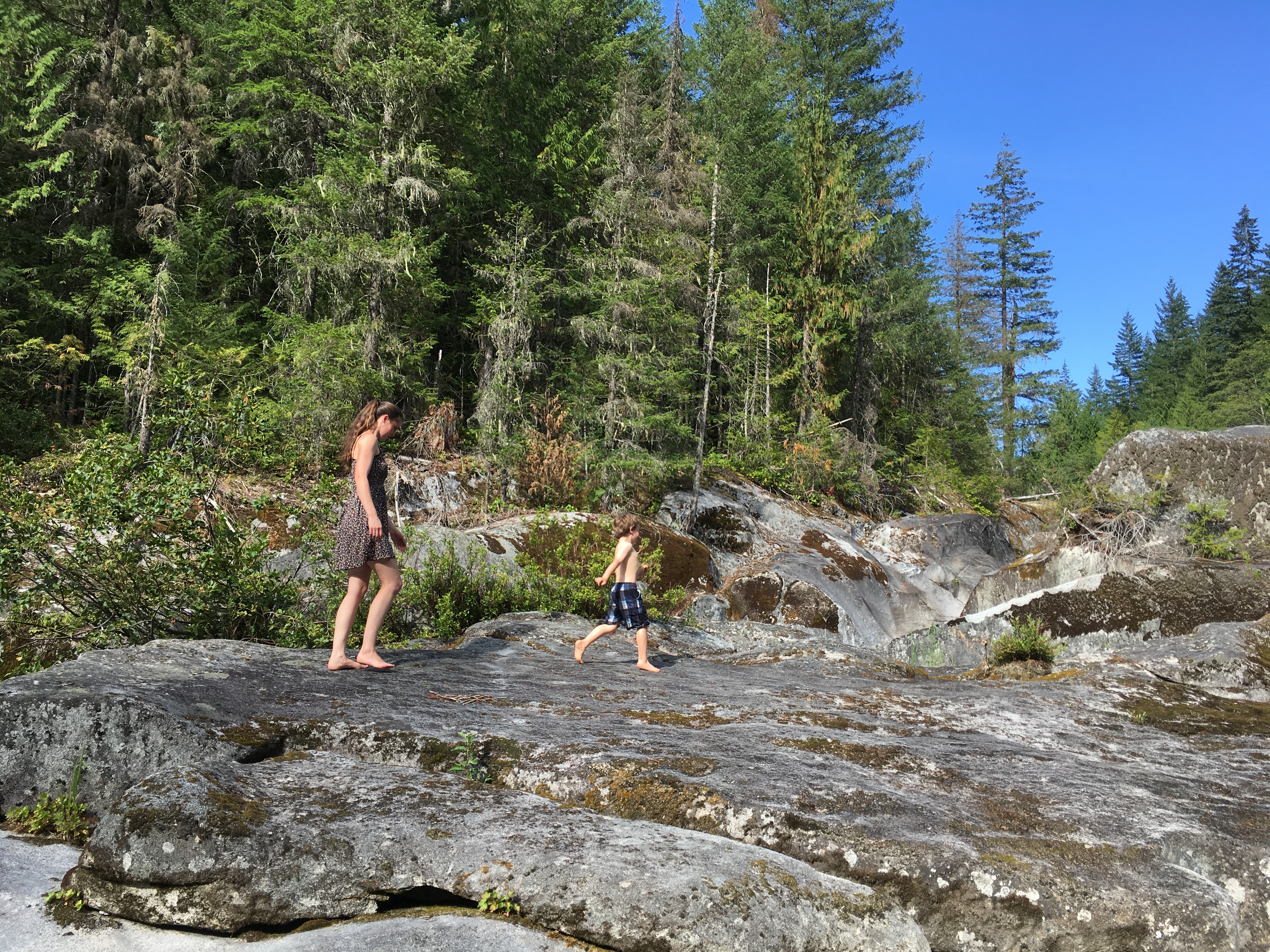
Later we did find a creek to cool down in, not far from the Clear Creek Hot Springs area. Thanks to the scorching summer day, the hot springs were not needed!
Kookipi Pass was a scenic highlight of the route over to the Nahatlach FSR.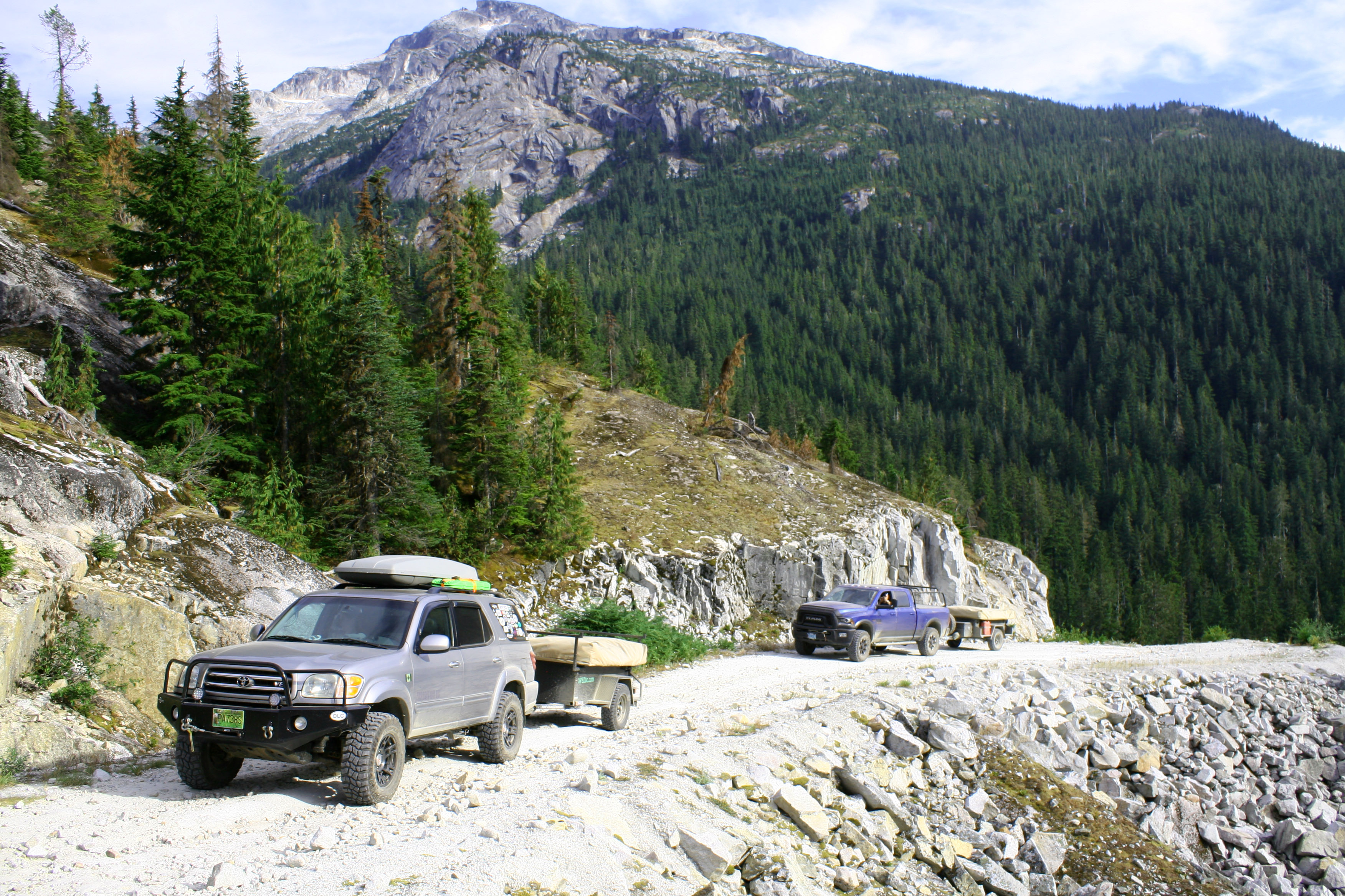
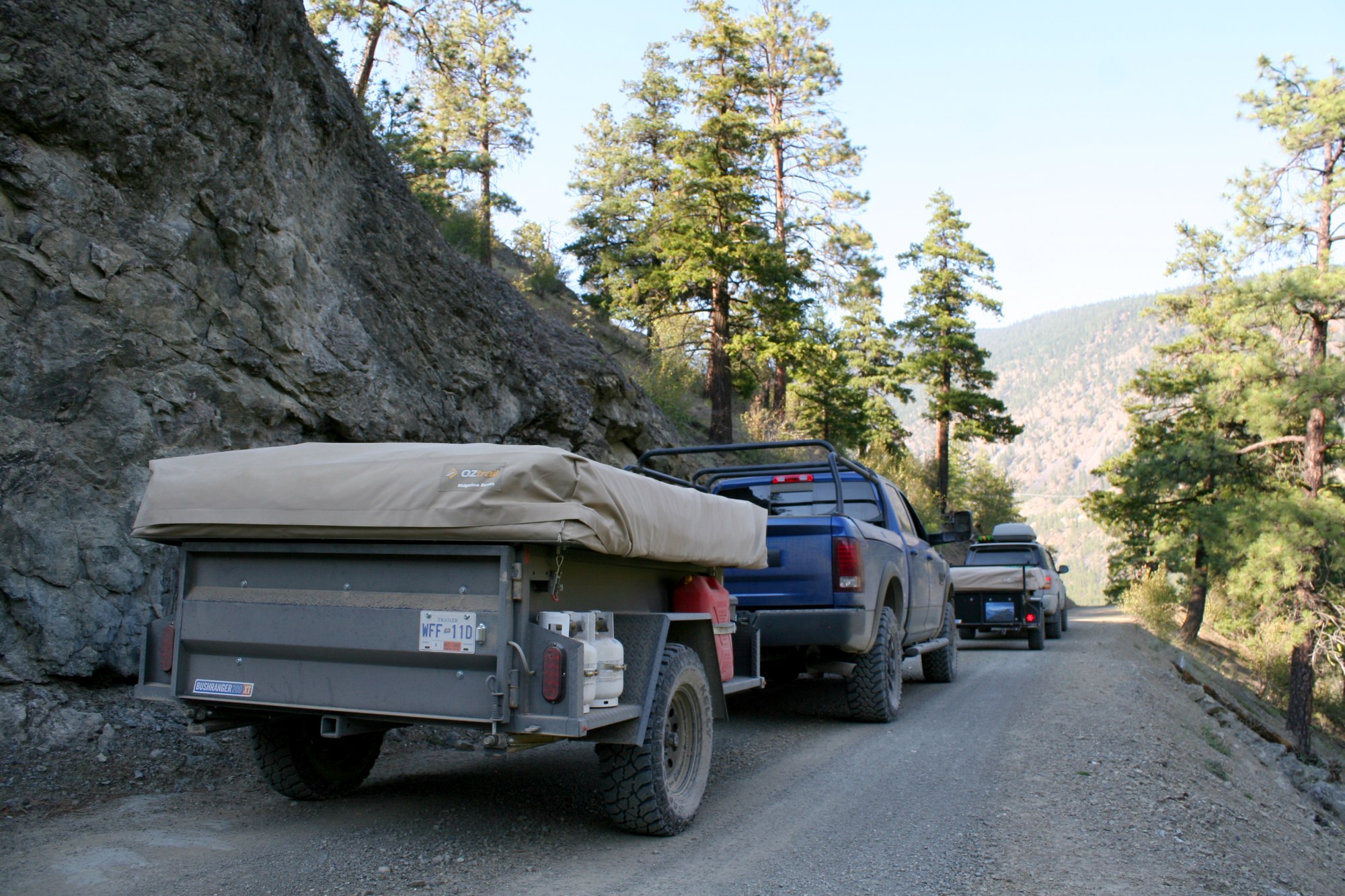
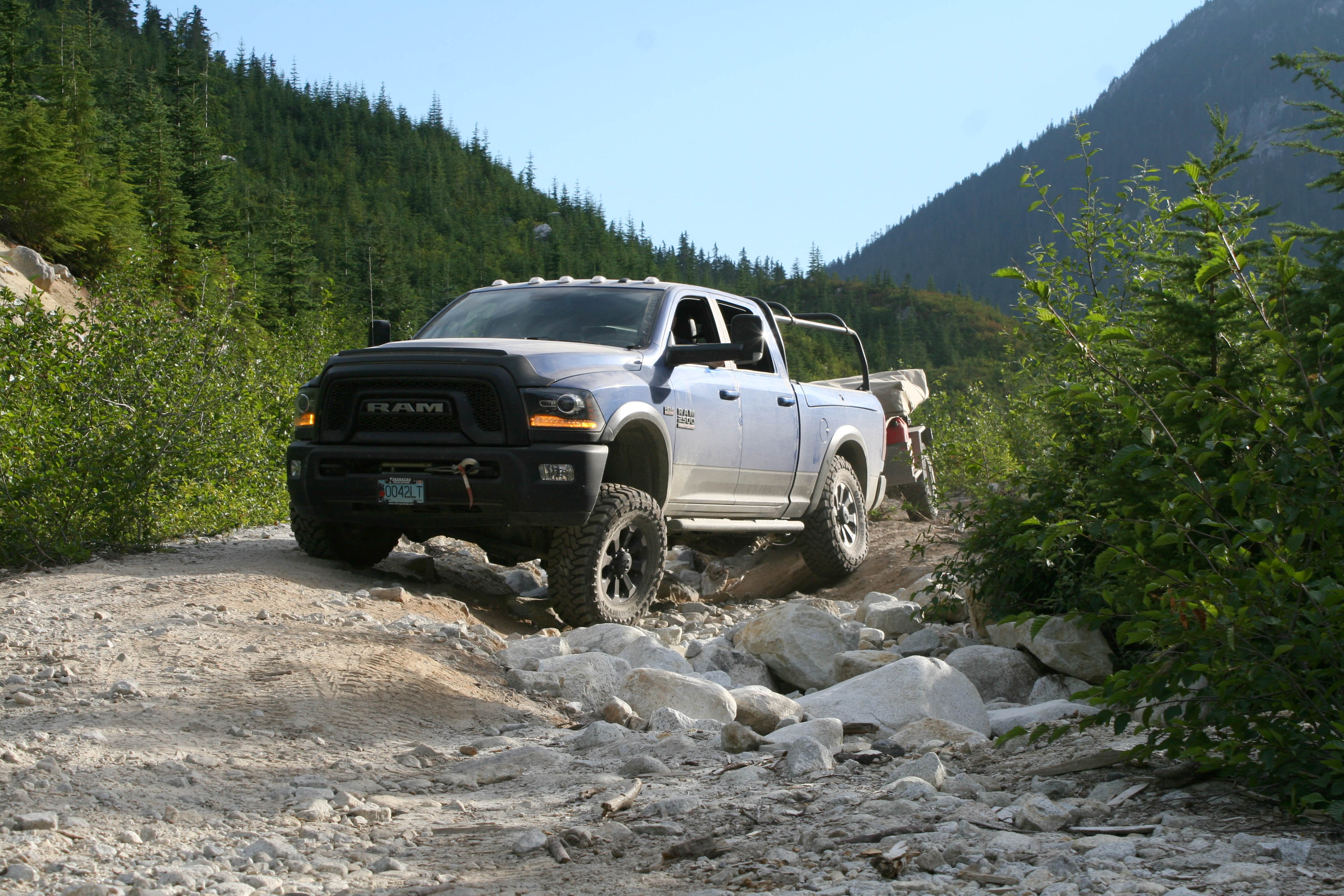
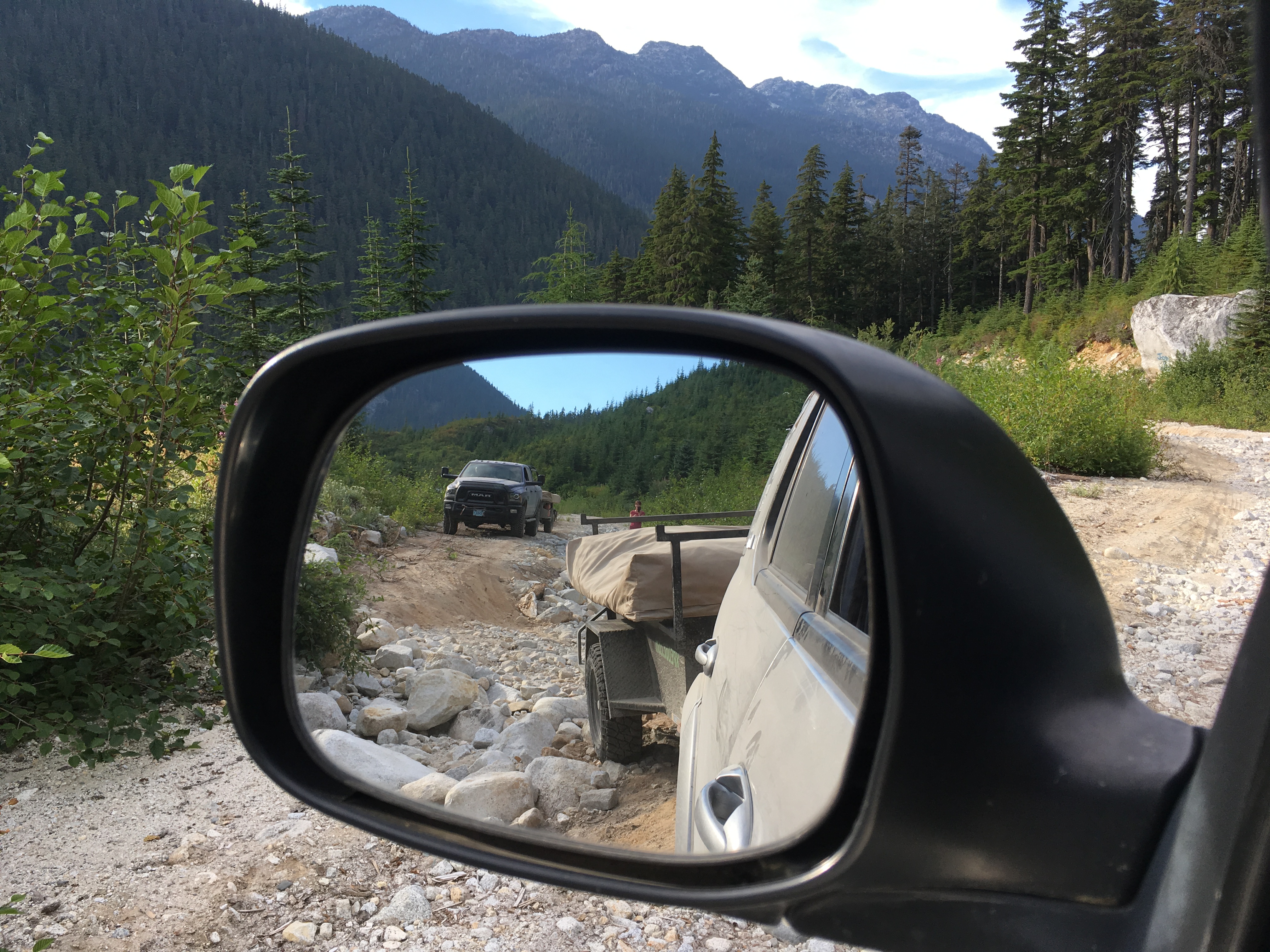
We found some washouts along the route and some other interesting areas which broke up the monotony of the relatively smooth FSR. 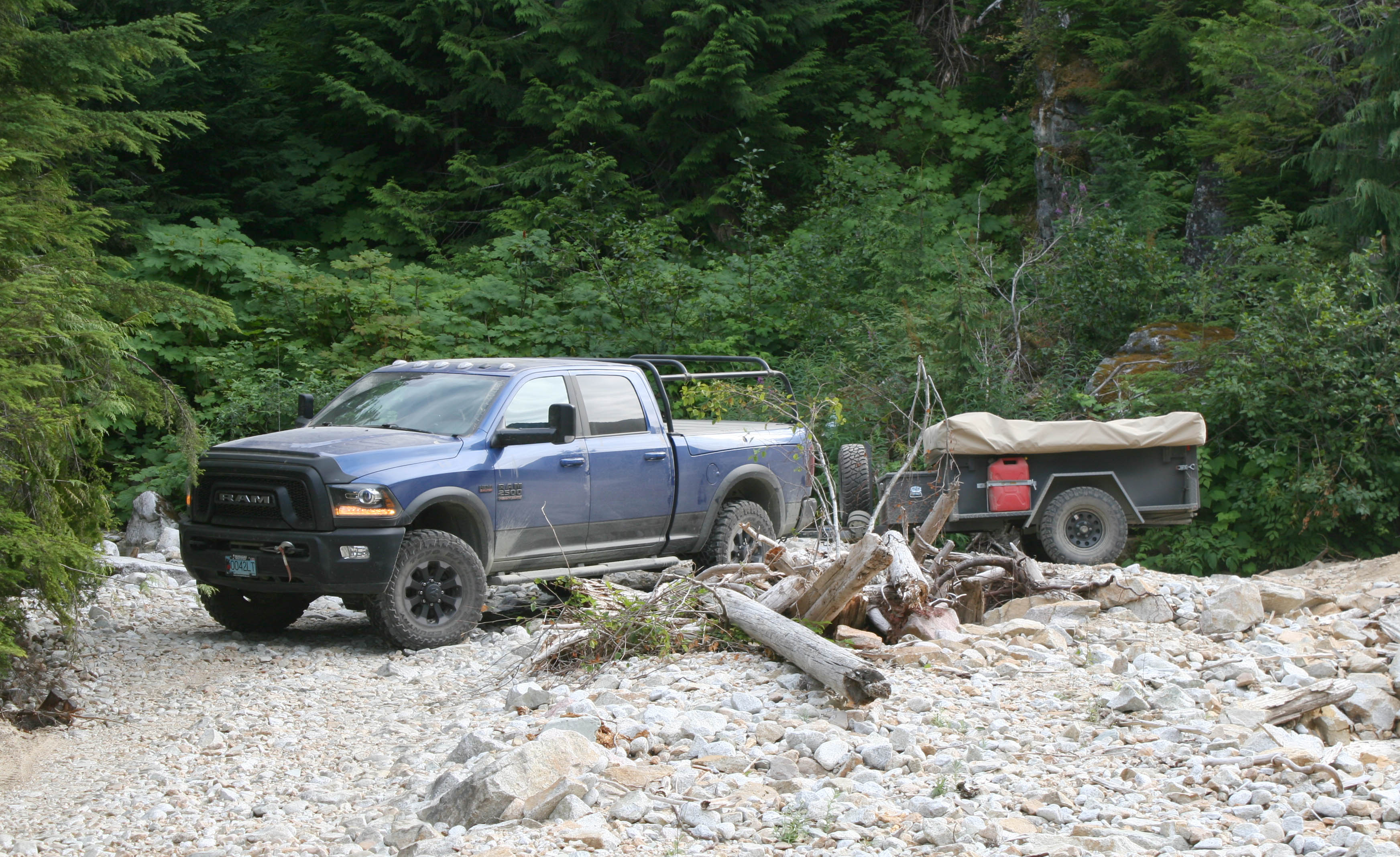
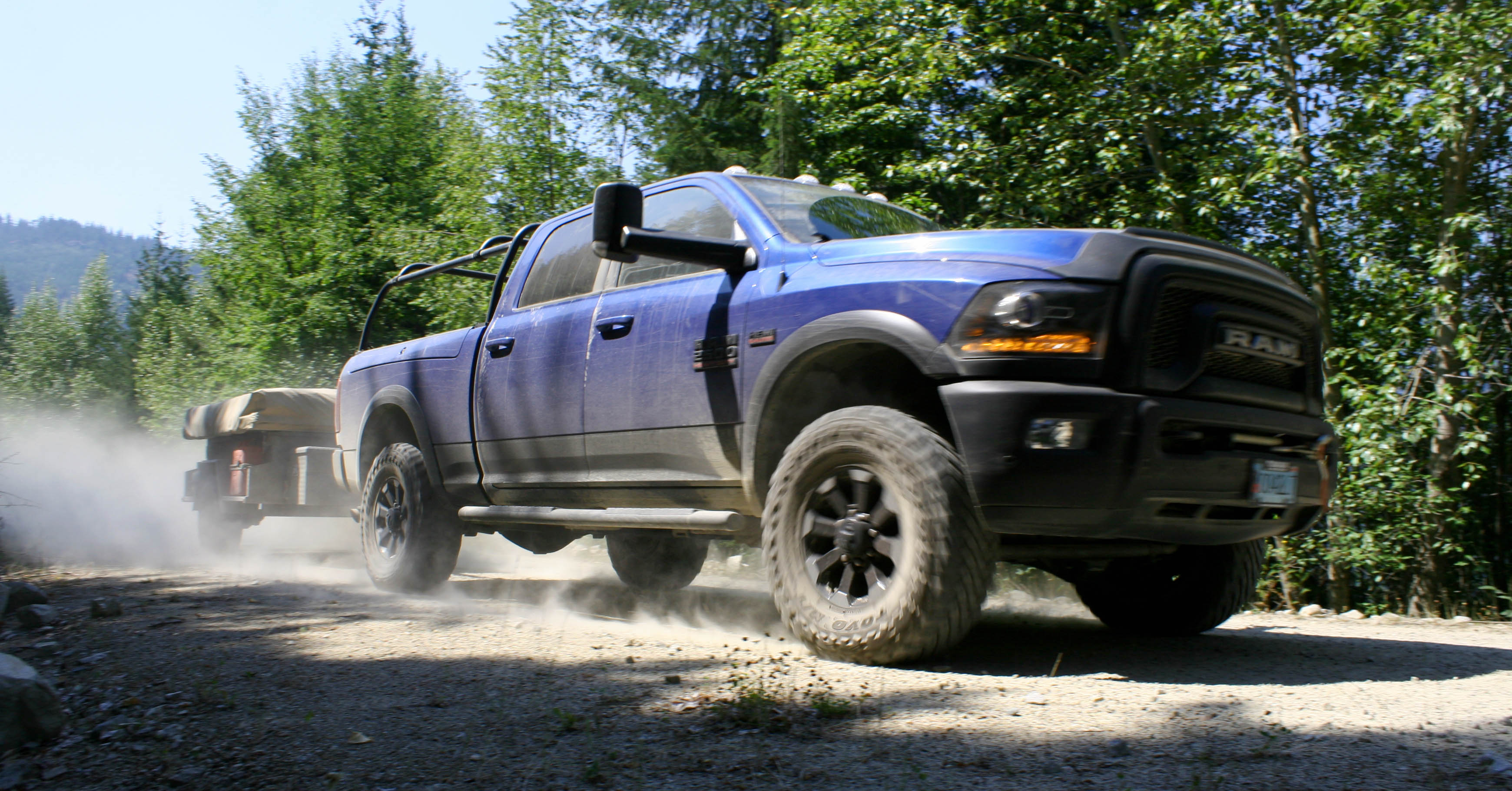
The Power Wagon in factory form is an impressive beast.
The Bushranger trailers are equipped with the Australian made Max-Coupler which makes for tension-free articulation and less worrying about the trailer following your line.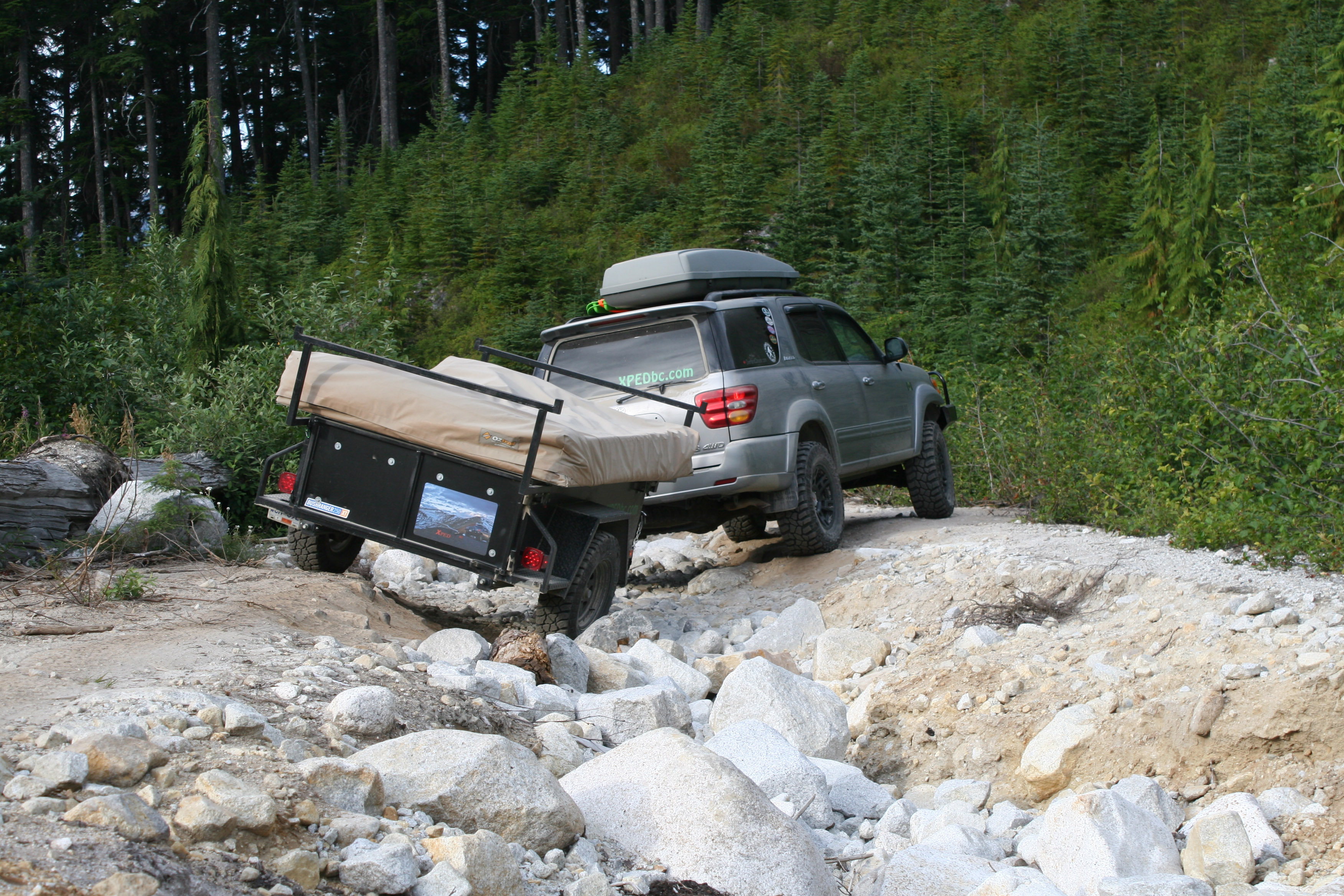
We continued on our way without any real trouble on the downhill toward the Nahatlatch area. The dust an always present but unwelcome companion.
We setup camp past the Nahatlatch Lakes just before dark and enjoyed chatting around the propane firepit after the kids went to bed.
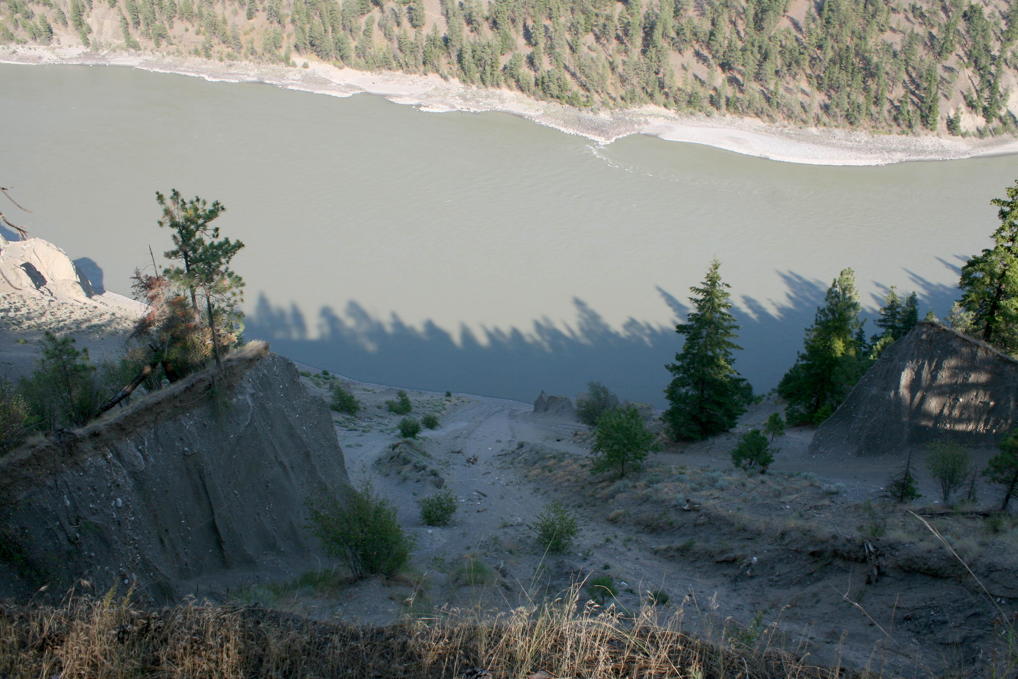
In the morning we only had a short jaunt to reach pavement again, near the communities of North Bend and Boston Bar. Pavement to pavement we covered 104 kms on off-road on the first stretch. Fueling up in town, we shot north on Highway 1 for eighteen clicks until hitting gravel again on the Mowohokan Creek FSR, which runs generally north, then connects to the Nicoamen FSR. This afforded us a nice view of the Thompson River far below.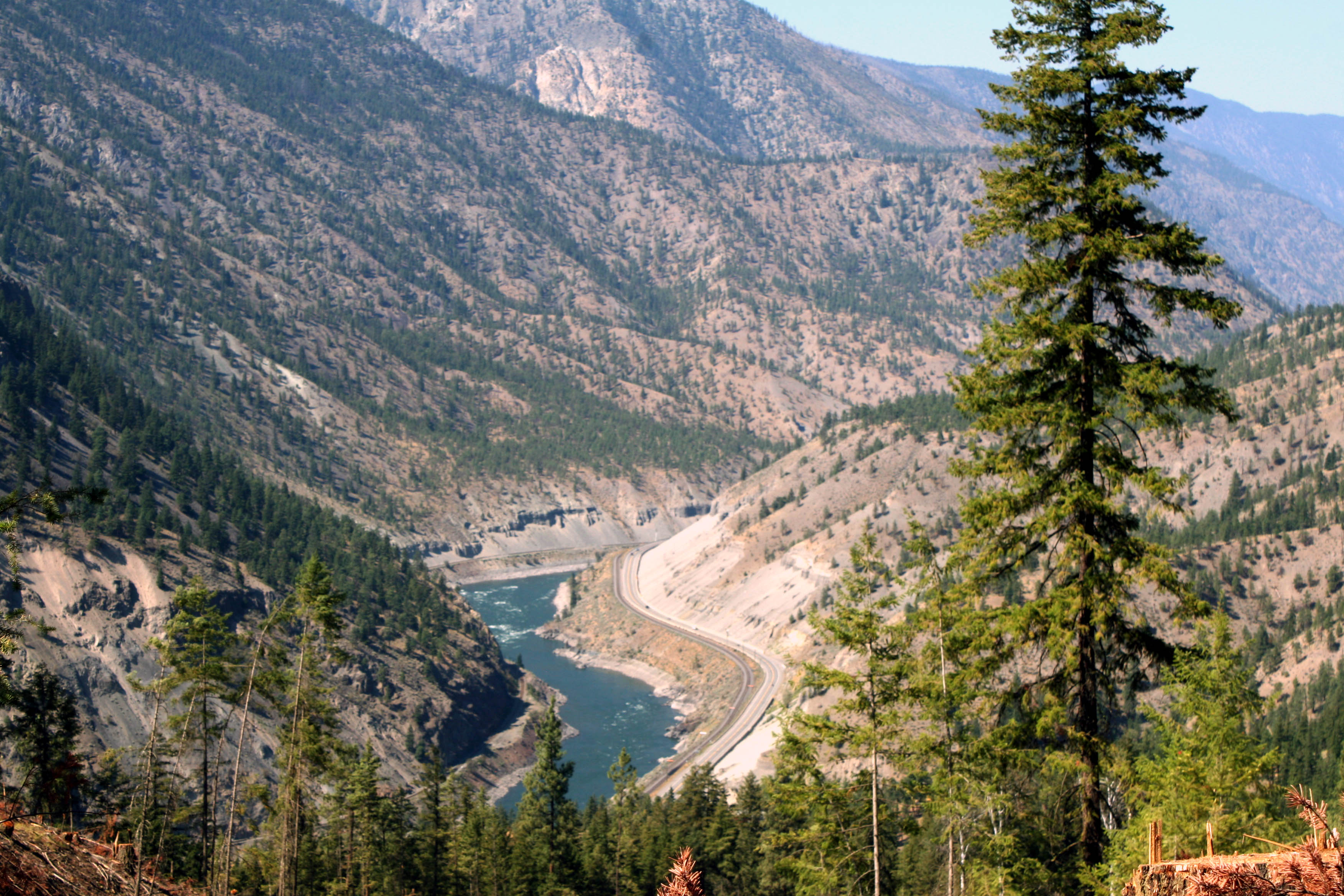
Another option from the Nahatlatch area would have been to stay west of the Fraser River and follow it on unpaved roads north to Lytton and beyond. This would have skipped pavement miles and been a more desirable option given our goal. Recent beta however was that the route suffered a major slide and a large section of road, possibly 100 feet long, was completely missing. Comparatively, the Mowohokan option was less scenic but we were happy for another option. This stretch of dirt covered 55 km’s, and deposited us back on Highway 1 just north of Lytton.
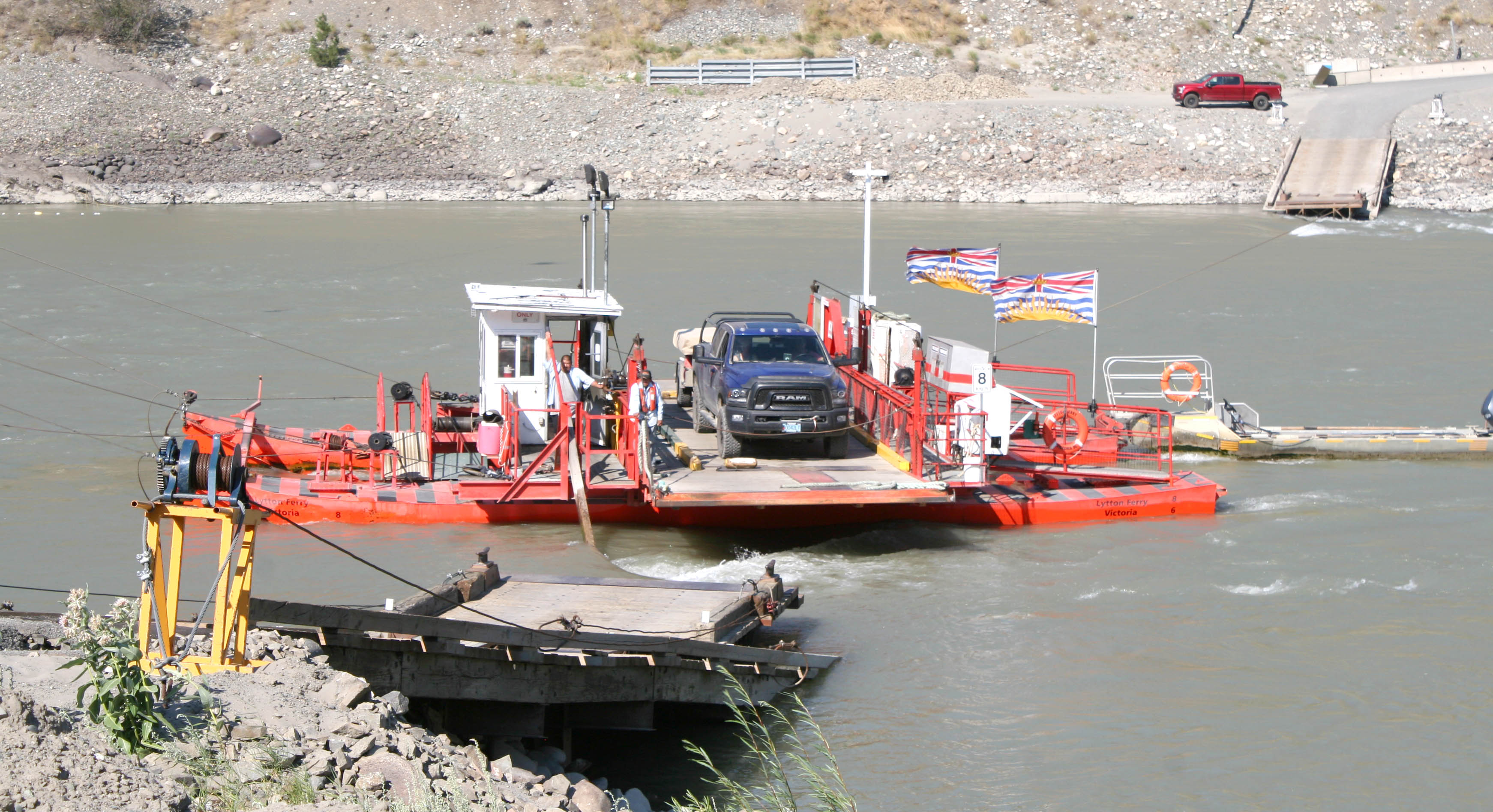
We backtracked south along the highway for 17 km’s until hopping on the Lytton reaction ferry, which carried us back across the Fraser River and back onto gravel roads. With our trailers hooked up, the ferry could only hold one of us per crossing. 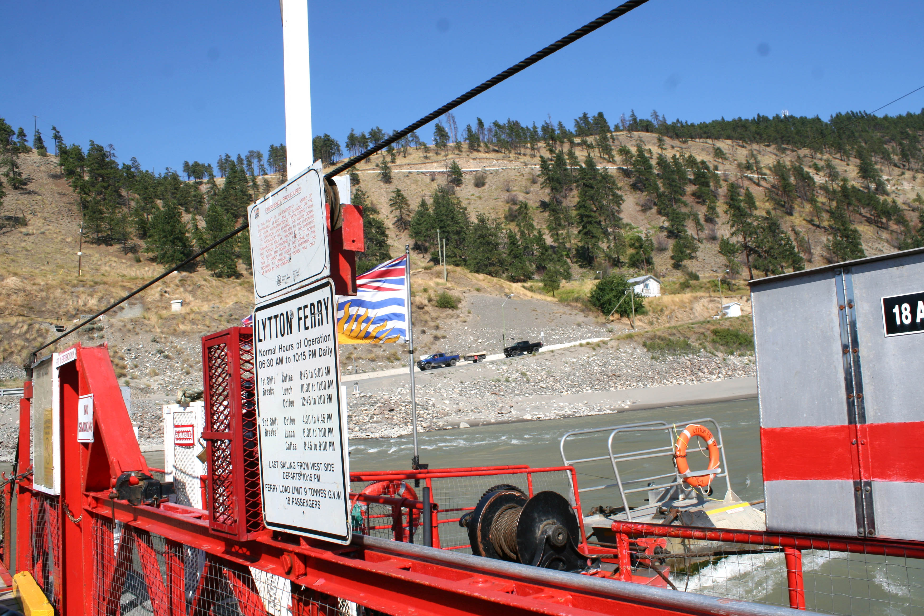
The Texas Creek Rd follows along the west side of the Fraser, with sharp blind corners and deadly drop offs right down to the churning waters. We took another break to scope out one of the cliffs.
The exterior temp gauges were registering at 41 degrees Celsius that afternoon and it was a struggle to find somewhere cooler to setup camp.

We made a turn up one of the deep slot canyons and found a spot tucked away in the forest.
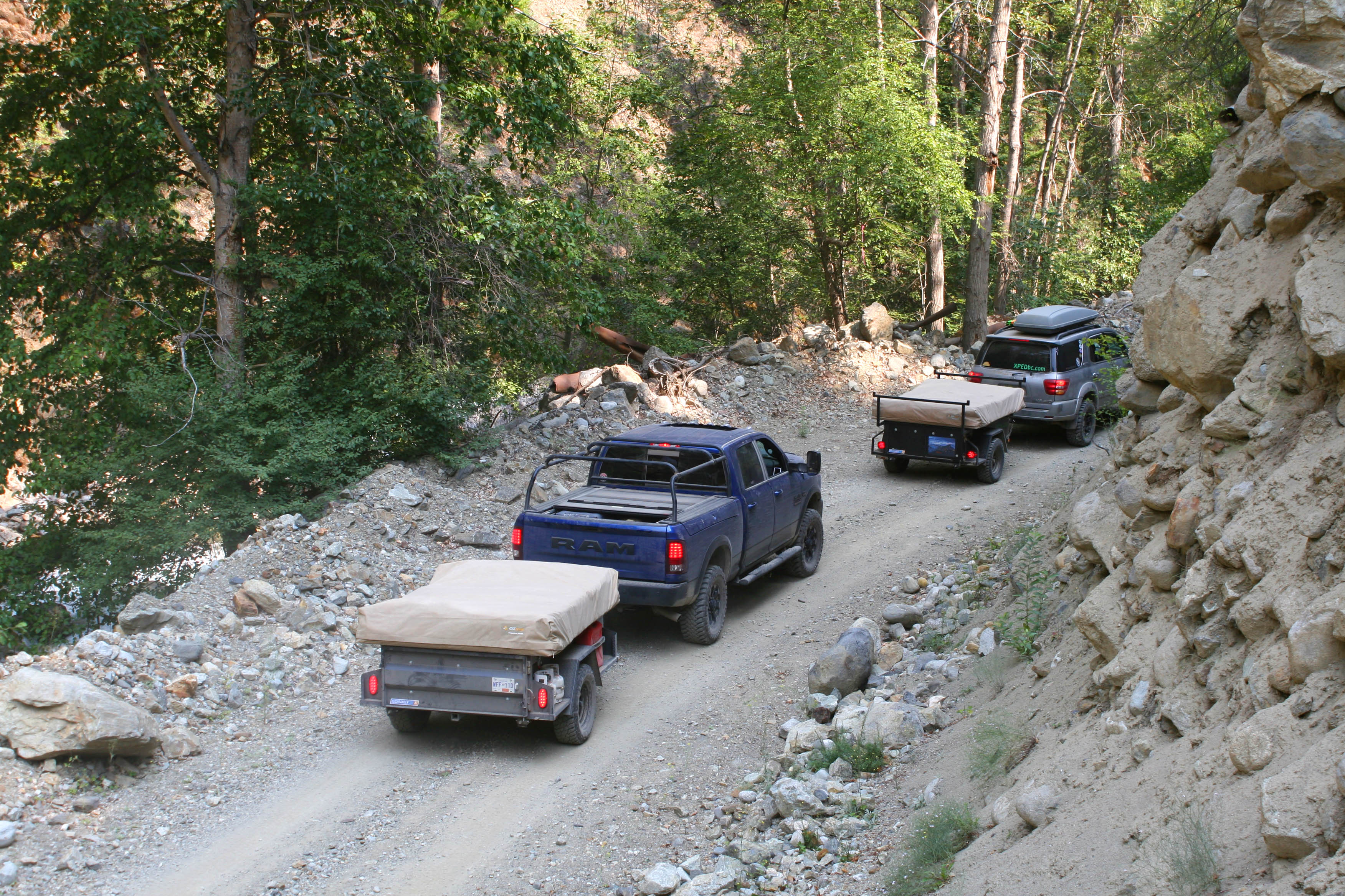
The temperature quickly dropped as evening approached, thanks to the towering canyon walls, as the sun would only penetrate the canyon bottom for a brief period each day. The kids kept busy throwing stones at a hanging wasp nest and we relaxed around the propane fire for another night. There was an outright campfire ban around most of the province, so Jeff’s firepit came in handy.
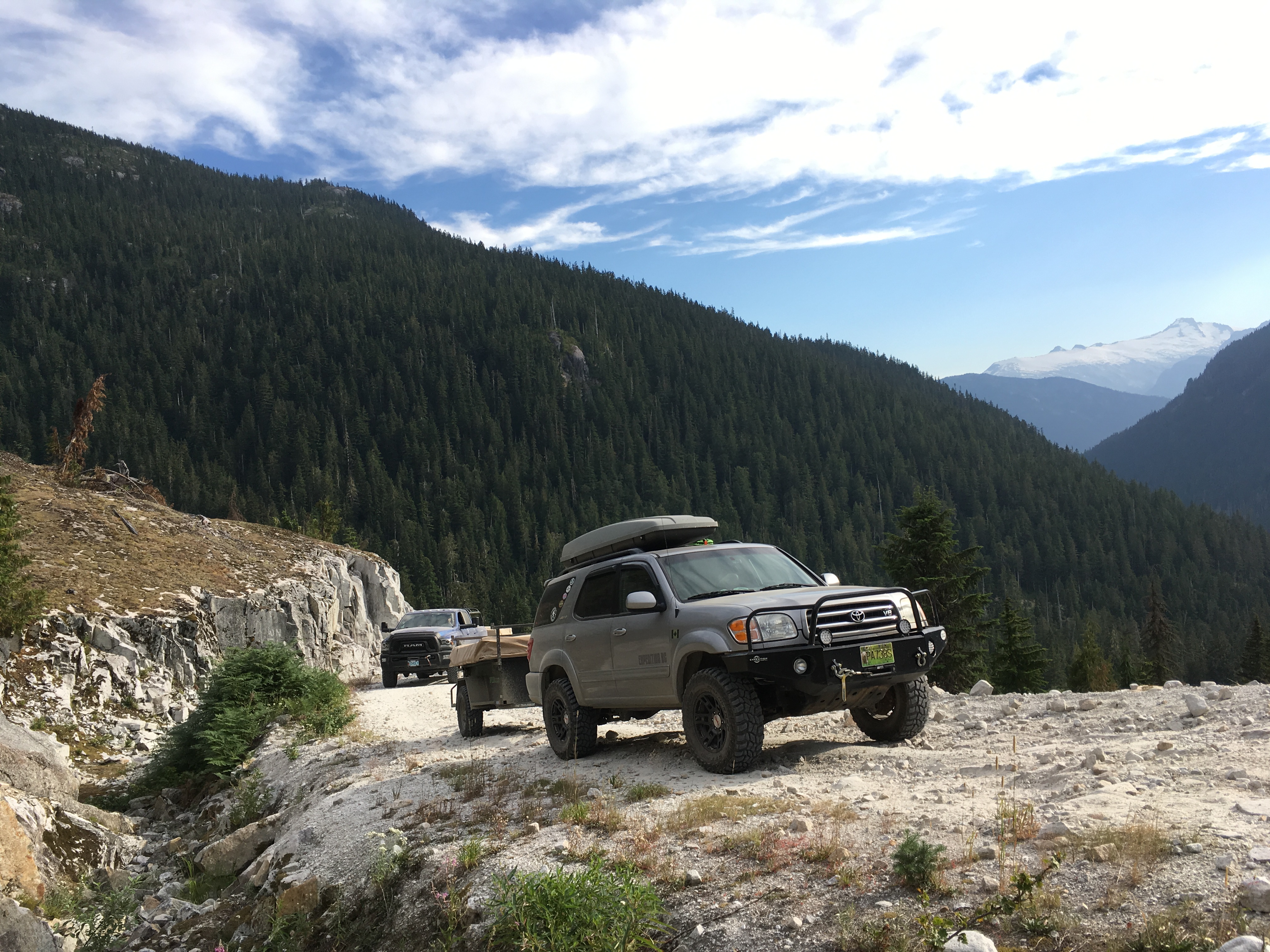
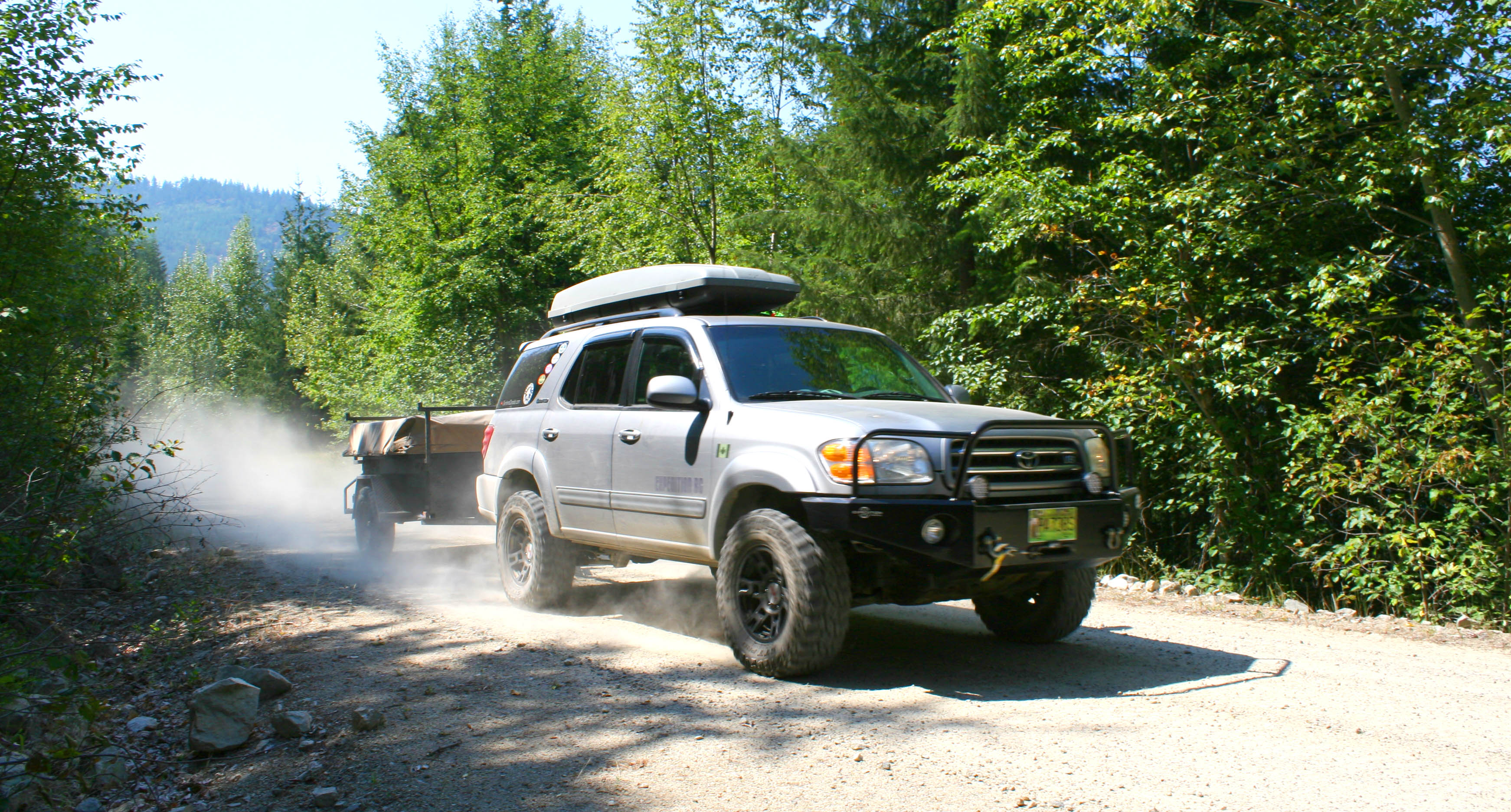
The next day we passed through Lillooet, ending another 56 km stretch of gravel along our route. We refueled again and traversed 22 more clicks of pavement through town to reach dirt on the West Pavillion Rd. This one can take you way back into the bush, far from any towns and still on the west side of the Fraser River. We followed it all day and enjoyed the desert-like vistas. The Sequoia was struggling to run at normal operating temperatures at slow speeds with the air conditioner running full blast. Many of the hills were climbed in low range. With approximately 360,000 kms on the clock at the time of this trip, it likely required some upgrades or maintenance to sort the issue out. 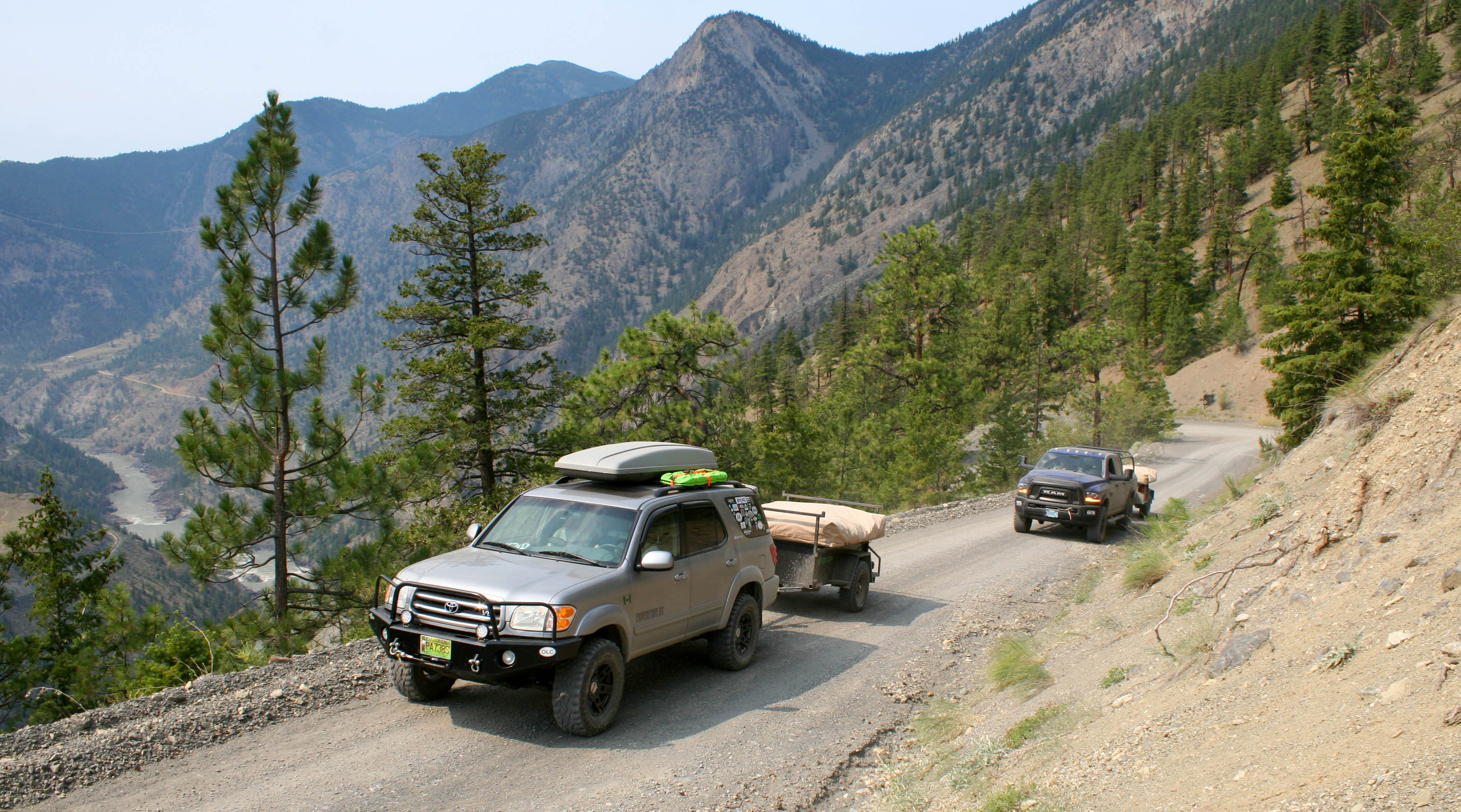
We reached our destination for the evening, Schraeder Lake, which has a nice little rec site right on the lake. This area is fairly remote, being over 100 kms from pavement, and I’ve rarely seen others camped here.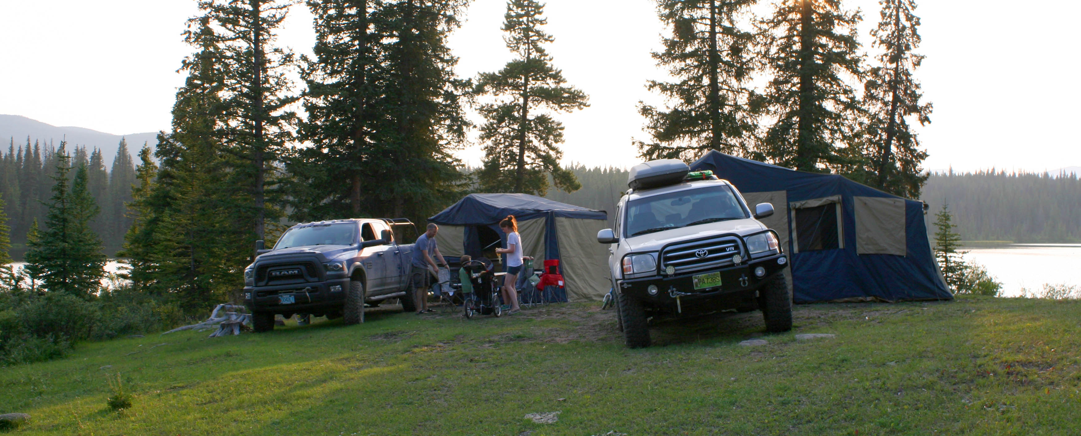
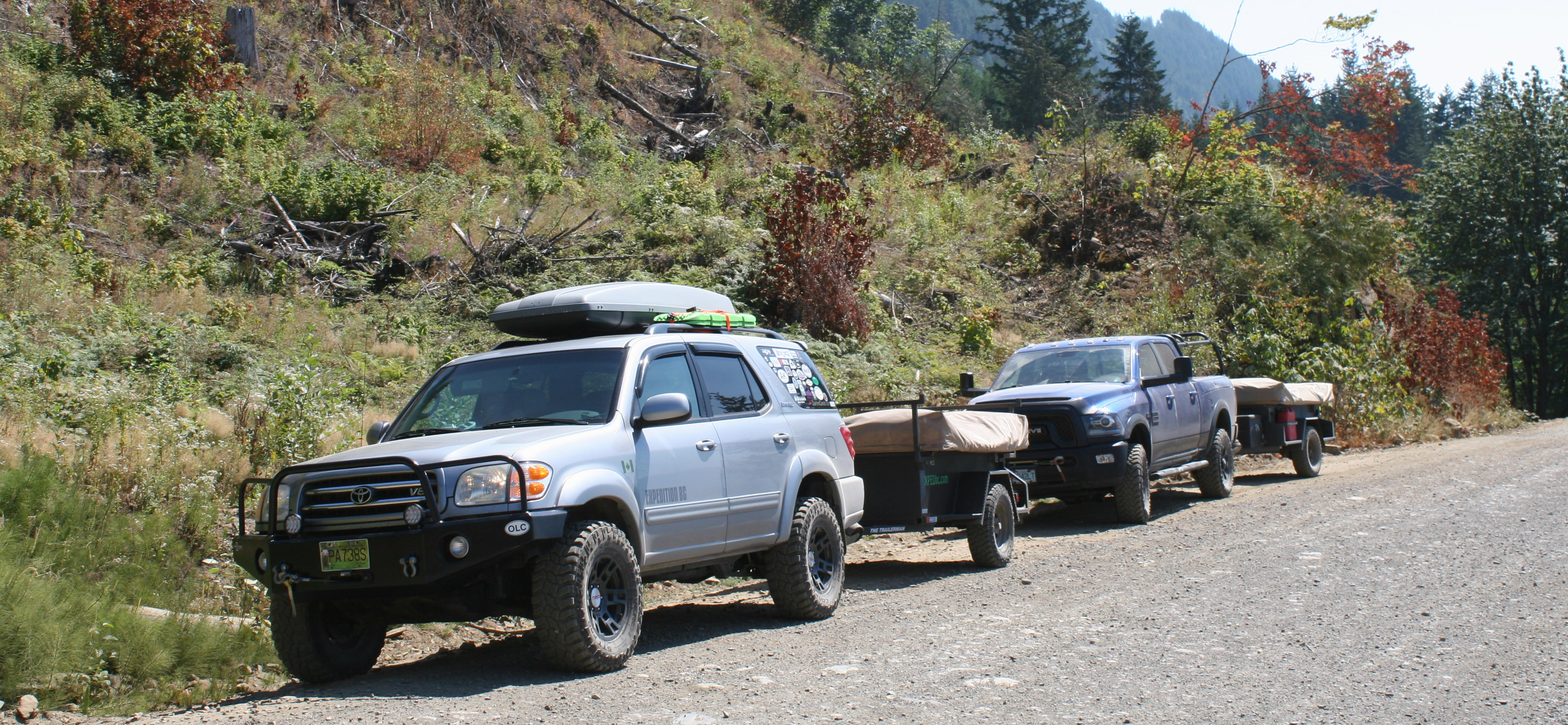
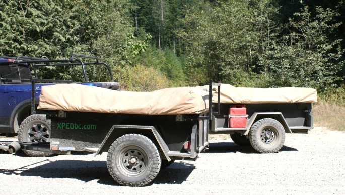
It took some planning to find large-enough flat spots for both tents. Here you can see the size difference between Jeff’s 200XT and our 250XT trailer tents.
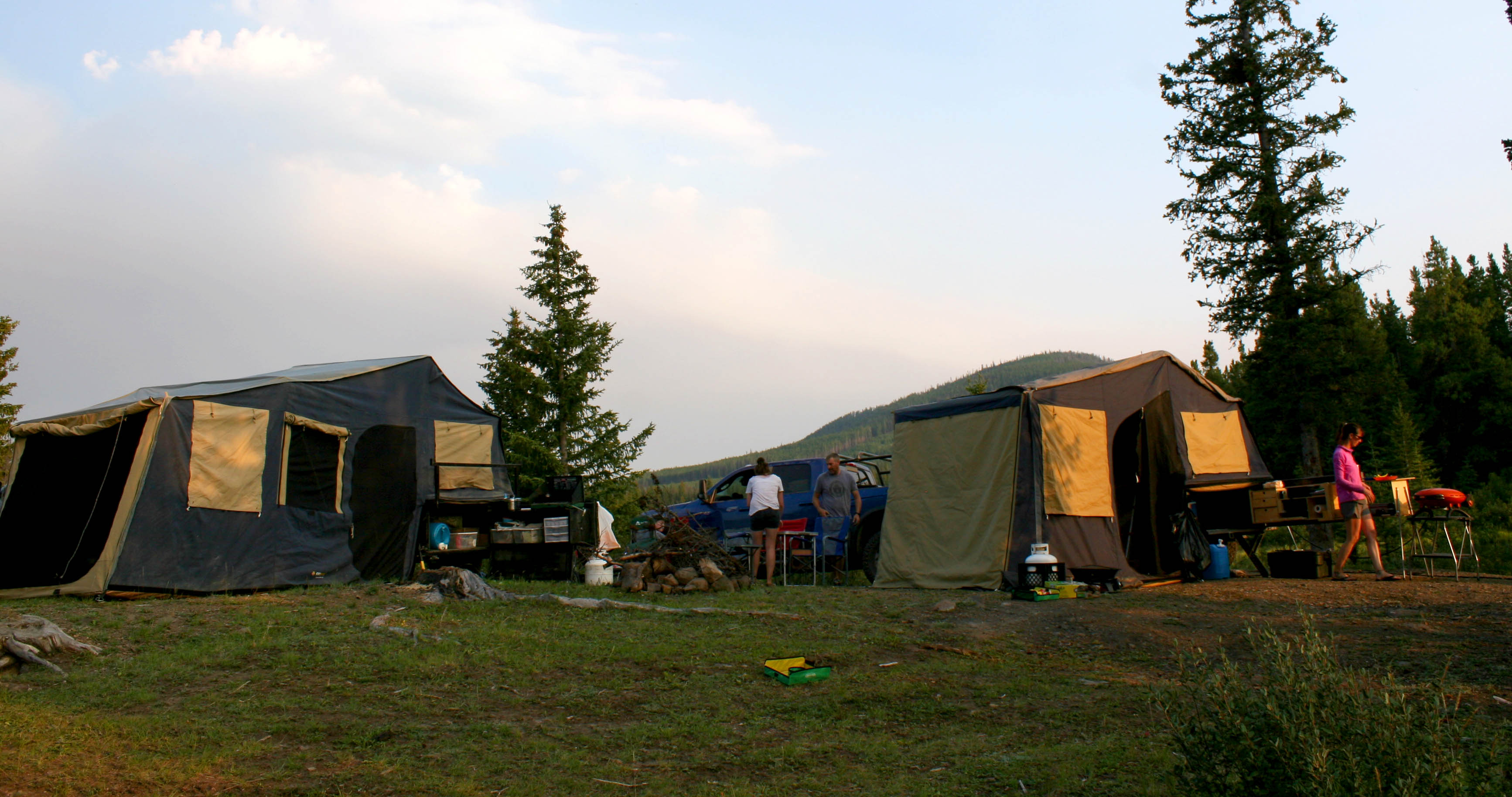
Another night spent by the fire, in a wild place, and with good company! This is what it’s all about. We joined our camp tables together to make a large one to fit us all for dinner.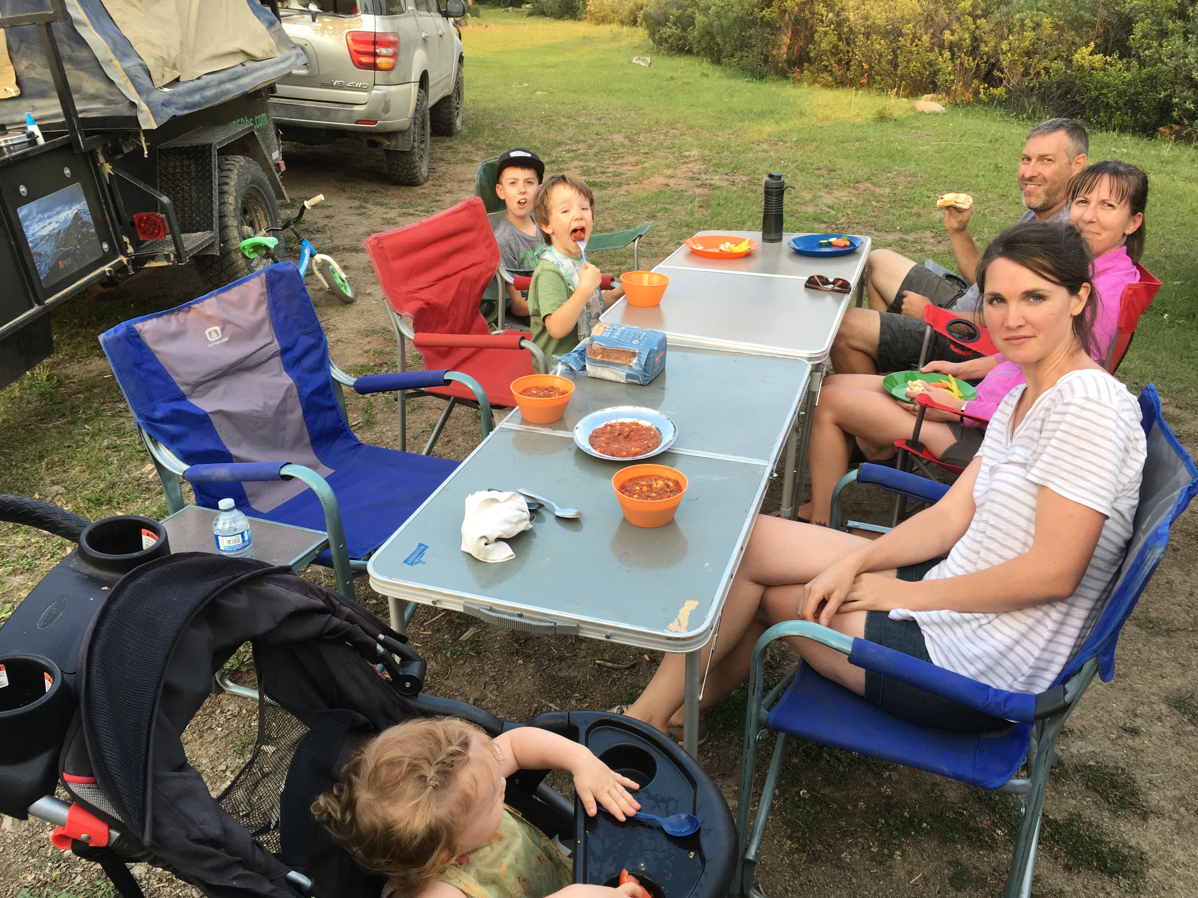
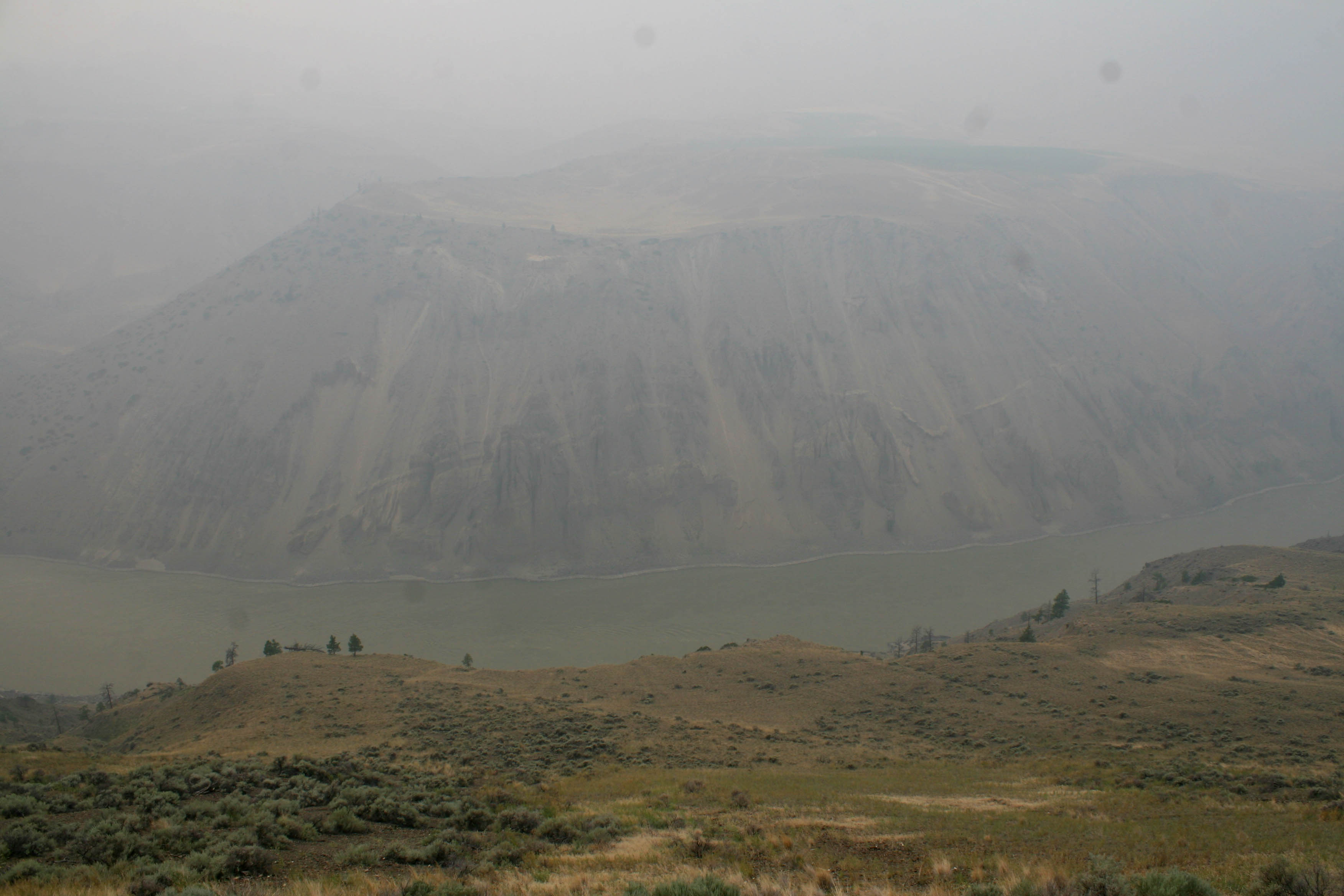
Based on our progress so far, we had hoped to continue the trip on dirt all the way to Williams Lake, right in the middle of the Cariboo Region. The weather and forest fires would have other plans though – check out the smoke moving into view on the horizon at sunset.
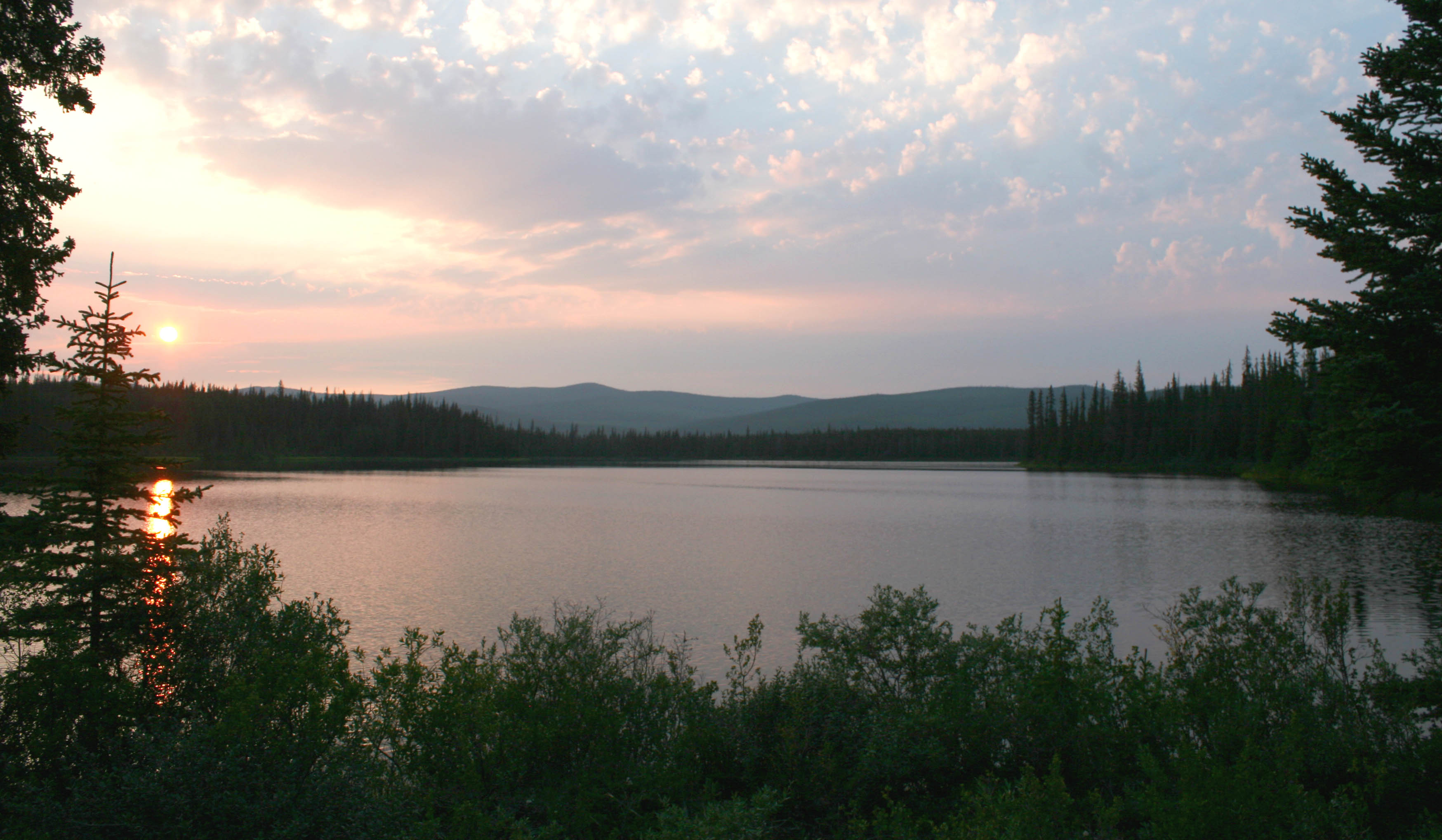
The next morning, we awoke to choking thick forest fire smoke and we had to make some decisions. Compare the sunset photo above to our view in the morning. We could taste the ash in the back of our throats.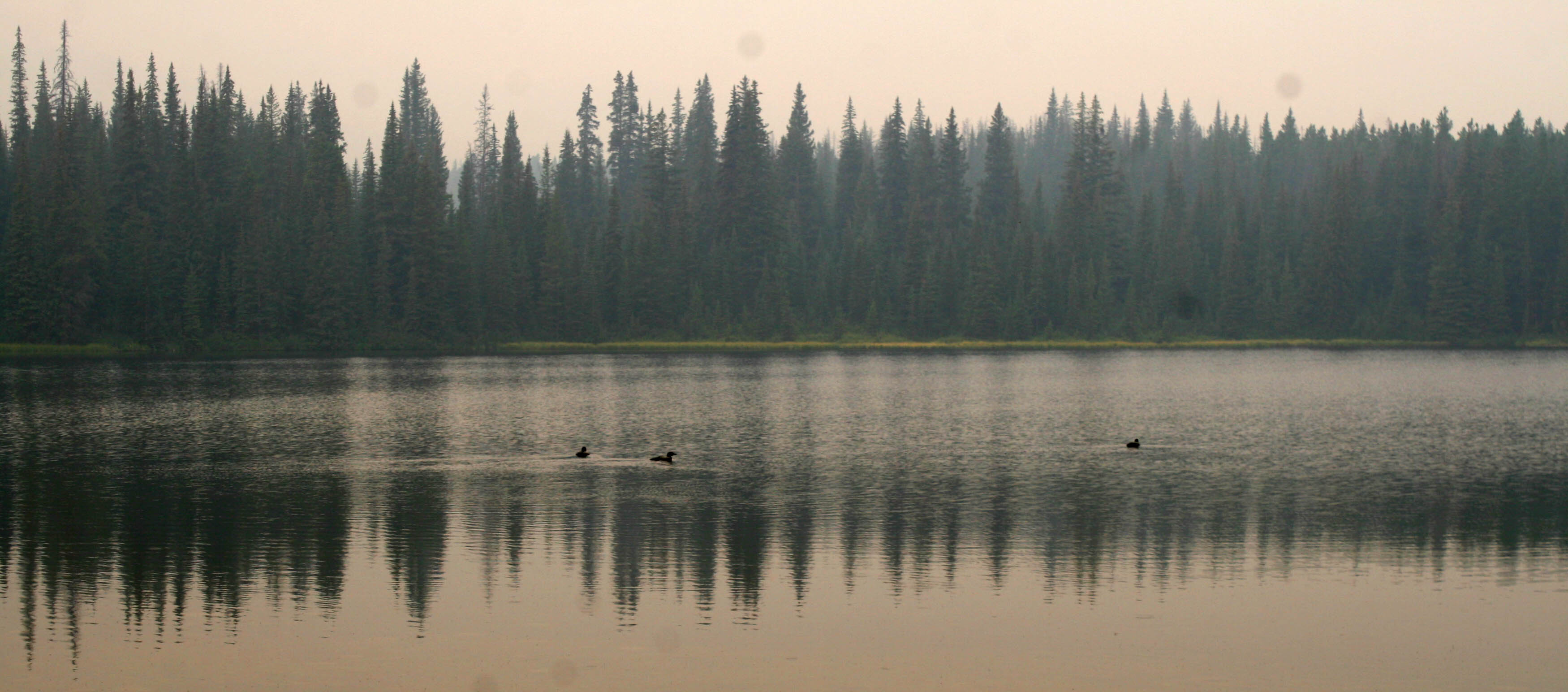
We were quite aware of the record-breaking fires burning across BC. Leading up to the trip, we had carefully monitored the fire locations and forecasts for the areas we planned to travel through. We also knew that conditions and circumstances can change rapidly, and were concerned that the fires were coming closer, or new ones had started with lightning overnight.
Not wanting to get cut off from fires burning across the road, we played it safe and opted to head out to the highway toward the town of Clinton, many miles to the east. It turned out to be a good decision as more thunder storms, heavy rain, and mudslides came later!
Packing up camp, we left Schraeder Lake behind to fend for itself in the smoke.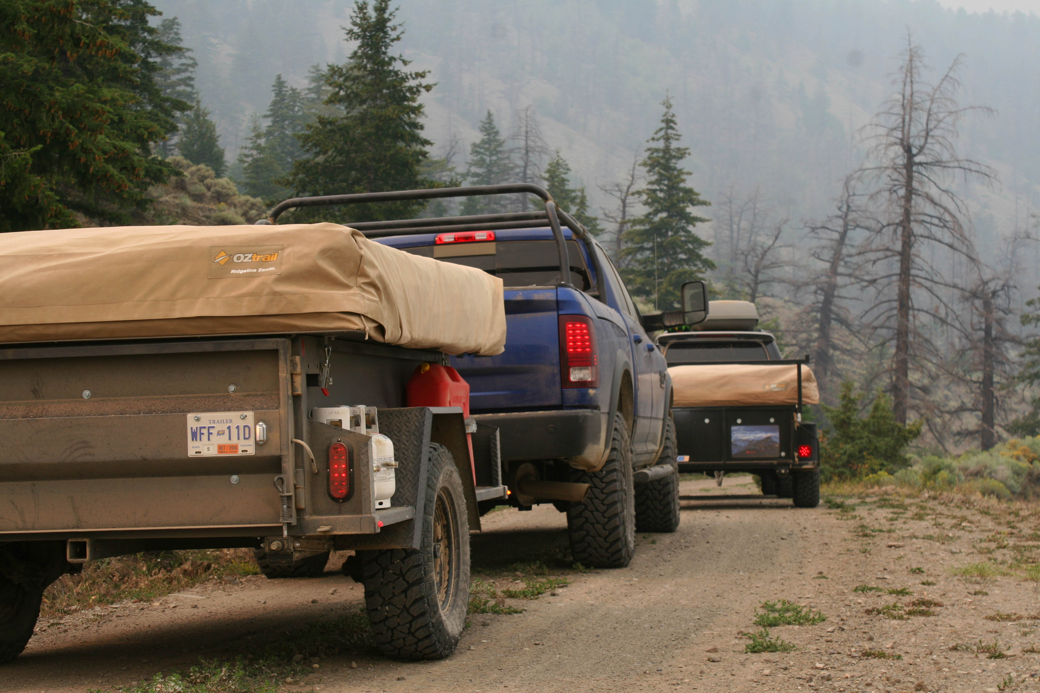
The smoke was filtering the light from the sun overhead and gave a red-orange tinge to the views.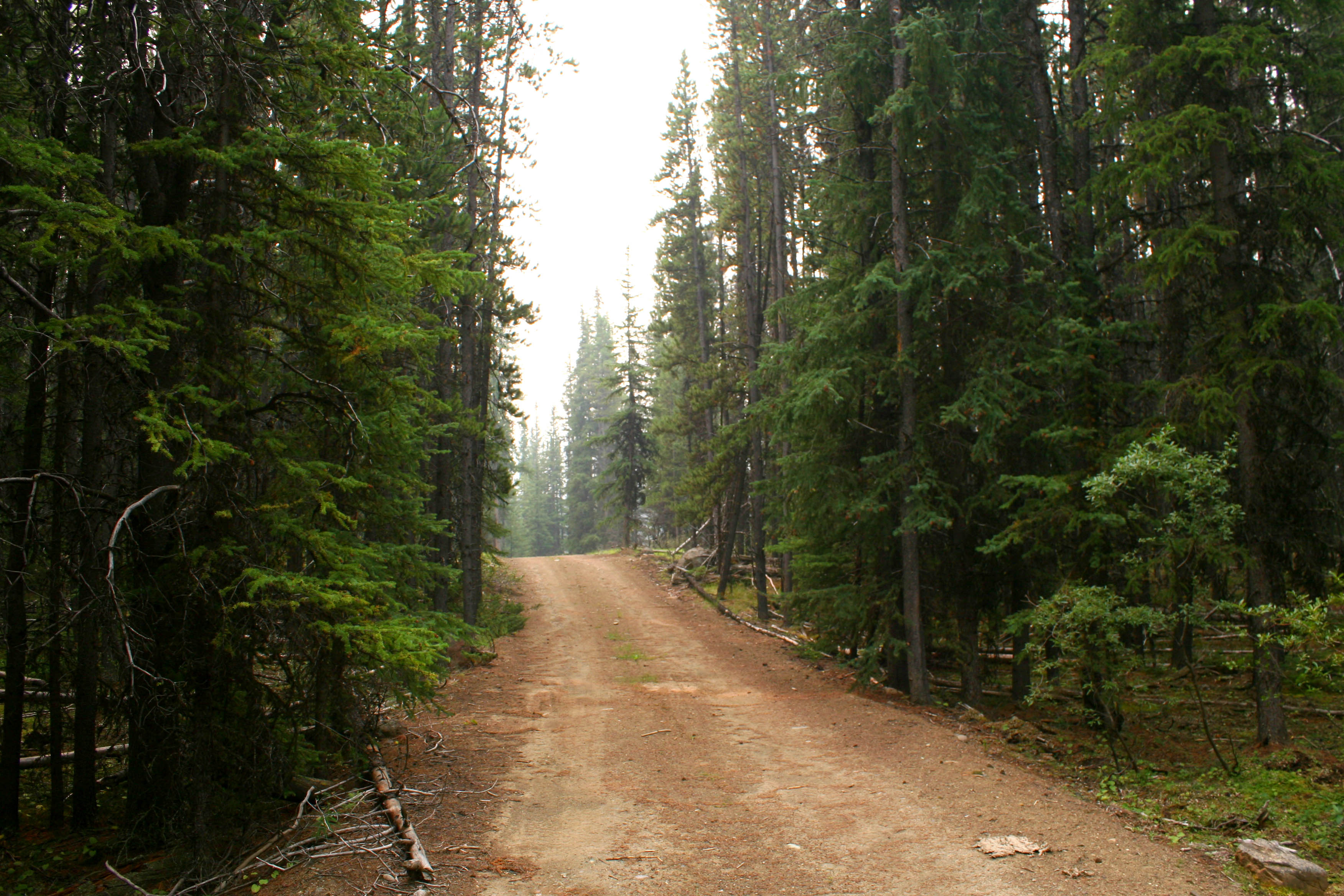
We took the switchbacks down to the Big Bar Reaction Ferry, similar to the Lytton Ferry we’d taken a few days prior. Once again we had to take turns as each of our rigs was too long to fit together. Depending on the water levels, you may need high clearance to avoid scraping when boarding and disembarking the ferry platform.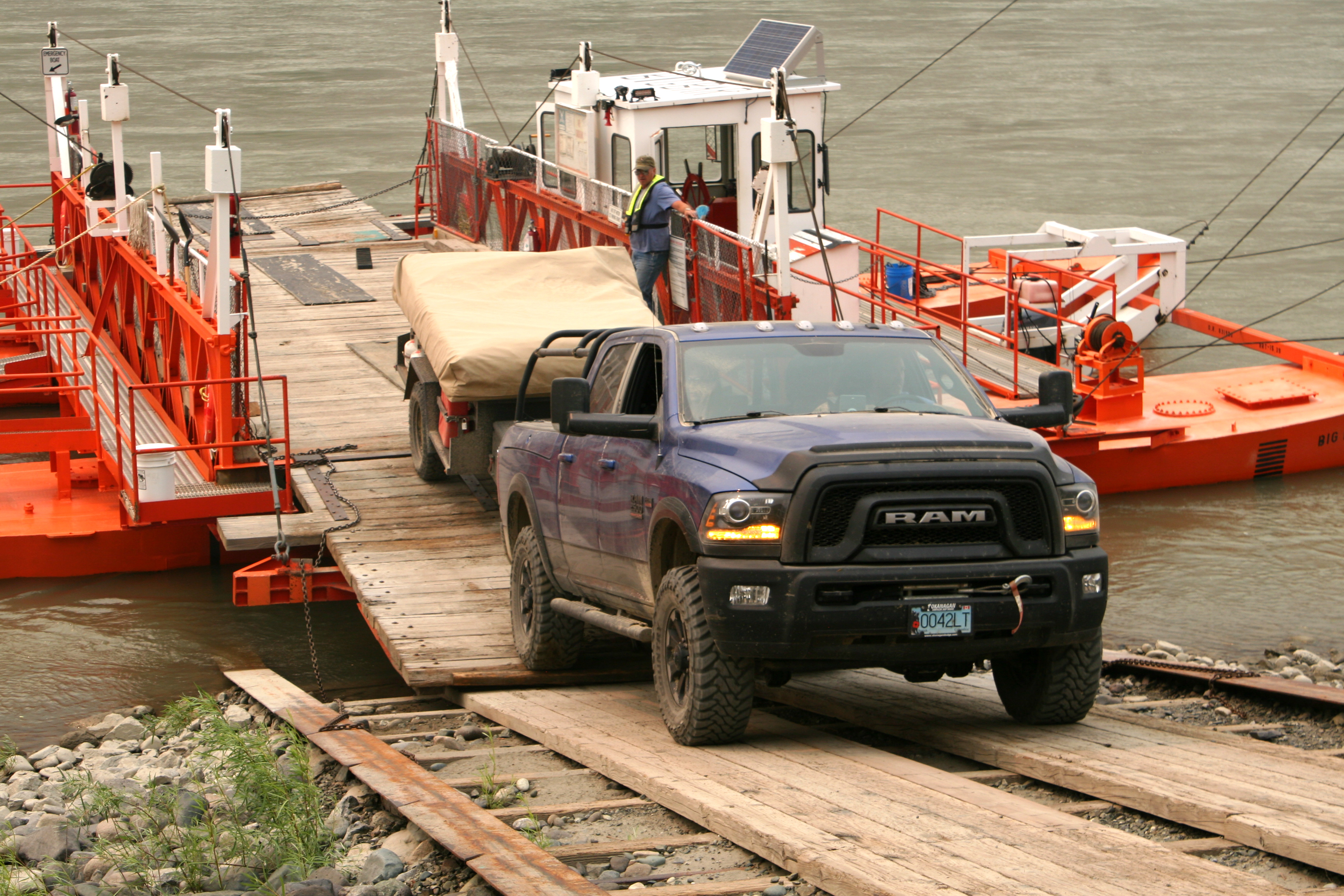
The intensity of the smoke increased throughout the day, limiting our views of the otherwise wild landscape above the Fraser!
There was a big climb we had to complete… up to 23% grade for several kilometers. Once again there were sharp switchbacks and large drop offs to negotiate. To further complicate things, the Sequoia was still having issues maintaining a normal operating temperature. At times we had to kill the AC and run the heater to aid in dropping the coolant temperatures. For most of the climb, we actually drove with the hood fully raised to increase airflow! Well Jeff found this quite hilarious and we all had a pretty good laugh about it.
Note of interest: I would later go on to replace the radiator and completely solve all the temperature issues – the old radiator appeared to be the original with 365,000 kms on it! It never ended up leaking but was plugged with grime between the cooling fins.
We reached the top of the grade and re-entered the pine and spruce forests, eventually ending up on the Jesmond Rd and then pavement on the Kelly Lake Road. The total off-road mileage we logged between leaving pavement in Lillooet and finding it again near the town of Clinton was 162 kilometers – and they were hard earned ones. 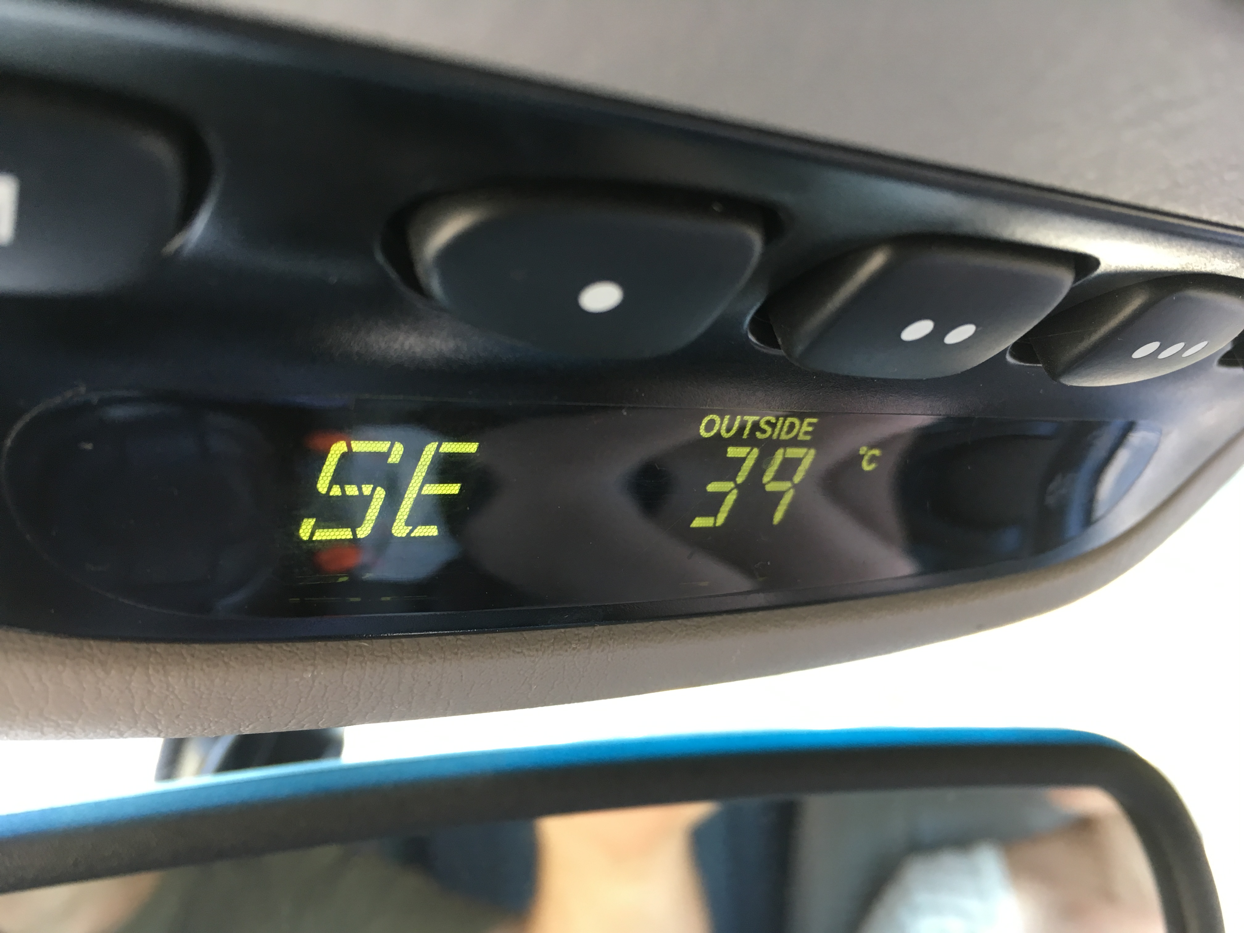
As we came into town, several severe storm cells had rolled in and it was raining buckets around nightfall. We rendezvoused for dinner at the Cariboo Lodge – a massive log-cabin style building. We were back in cellular reception and learnt that the storms were forecasted to continue. Furthermore, most of the highways leaving town had been washed out by mudslides and debris flows due to the heavy rain.
Based on that updated information, we were happy to end our adventure and capped it off with a big tasty meal together at the lodge. We parted ways from town as we had different routes back home. Due to closures and road conditions, Jeff and family had to make a major detour and arrived home in the middle of the night. We had a similar experience but arrived safely, also quite late at night.
Overall the route was a success! There were long, dusty and hot days on the trail, but the scenery and camping spots were fantastic and the company even better. Our family and Jeff’s would go on to do future multi-day off-roading trips together and enjoy more family adventures. The Kakadu trailers are a great option to take the whole family off-grid and camp comfortably for days at a time, without losing off-road capability.
NOTE: We would later learn via news reports that a car was tragically swept off the paved highway in a debris flow just a few miles away on the day we reached the end of our trip. The lady in the car was carried away in the mud and sadly her body was never found. The area is prone to debris flows after previous mega town-evacuating wildfires have scorched the hills above the valleys and destroyed vegetation that stabilizes the hillsides.
Our stats for this route:
Our overall KM’s travelled between leaving pavement in Harrison Hotsprings and entering back onto paved highways for the last time near Clinton was 436 kilometers. I tallied the portions of pavement we were required to travel during the route, which was 57 kilometers. That leaves us with 379 kilometers travelled off-road.
If my math is correct, our percentage of off-road compared to pavement was roughly 85%! I figure that we would have been closer to 95% gravel-travel if we didn’t have to avoid the washout north of the Nahatlatch River area… oh well – we will try that route another time.
-JC
